Great Northern Railway Trail
![]()
![]() Enjoy a cycle or walk along this disused railway line in the Bradford area. The trail follows the route of the old Great Northern railway line between Bradford and Keighley. The lines were closed in 1972 but have been converted into a pleasant leisure route for walkers and cyclists. The route runs for a distance of just under 6 miles on a reasonably flat path passing a series of interesting old viaducts.
Enjoy a cycle or walk along this disused railway line in the Bradford area. The trail follows the route of the old Great Northern railway line between Bradford and Keighley. The lines were closed in 1972 but have been converted into a pleasant leisure route for walkers and cyclists. The route runs for a distance of just under 6 miles on a reasonably flat path passing a series of interesting old viaducts.
The route starts at Queensbury where you can pick up the trail and head north towards Thornton Viaduct. The structure is 300 yards (270 m) long and has 20 arches. From the top of the viaduct there are fine views to enjoy.
The trail then bends round to the north west, passing Close Head Row before coming to Doe Park Reservoir.
The path continues north to Hewenden Reservoir and Viaduct.
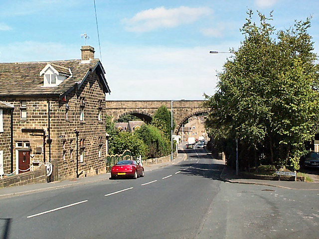
The viaduct crosses the Hewenden Beck valley and provides nice views down to the reservoir of the same name.
After descending the viaduct the trail arrives in Cullingworth where the route finishes at Cullingworth Viaduct.
Great Northern Railway Trail Ordnance Survey Map  - view and print off detailed OS map
Great Northern Railway Trail Open Street Map  - view and print off detailed map
*New* - Walks and Cycle Routes Near Me Map - Waymarked Routes and Mountain Bike Trails>>
Great Northern Railway Trail OS Map  - Mobile GPS OS Map with Location tracking
Great Northern Railway Trail Open Street Map  - Mobile GPS Map with Location tracking
Pubs/Cafes
On the route you could stop off at Christophes Coffee House located just to the north east of the viaduct in Thornton. It's a bit of a hidden gem with great food and a cosy log burner for colder days. You can find it at 381 Thornton Rd with a postcode of BD13 3JX for your sat navs.
Near the end of the route you could head a little west and visit The Dog and Gun at Denholme. This 17th Century coaching inn has a fine dining room with spectacular views of the surrounding area. The interior is full or character with oak beams and two open fires for chilly days. You can find the pub on the Denholme Road at a postcode of BD22 9SN for your sat navs.
Dog Walking
The trail makes for a nice dog walk though it may be best to keep them on leads as there will probably be few cyclists around. Christophes mentioned above is also dog friendly.
Further Information and Other Local Ideas
Just to the north east of the end of the trail you could extend the walk and visit Goit Stock Waterfall where there's some nice woodland trails surrounding the pretty falls.
Also near Cullingworth you could head west and try the Oxenhope Walk which visits two more of the pretty local reservoirs. The lovely Bingley St Ives Estate is ideal for walkers and located .
For more walking ideas in the area see the Yorkshire Dales Walks and the Nidderdale Walks pages.
Cycle Routes and Walking Routes Nearby
Photos
Start of the route at Queensbury,from the site of the old station. The old station-master's house is pretty much all that remains, among the trees
Headley Lane crossing the former Great Northern Railway. The Blue sign indicates the entrance to the Great Northern Way bridle path which crosses the Thornton Viaduct to give access to Thornton. Below it can be seen a conventional Public Footpath sign indicating the traditional footpath route to Thornton.
Hewenden Viaduct. One of the viaducts on the long-closed former Great Northern route from Queensbury to Keighley, but recently opened to cyclists and pedestrians as part of the National Cycle Network. Viewed from near East Manywells Farm


