Queensbury Railway Walk
![]()
![]() This large, elevated village is located in the Bradford area of West Yorkshire. It is notable for its old railway line and the Black Dyke Mills which is now a heritage venue where you can see concerts and learn about the village's interesting industrial heritage.
This large, elevated village is located in the Bradford area of West Yorkshire. It is notable for its old railway line and the Black Dyke Mills which is now a heritage venue where you can see concerts and learn about the village's interesting industrial heritage.
This walk from the village uses part of the Great Northern Railway Trail and other public footpaths to visit one of the local highlights at Thornton Viaduct. It's about a 2 mile walk from the village to the viaduct, passing along the shared cycling and walking trail. From the top of the viaduct you can enjoy excellent views over the countryside Yorkshire Dales and Bronte country.
To extend your walk you can continue along the rail trail to Hewenden Reservoir and Viaduct.
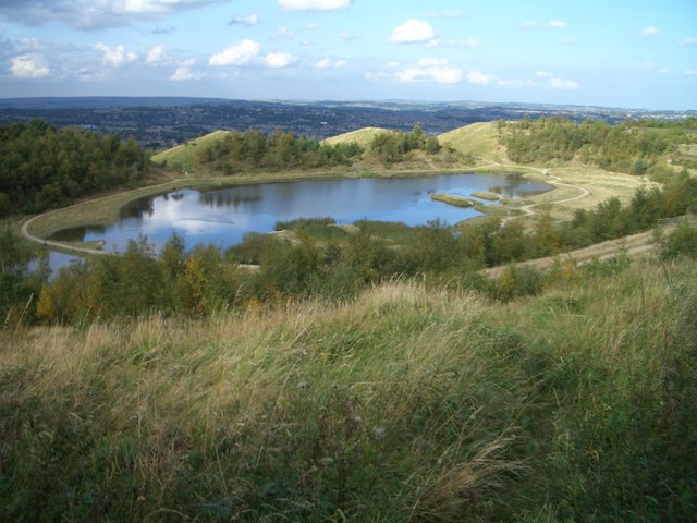
To continue your walking around Queensbury head a mile east to visit Horton Bank Country Park and Brayshaw Reservoir. There's some nice footpaths here taking you around pretty lake with lots of wildlife to see. There are also some hills in the park which you can climb for some wonderful views over the the city of Bradford.
Queensbury Ordnance Survey Map  - view and print off detailed OS map
Queensbury Open Street Map  - view and print off detailed map
Queensbury OS Map  - Mobile GPS OS Map with Location tracking
Queensbury Open Street Map  - Mobile GPS Map with Location tracking
Walks near Queensbury
- Great Northern Railway Trail - Enjoy a cycle or walk along this disused railway line in the Bradford area
- Thornton Viaduct - This walk visits the Thornton Viaduct in the Thornton area of Bradford.
The walk starts just to the west of the village at Close Head Row - Hewenden Reservoir and Viaduct - This circular walk in Cullingworth takes you to Hewenden Reservoir and Viaduct.
Start the walk from Cullingworth Gate where you can pick up a dismantled railway line and follow it south east toward the viaduct - Goit Stock Waterfall - This circular walk takes you to the lovely Goit Stock Waterfall near Cullingworth in West Yorkshire
- Oxenhope - A walk from the West Yorkshire village of Oxenhope in West Yorkshire, visiting Leeming Reservoir and Thornton Moor Reservoir.
- Harden Beck - This circular walk from the West Yorkshire village of Harden takes you along the Harden Beck to two of the area's highlights at Goit Stock Waterfall and Hewenden Reservoir.
- Doe Park Reservoir - This circular walk explores Doe Park Reservoir in Denholme, near Bradford in West Yorkshire.
- Horton Bank Country Park - This pretty country park in Bradford has some well laid out walking trails to try.
- Bradford - This major UK city is located in the West Riding of Yorkshire
- Halifax - This circular walk around Halifax explores the waterways and woods to the south of the town.
Start the walk from the train station and then head south along the Hebble Way which takes you along the Hebble Brook - Shibden Park - This delightful country park in Halifax is the perfect place for a peaceful afternoon stroll
- Calderdale Way - The Calderdale Way is a walking circuit around the beautiful district of Calderdale in West Yorkshire
- Ogden Water - Enjoy fabulous views of the Pennine hills in this country park near Halifax
- Elland Park Wood - These woods in Halifax have some nice walking trails and pretty bluebells in the springtime
- Bronte Way - Follow the Bronte Way through Lancashire and Yorkshire and visit many of the places associated with writings and lives of the Bronte Sisters.
Highlights on the walk include:
Gawthorpe Hall - visited by Charlotte Bronte on several occasions, the impressive Gawthorpe Hall is the start point of the walk
Wycoller Country Park - Wycoller Hall is believed to have inspired Ferndean Manor in Charlotte Bronte's "Jane Eyre" - Shipley Glen - Enjoy a short walk through this delightful glen near Bradford
- Chellow Dene Reservoir - Visit this lovely beauty spot on the outskirts of Bradford on this easy circular walk in West Yorkshire
- Shibden Valley - This circular walk explores Shibden Valley and Shibden Dale near Halifax in West Yorkshire
Photos
Site of Queensbury station. The triangular station at Queensbury was a strategic junction between lines serving Bradford, Halifax and Keighley. Services were so arranged that it was possible to make a connection without delay to another train. Very sadly this station and all of its lines to the three towns mentioned above, was closed in 1955. It never had the benefit of diesel trains, which could have transformed the economics. With hindsight from 2007, a valuable asset was thrown away back in 1955.


