Hackney Canal Walk
![]()
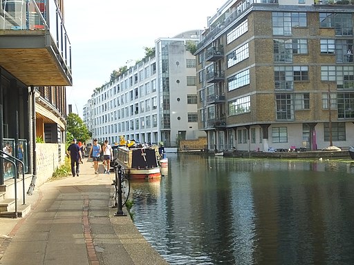
![]() This circular walk in Hackney takes you along the Hertford Union Canal, the Regent's Canal and through Victoria Park.
This circular walk in Hackney takes you along the Hertford Union Canal, the Regent's Canal and through Victoria Park.
The walk starts from Hackney Wick train station. It's a short walk from here to Victoria Park and down to the Hertford Union Canal. Follow the towpath west and it will take you to Old Ford where the canal meets with the Regent's Canal. Head north west and you will soon come to Old Ford Lock. The associated lock cottage, and stables were designated Grade II listed buildings in 1990. Thames lighters using the canal would have horses provided by the operators of the canal.
From this part of the canal you can enter Victoria Park and enjoy a stroll along the footpaths here. The park boasts two cafes, a boating lake and several tree lined walkways. You follow the trails east through the park to return to Hackney Wick train station.
To continue your walking in the area head to the Hackney Marshes. There's nice waterside footpaths to follow along the River Lea and the Lea Canal here too. You'll also visit the Middlesex Filter Beds Nature Reserve at the northern end of the marshes.
Hackney Canal Walk Ordnance Survey Map  - view and print off detailed OS map
Hackney Canal Walk Open Street Map  - view and print off detailed map
Hackney Canal Walk OS Map  - Mobile GPS OS Map with Location tracking
Hackney Canal Walk Open Street Map  - Mobile GPS Map with Location tracking
Cycle Routes and Walking Routes Nearby
Photos
Old Ford lock from Old Ford Bridge, Regent's Canal. An important staging-post in former days, close to the junction of the Hertford Union canal and with winding-hole to enable narrow boats to turn, this lock also had stabling for horses. Now it supplies water and disposal facilities to recreational boat people.
Fishing in the canal, Bethnal Green. The canal curves sharply towards the west here; the old Haggerston gasholder up ahead.
Passing under Mare Street. Following the canal upstream the bridge marks the transition from Bethnal Green to Hackney through what was once an intensely industrial and extremely impoverished area of London. On the left of the image can be seen an opening that presumably led to a wharf or warehouse. The canal was itself an essential artery of transport for the very building materials that were needed for construction and development.


