Hertfordshire Way Circular Walk Map and GPX
![]()
![]() Explore some of the finest countryside and prettiest towns and villages in this fascinating county. The path is circular, visiting Ashridge Forest, St Albans, Hertford, Codicote, Tring, Kings Langley, Cuffley and Bishop's Stortford Canal and River Walk. There's also some lovely scenery to enjoy with much of the walk taking place with the Chiltern Hills in the background. Places of interest include the beautiful Ashridge Estate near Berkhamsted (video below) and Shaw's Corner - the former residence of playwright Bernard Shaw located at Ayot St Lawrence, near Welwyn. You'll also pass through the pretty Royston Heath where there are fine views over the Cam Valley from Therfield Hill.
Explore some of the finest countryside and prettiest towns and villages in this fascinating county. The path is circular, visiting Ashridge Forest, St Albans, Hertford, Codicote, Tring, Kings Langley, Cuffley and Bishop's Stortford Canal and River Walk. There's also some lovely scenery to enjoy with much of the walk taking place with the Chiltern Hills in the background. Places of interest include the beautiful Ashridge Estate near Berkhamsted (video below) and Shaw's Corner - the former residence of playwright Bernard Shaw located at Ayot St Lawrence, near Welwyn. You'll also pass through the pretty Royston Heath where there are fine views over the Cam Valley from Therfield Hill.
The Friends of the Hertfordshire way have split the walk into the following manageable sections, each of about 12 miles in length:
| Royston to Wallington | 11.1 miles |
| Wallington to Willian (Letchworth) | 11.4 miles |
| Willian to Codicote | 11.8 miles |
| Codicote to St. Albans | 12.6 miles |
| St. Albans to Markyate | 11.0 miles |
| Markyate to Tring Station | 10.9 miles |
| Tring Station to Kings Langley | 15.0 miles |
| Kings Langley to Shenley | 12.8 miles |
| Shenley to Cuffley | 11.5 miles |
| Cuffley to Hertford | 12.6 miles |
| Hertford to Broxbourne | 12.0 miles |
| Broxbourne to Hertford | 12.5 miles |
| Hertford to Widford | 13.6 miles |
| Widford to Bishop's Stortford | 11.1 miles |
| Bishop's Stortford to Hare Street | 11.4 miles |
| Hare Street to Royston | 12.7 miles |
The walk is waymarked with a green sign featuring the head of a deer.
Please click here for more information
Hertfordshire Way Ordnance Survey Map  - view and print off detailed OS map
Hertfordshire Way Open Street Map  - view and print off detailed map
*New* - Walks and Cycle Routes Near Me Map - Waymarked Routes and Mountain Bike Trails>>
Hertfordshire Way OS Map  - Mobile GPS OS Map with Location tracking
Hertfordshire Way Open Street Map  - Mobile GPS Map with Location tracking
Pubs/Cafes
Just off the route in Chipperfield you can visit the lovely Two Brewers. A fine example of an 18th Century Inn The Two Brewers in the tranquil and picturesque village of Chipperfield is a traditional pub filled with old world charm. Opposite the pub is a quintessential village green where guests are free to take in a local cricket match or just simply soak up the sun. Indoors on cold days there’s a roaring open fire surrounded by luxurious leather sofas. You can find the pub at postcode WD4 9BS for your sat navs.
In Ayot St Lawrence head to the the delightful Brocket Arms. This noteworthy country inn was built in the 14th century and retains all of its traditional features. It's full of character with low ceilings, oak beams and inglenook fireplaces. It also has an interesting history having originally been the monastic quarters for the Norman church until the Reformation. There's a nice large garden outside to relax in on on warmer days. You can find the pub in the village at postcode AL6 9BT.
In the pretty village of Much Hadham there's The Bull Inn. They serve good quality food and have a nice garden area to relax in. You can find them on the High Street at postcode SG10 6BU for your sat navs. The pub is also dog friendly if you have your canine friend with you. The village is also well worth exploring with a number of listed buildings including the 13th century church and a number of fine looking timber framed cottages.
In Codicote The Goat Inn is well worthy of investigation. The building dates back to 1590 with the pub dating back to the 18th century. They do a fine Sunday roast and can be found on the High Street at postcode SG4 8XE for your sat navs. There's also The Globe on the High Street. It's another quintessentially English village pub with a pleasant little garden to sit in.
Just south of Hertford you'll pass Little Berkhamsted where you can visit the Grade II listed Stratton's Tower, an excellently preserved five-storey observatory dating to 1789. For refreshment there's the Five Horseshoes. The Grade II listed pub serves a fine Sunday lunch and has a pleasant garden area to relax in. They are located on Church Road at postcode SG13 8LY for your sat navs.
Cycle Routes and Walking Routes Nearby
Photos

Southmill Lock, River Stort
.jpg)
St Michael and All Angels church, Waterford

Hadham Hall

Ford near Munden House. This ford is on the Hertfordshire Way near Munden House. There is also a footbridge for walkers, which cannot be seen here.

Waymarkers Galore. This stile on the Hertfordshire Way carries a variety of other waymarkers. The paths in this area include the Grand Union Canal and Kings Langley Circular Walks.

Near Newgate Street. A well surfaced farm track classed as a 'restricted byway' (formerly 'road used as a public path') and therefore open to cyclists.

On the Hertfordshire Way, approaching Waterford Marsh

Kings Langley countryside
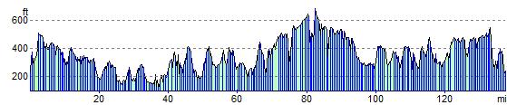
Elevation Profile