Hestercombe Gardens Walks
![]()
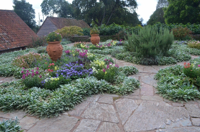
![]() Explore the beautiful gardens surrounding this historic country house on the edge of the Quantock Hills. It's a nice place for an afternoon stroll with good footpaths taking you to peaceful woodland, beautiful lakes, a gothick alcove, a Tuscan temple arbour and a folly mausoleum. Hestercombe is generally considered to be one of the finest gardens in England.
Explore the beautiful gardens surrounding this historic country house on the edge of the Quantock Hills. It's a nice place for an afternoon stroll with good footpaths taking you to peaceful woodland, beautiful lakes, a gothick alcove, a Tuscan temple arbour and a folly mausoleum. Hestercombe is generally considered to be one of the finest gardens in England.
The castle is located just north of Taunton where you can visit the old castle and pick up the Bridgwater and Taunton Canal and the Grand Western Canal. There's also something of a hidden gem to be found at the Trull Waterfall, just to the south of the town.
Postcode
TA2 8LG - Please note: Postcode may be approximate for some rural locationsPlease click here for more information
Hestercombe House Ordnance Survey Map  - view and print off detailed OS map
Hestercombe House Open Street Map  - view and print off detailed map
Hestercombe House OS Map  - Mobile GPS OS Map with Location tracking
Hestercombe House Open Street Map  - Mobile GPS Map with Location tracking
Cycle Routes and Walking Routes Nearby
Photos
Hestercombe House was used as the headquarters of the British 8th Corps in the Second World War, and has been owned by Somerset County Council since 1951. It was used as the headquarters of Somerset Fire Brigade until 2007, and housed the Emergency Call Room for the Somerset Area of Devon and Somerset Fire and Rescue Service until April 2012. It is used as an administrative centre for Somerset County Council.


