High Pike Caldbeck Walk
![]()
![]() This walk climbs to High Pike from the village of Caldbeck in the Lake District. The walk follows the Cumbria Way all the way from the village to the summit. As such the route takes place on good waymarked paths.
This walk climbs to High Pike from the village of Caldbeck in the Lake District. The walk follows the Cumbria Way all the way from the village to the summit. As such the route takes place on good waymarked paths.
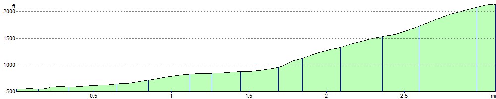
It's about a 3 mile walk from Caldbeck to High Pike. From the car park in the village head south to Nether Row before climbing past Low Pike to the 658 m (2,159 ft) summit. Here you will find a trig point and a substantial wind shelter which has been built from the stones of a ruined cottage. There are great views of the Solway Firth and the Scottish Border hills to the north. To the south are good views of Skiddaw and Blencathra.
To extend your walking in the area try our Caldbeck Walk which visits the waterfalls along the beck before climbing to Brownrigg.
You could also continue south along the Cumbria Way and climb to Skiddaw. Just to the south east is Carrock Fell which is often climbed as part of a circular walk with High Pike.
Also nearby is the expansive Greystoke Forest where you will find miles of mountain bike trails and footpaths.
High Pike Ordnance Survey Map  - view and print off detailed OS map
High Pike Open Street Map  - view and print off detailed map
High Pike OS Map  - Mobile GPS OS Map with Location tracking
High Pike Open Street Map  - Mobile GPS Map with Location tracking
Pubs/Cafes
Back in the village the Oddfellows Arms is a nice place for some post walk refreshments. A split level pub with a very large dining room serving a-la-carte meals, children are welcome until 9.00 pm. Accommodation is reasonably priced for the area and makes an ideal base for walking and exploring the area. Runs darts, dominoes and pool teams. You can find them at postcode CA7 8EA for your sat navs. The pub also has a nice garden area and is dog friendly.
The village is also the Home of John Peel, he of the famous hunting song, who is buried in the local graveyard.
Cycle Routes and Walking Routes Nearby
Photos

Hill Top, Nether Row

The Cumbria Way north from High Pike

High Pike

Approaching High Pike

Gill Beck in the village of Caldbeck.

Oddfellows Arms Caldbeck

Colourful cottages in Caldbeck

High Pike Haw
Elevation Profile