Hod Hill

 This circular walk climbs to the Hod Hill fort from Stourpaine in Dorset.
The walk starts in the village of Stourpaine just to the south of the hill. From here you can pick up the Stour Valley Way and follow the waymarked trail north past the tranquil River Iwerne and on to the 143 metre (469 ft) chalk hill top. Here you'll find the site of the old Roman fortifications and fine countryside views from the hill's elevated position. The route then descends to Nutcombe Wood before picking up a riverside path along the Stour through Hod Wood. You then follow Hod Drive south east to return to Stourpaine.
It's easy to extend the walk by continuing north to visit the nearby Hambledon Hill.
Hod Hill Ordnance Survey Map  - view and print off detailed OS map
Hod Hill Open Street Map  - view and print off detailed map
Hod Hill OS Map  - Mobile GPS OS Map with Location tracking
Hod Hill Open Street Map  - Mobile GPS Map with Location tracking
Pubs/Cafes
Back in Stourpaine the White Horse is a fine choice for some post walk refreshment. The classic village pub dates from the early 18th Century and includes a bar, restaurant, shop, post office, games room, wood burning stoves & an open fire. Outside there's a covered outdoor decking area at the rear and a seating area out the front. They serve good quality food and can be found at postcode DT11 8TA.
Dog Walking
The hill, woods and country trails make for a fine dog walk. The White Horse mentioned above is also very dog friendly with water and treats available.
Further Information and Other Local Ideas
To the south is Blandford Forum where there some good riverside trails to try.
To the west there's the picturesque old town of Sturminster Newton to explore. There's nice riverside trails along the Stour Valley Walk and the historic Sturminster Mill to visit here.
To the south west there's another climb to Okeford Hill to try. There's more great views here and some popular mountain bike trails for cyclists as well. The epic Wessex Ridgeway can be picked up on the hill too.
To the north is the pretty village of Compton Abbas where you can visit Fontmell and Melbury Downs, Compton Abbas Airfield and the highest point in the Cranborne Chase AONB at Win Green Hill.
For more walking ideas in the area see the Cranborne Chase Walks and Dorset Walks page.
Cycle Routes and Walking Routes Nearby
Photos
Stourpaine, Post Office and pub Situated on the A350 between Shaftesbury and Blandford Forum, Dorset. The pub is called The White Horse.
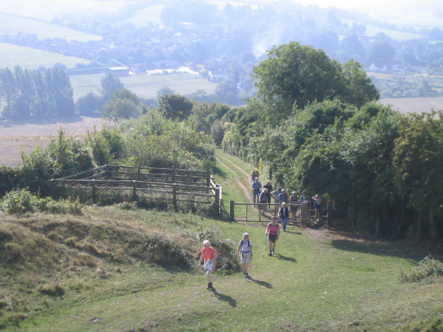
Footpath up to Hod Hill. Photo shows a group of walkers on the steep uphill footpath entering the earthworks at Hod Hill Roman fort.
Roman fortifications, Hod Hill. The hill was captured in AD 43 by the Roman Second Legion (Augusta), led by Vespasian, who had already captured Maiden Castle and other hill forts to the south. The Romans built a camp in the north-west corner of the original fort, occupied by a mixed force of 720 legionaries and auxiliaries. The fort was used as a base for about 5 or 6 years, but passed out of use by about AD 50, when troops were withdrawn for the campaigns against Caractacus in Wales, and the remaining men were moved to a new fort further west at Waddon Hill.
Ramparts and ditch. These great ramparts surround 54 acres of the top of Hod Hill. The hill was fortified by the Celtic Durotriges tribe in the Iron Age about 500 BC. Hod Hill was captured in AD 43 by the Roman Second Legion (Augusta), led by Vespasian, who had already captured Maiden Castle and other hill forts to the south. At the time the Augusta was based at Lake Farm fortress near Wimborne.
Green lane to Stourpaine. The lane descends steeply from the hill to Stourpaine, and through its long history has become sunken below field level and lined with trees and vegetation
River Stour. Looking downstream along the River Stour, to the west of the hill. The river makes a very abrupt change of direction where it meets the chalk "island" of Hod and Hambledon Hills, and has cut a steep cliff into the western side of the hill. The beech trees growing on the steep slope overhang the river.


