Compton Abbas Walk

 This pretty village is in a great location for exploring some of the most attractive parts of the Cranborne Chase AONB.
This circular walk from the village visits some of the local highlights including Fontmell and Melbury Downs, Compton Abbas Airfield, Win Green Hill, Melbury Wood, the village of Melbury Abbas and Melbury Hill.
The route starts in the village and then heads east through the Fontmell and Melbury Downs Nature reserve towards the Compton Abbas Airfield. The airfield is a local attraction offering flight experiences in vintage aircraft and classic car driving.
The walk continues east along the airfield before turning north and then east to climb to Win Green Hill. The hill is notable as the highest point in the Cranborne Chase AONB, commanding wonderful views over Salisbury Plain, Shaftesbury, Glastonbury Tor, the Mendips, the Quantocks, the Purbecks and the south coast.
You then head west to visit Melbury Wood where there's a series of peaceful woodland trails to try.
You'll then pass Melbury Down before turning north to visit the neighbouring village of Melbury Abbas. From here it is a short walk west to climb up to the splendid viewpoint at Melbury Beacon.
After taking in the views you descend east and then south to return to the village.
Compton Abbas Ordnance Survey Map  - view and print off detailed OS map
Compton Abbas Open Street Map  - view and print off detailed map
Compton Abbas OS Map  - Mobile GPS OS Map with Location tracking
Compton Abbas Open Street Map  - Mobile GPS Map with Location tracking
Walks near Compton Abbas
- Fontmell and Melbury Downs - Enjoy a variety of beautiful flora and fauna in this nature reserve in Compton Abbas on the Dorset/Wiltshire border
- Shaftesbury - Enjoy a short walk around the Dorset town of Shaftesbury with a climb to Gold Hill, made famous from the Hovis adverts of the 1970s
- Duncliffe Wood - Explore miles of cycling and walking trails in this large area of ancient woodland near Shaftesbury
- Win Green Hill - Climb to the highest point in the Cranborne Chase AONB and enjoy wonderful views over Shaftesbury, Salisbury Plain, Glastonbury Tor, the Mendips, the Quantocks, the Purbecks and the south coast
- Tollard Royal - This Wiltshire based village is in a nice location for exploring the woodland and countryside of the Cranborne Chase Area of Outstanding Natural Beauty
- Old Wardour Castle - This circular walk explores the countryside surrounding the 14th century Old Wardour Castle in Tisbury, Wiltshire
- Hambledon Hill - Climb Hambledon Hill and enjoy far reaching views over the Cranborne Chase AONB on this walk near Child Okeford in Dorset
- Hod Hill - This circular walk climbs to the Hod Hill fort from Stourpaine in Dorset.
- Blandford Forum - This Dorset based market town has some nice walks along the River Stour and in the Dorset AONB to try.
This route uses sections of the Stour Valley Way and the North Dorset Trailway to create a circular walk around the town - Martin Down Nature Reserve - This beautiful nature reserve on the Hampshire/Dorset border consists of 350 hectares of unspoiled chalk downland
- Tisbury - This Wiltshire based village is located in a lovely spot in the valley of the River Nadder
- Fonthill Estate - Enjoy a lovely circular walk around the village of Fonthill Bishop on this circular walk near Salisbury in Wiltshire
- Dinton Park - Explore the parkland and woodland surrounding this Neo-Grecian house in Dinton, Salisbury.
- Mere - This delightful Wiltshire based town is a fine place to start a walk with miles of trails to explore the surrounding downland and farmland of the Cranborne Chase and West Wiltshire Downs Area of Outstanding Natural Beauty.
Further Information and Other Local Ideas
For more walking ideas in the area see the Cranborne Chase Walks page.
Photos
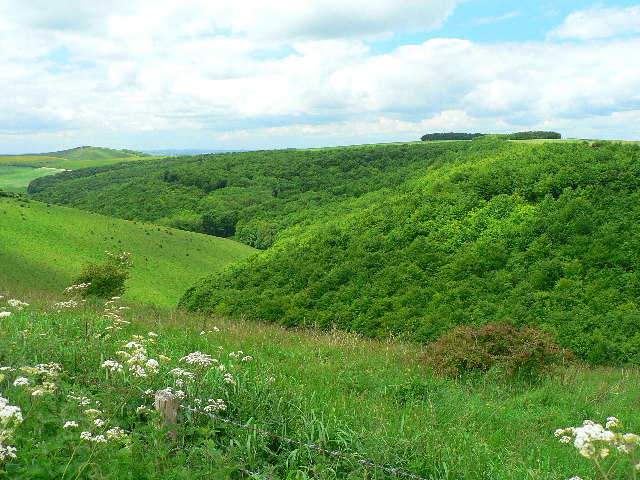
Melbury Abbas from Compton Down. Distant view of Melbury Abbas from point where Bridleway crosses the beginning of the ascent of Melbury Hill


