Walks Around Holt Wrexham
![]()
![]() This village in North East Wales is located in the Welsh Marches, close to the border with England.
This village in North East Wales is located in the Welsh Marches, close to the border with England.
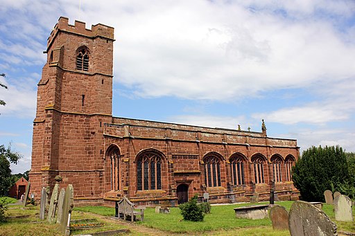
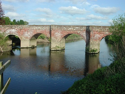
This circular walk visits the neighbouring villages of Farndon and Churton before a riverside stroll along the River Dee. The walk starts from the ruins of the 13th century Holt Castle which sit in a picturesque location next to the river. You then follow footpaths north crossing the river to visit Farndon in Cheshire, England. This pretty border village includes a 14th century church and a noteable medieval stone bridge.
The route continues north along the long distance Marches Way to Churton. Here you turn west to follow a country lane to the River Dee. You can then pick up a riverside footpath heading south to return to the village.
Holt Wrexham Ordnance Survey Map  - view and print off detailed OS map
Holt Wrexham Open Street Map  - view and print off detailed map
Holt Wrexham OS Map  - Mobile GPS OS Map with Location tracking
Holt Wrexham Open Street Map  - Mobile GPS Map with Location tracking
Walks near Holt Wrexham
- Farndon - This pretty village is located on the banks of the River Dee right on the England-Wales Border
- Peckforton Castle and Peckforton Hills - Explore the Peckforton Castle Estate and the Peckforton Hills on this walk in Cheshire
- Beeston Castle - Climb to the ruins of this 13th century castle and enjoy wonderful views over the Cheshire Plain on this short circular walk in the Peckforton Hills
- Bickerton Hill and Maiden Castle - This walk uses part of the Sandstone Trail to visit Maiden Castle Iron Age hill fort and Bickerton Hill
- Shropshire Union Canal - Travel from the ourskirts of Wolverhampton to Ellesmere Port on this long distance waterside walk along the Shropshire Union Canal.
The route starts at Autherley Junction in the Oxley area of Wolverhampton - Bulkeley Hill - Enjoy a walk through these peaceful woods to the Bulkeley Hill viewpoint on this walk in Cheshire
- Burwardsley - This Cheshire based village is crossed by two signficant long distance trails
- Tarporley - Tarporley is a very pretty Cheshire village with some nice country trails and waterside walks along the nearby canal towpath.
- Kelsall - This Cheshire based village makes a great base for exploring the surrounding countryside and woodland of the expansive Delamere Forest and the Sandstone Hills.
- Malpas - This Cheshire based market town is a fine place for a stroll with a number of historic buildings including a significant 14th century church and several picturesque timber framed properties
- Sandstone Trail - This is a popular walk that runs through Cheshire and Shropshire from Frodsham to Whitchurch.
The path starts in Frodsham and heads south to Frodsham Hill with lovely views over the Cheshire Plain and the Mersey Estuary - Tattenhall - This Cheshire village is in a great location for exploring the Shropshire Union Canal and the woodland and countryside of the Cheshire Plain.
- Wrexham - This circular walk explores the countryside to the south of Wrexham
- Alyn Waters Country Park - Enjoy peaceful walking and cycling in this lovely country park in the Alyn Valley, Wrexham
- Eccleston - This Cheshire based village lies just to the south of the city of Chester.
Photos
Remains of Holt Castle. This was built in the 13th century following the conquest of North Wales by King Edward I. After playing a crucial part in the Civil war in the 17th c. it was partly demolished and the stones from the site were used to build Eaton Hall. The remains of the castle, shown above, are believed to be the inner courtyard. The building was also called Castle Lyons originally.


