Honeybourne Walks
![]()
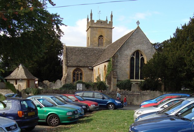
![]() This rural Worcestershire based village is located near the Vale of Evesham, the Cotswolds National Park and the villages of Mickleton and Badsey. The historic settlement includes several timber framed and thatched buildings including a splendid old pub for refreshment after your exercise.
This rural Worcestershire based village is located near the Vale of Evesham, the Cotswolds National Park and the villages of Mickleton and Badsey. The historic settlement includes several timber framed and thatched buildings including a splendid old pub for refreshment after your exercise.
This circular walk from Honeybourne follows footpaths to the nearby village of
Bretforton. You will pass through attractive farmland before arriving at the neighbouring village which lies just to the west. The village includes the noteworthy Fleece Inn, a traditional English pub owned by the National Trust. It's set in a half-timbered medieval farmhouse which originally sheltered a farmer and his stock.
Postcode
WR11 7PQ - Please note: Postcode may be approximate for some rural locationsHoneybourne Ordnance Survey Map  - view and print off detailed OS map
Honeybourne Open Street Map  - view and print off detailed map
Honeybourne OS Map  - Mobile GPS OS Map with Location tracking
Honeybourne Open Street Map  - Mobile GPS Map with Location tracking
Walks near Honeybourne
- Mickleton - This pretty Cotswolds village is the northernmost village in the county of Gloucestershire
- Hidcote Manor Garden - Explore these stunning National Trust owned gardens on this short walk in the Cotswolds
- Chipping Campden to Dover's Hill - This walk climbs to Dover's Hill from the lovely market town of Chipping Campden in the Cotswolds
- Ebrington and the Foxcote Estate - This circular walk takes you around some beautiful countryside on the Gloucestershire/Warwickshire border in the Cotswolds AONB
- Upper Quinton - This pretty Warwickshire village sits on the edge of the Cotswolds, just south of Stratford Upon Avon
- Chipping Campden to Dover's Hill - This walk climbs to Dover's Hill from the lovely market town of Chipping Campden in the Cotswolds
- Evesham Country Park - Enjoy an easy circular walk around this pretty country park located just to the north of Evesham
- Elmley Castle - This little village is generally agreed to be one of the prettiest in Worcestershire
- Stratford Upon Avon - The Warwickshire town of Stratford Upon Avon is famously associated with William Shakespeare
- Bredon Hill - Climb to the 299 m (981 ft) summit of this hill in the Cotswolds and enjoy fine views over the surrounding countryside
- Pershore - This circular walk from the market town of Pershore visits some of the highlights of the area
- Ashton Under Hill - This attractive Worcestershire based village is in a great location for countryside walking
- Evesham - This historic market town is located in Worcestershire, on the River Avon.
- Bretforton - This attractive rural village is located in Worcestershire, near the village of Honeybourne, the town of Evesham and the beautiful Cotswolds.
- Badsey - Badsey is located in the Wychavon district of Worcestershire Honeybourne, Bretforton and Evesham
Pubs/Cafes
The Thatched Tavern is a delightful old village pub with flagstone floors and exposed beams. The building dates all the way back to the 13th century and was converted to a pub in the late 16th century. They serve high quality locally sourced food and are also dog friendly. You can find them on the High Street at postcode WR11 7PQ.
Further Information and Other Local Ideas
Head east and you can visit neighbouring Mickleton and explore the beautiful Hidcote Manor Garden. The long distance Heart of England Way can also be picked up and used to explore the Cotswolds.
Photos
Honeybourne cottages. Historically, Honeybourne was made up of two villages: Church Honeybourne was in Worcestershire while Cow Honeybourne was in Gloucestershire. Their names are derived from Old English hunig, "honey", and burna, "stream", the whole meaning "(places on) the stream by which honey is found". Boundary changes in 1931 moved Cow Honeybourne into Worcestershire and the two parishes were united in 1958.


