Llyn Cwm Llwch
![]()
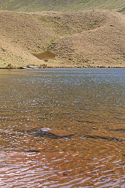
![]() Llyn Cwm Llwch is the best preserved glacial lake in South Wales. There are many legends about the lake and the fairies that live on an invisible island in the lake.
Llyn Cwm Llwch is the best preserved glacial lake in South Wales. There are many legends about the lake and the fairies that live on an invisible island in the lake.
This walk takes you through the Cwm Llwch valley to this popular beauty spot in the Brecon Beacons National Park.
The walk starts at the car park near the lake and involves a steep climb along the Cwm Llwch river to the beautiful lake. The surrounding scenery of the Brecon mountains is simply stunning.
Llyn Cwm Llwch Ordnance Survey Map  - view and print off detailed OS map
Llyn Cwm Llwch Open Street Map  - view and print off detailed map
Llyn Cwm Llwch OS Map  - Mobile GPS OS Map with Location tracking
Llyn Cwm Llwch Open Street Map  - Mobile GPS Map with Location tracking
Pubs/Cafes
Just to the north west of the car park you'll find The Tai’r Bull Inn. There's a cosy interior with a warming log fire and a good selection of ales. They serve good hearty dishes and have an outdoor area with a fine view of Pen Y Fan. The pub also provides parking and is dog friendly. Postcode is LD3 8EL.
Further Information and Other Local Ideas
To extend your exercise in the area you could enjoy a walk to the towering Pen Y Fan above the lake. There's also the Pen y Fan Horseshoe Walk as an alternate path.
For more walking ideas in the area see the Brecon Beacons Walks page.
Cycle Routes and Walking Routes Nearby
Photos
Llyn Cwm Llwch. Looking across the tarn towards a ridge of moraine and then the headwall and peaks of Pen Y Fan and Corn Du.
The footpath to Llyn Cwm Llwch. The red earth footpath leading down to the tarn in the valley can be seen winding its way along the edge of the ridge which descends from Corn Du.
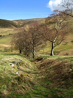
The footpath descending Pen Y Fan via Cwm Llwch. This part of the path crossed through land which is 'humpy' and dotted with gnarled trees. A lot of the little numps and ridges appeared to be man made but I'm not sure of their purpose. The high ground in the background is the northern ene of Cefn Cwm Llwch.


