Llyn y Fan Fach Short Easy Walk
![]()
![]() This is a super waterside walk through a particularly beautiful section of the Brecon Beacons. The walk starts at a parking area north of the lake and takes you along the Afon Sawddle to the lovely Llyn y Fan Fach. It's a good track that climbs steadily towards the lake where you will first reach the Dam before climbing to Bannau Sir Gaer on the western side of the water. From here there a truly wonderful views over the lake and surrounding mountains.
This is a super waterside walk through a particularly beautiful section of the Brecon Beacons. The walk starts at a parking area north of the lake and takes you along the Afon Sawddle to the lovely Llyn y Fan Fach. It's a good track that climbs steadily towards the lake where you will first reach the Dam before climbing to Bannau Sir Gaer on the western side of the water. From here there a truly wonderful views over the lake and surrounding mountains.
The lake is a great place for bird spotting. Look out for red kite, common buzzard, kestrel, carrion crow, common raven and skylark as you make your way around the water.
The Brecon Beacons Way runs past the lake so you could pick this up and head east to Llyn y Fan Fawr to continue your walk. Heading north would take you to Llanddeusant with wonderful views over the Black Mountains.
Postcode
SA19 9UN - Please note: Postcode may be approximate for some rural locationsLlyn y Fan Fach Ordnance Survey Map  - view and print off detailed OS map
Llyn y Fan Fach Open Street Map  - view and print off detailed map
*New* - Walks and Cycle Routes Near Me Map - Waymarked Routes and Mountain Bike Trails>>
Llyn y Fan Fach OS Map  - Mobile GPS OS Map with Location tracking
Llyn y Fan Fach Open Street Map  - Mobile GPS Map with Location tracking
Dog Walking
It's a lovely area for a dog walk but it's best to keep them on leads especially around the higher points.
Further Information and Other Local Ideas
Despite being in quite a remote spot the lake is a popular destination for hikers when the weather is good. As such it's a good idea to get to the car park fairly early as it's quite small and will fill up quite quickly in holiday season. There are two good campsites just to the east of the car park and the Red Lion Youth Hostel in nearby Llanddeusant. They are all good options if you would like to stay over.
For a longer, more challenging walk try the Llyn Y Fan Fawr Walk. This circular walk will take you to the neighbouring lake of Llyn Y Fan Fawr while also climbing to the hills of Picws Du and Fan Brycheiniog.
The epic Cambrian Way passes the lake. You could follow this south to visit the ridge walk along Fan Hir. This starts from near to the noteworthy Dan yr Ogof and the National Showcaves of Wales where you can explore a wonderful 11 mile long cave system.
A few miles to the north you'll find the Usk Reservoir. This is another significant body of water in the area and well worth a visit. There's nice trails around the water with attractive woodland and the opportunity to spot a few Red Kites soaring above the reservoir.
Just to the east there's also the Cray Reservoir. This lake has a different feel to it being surrounded by lush countryside. There's parking and a footpath on the eastern side of the water. To the south of the reservoir there's the climb to Fan Gyhirych which affords splendid views down to the lake below.
Cycle Routes and Walking Routes Nearby
Photos

Bannau Sir Gaer rises above Llyn y Fan Fach
.jpg)
A larger view of the lake

Carmarthen Fan. A view along the ridge of Bannau Sir Gaer, the finest hill walk in South Wales.

Dam at Llyn y Fan Fach. Looking south towards Bannau Sir Gaer.
.jpg)
The lake comes into view behind Picws du

The start of the footpath to Llyn y Fan Fach and beyond. In the distance can be seen Picws Du.

Picws Du (left) rising in the distance.

Waun Lefrith and the western end of Llyn y Fan Fach
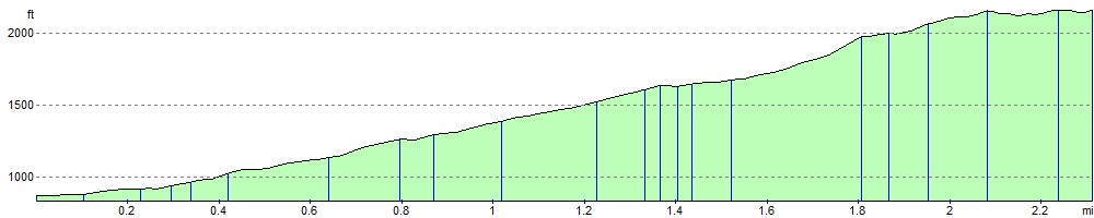
Elevation Profile