Loch Maree
![]()
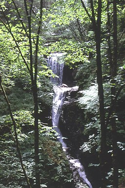
![]() This walk visits the beautiful Victoria Falls next to Loch Maree in the Northwest Highlands of Scotland.
This walk visits the beautiful Victoria Falls next to Loch Maree in the Northwest Highlands of Scotland.
The loch is over 13 miles long making it the fourth largest freshwater loch in Scotland.
You can start your walk at the Victoria Falls car park which is located on the southern side of the loch. The splendid falls are named after Queen Victoria who visited the site in 1877. There are nice trails to follow through the surrounding Caledonian Pinewood Forest and great views over Loch Maree from the elevated position of the falls. The water at the falls comes from the Beinn Eighe mountain to the south. After viewing the falls you can stroll down to the loch shore and visit another viewpoint and car park just to the west at Slattadale.
The area is great for wildlife so keep your eyes peeled for crossbills, Black-throated divers and sea eagles as you make your way along the footpaths.
Postcode
IV22 2HW - Please note: Postcode may be approximate for some rural locationsPlease click here for more information
Loch Maree Ordnance Survey Map  - view and print off detailed OS map
Loch Maree Open Street Map  - view and print off detailed map
Loch Maree OS Map  - Mobile GPS OS Map with Location tracking
Loch Maree Open Street Map  - Mobile GPS Map with Location tracking
Pubs/Cafes
Just to the east of the falls there's the Loch Maree Hotel for post walk refreshment. The hotel dates from 1872 and was visited by Queen Victoria in 1877. They have a small restaurant serving good quality food.
Dog Walking
The expansive woods and lochside paths are ideal for dog walking.
Further Information and Other Local Ideas
Head south from the falls and you could pick up the Beinn Eighe Mountain Trail. On the circular trail there are more waterfalls and great views back down to the loch.
To the east there's the wonderful Corrieshalloch Gorge to visit. Here the River Droma runs through a flora rich gorge, dropping dramitcally through a series of waterfalls, including the 46 metre Falls of Measach.
At nearby Loch Broom there's another hidden gem at the delightful Ardessie Falls in the Ardessie Burn gorge.
Also nearby is the town of Ullapool where you can climb to the viewpoint at Ullapool Hill and catch the ferry over to Stornoway in the Outer Hebrides.
To the west there's the Loch Gairloch where you can pick up the Gairloch Waterfall Walk in the lovely Flowerdale Glen.
Head north and you could visit the village of Poolewe and enjoy a stroll around the beautiful Inverewe Garden. The lochside gardens are a lovely place for a stroll with some nice footpaths taking you to subtropical plants, fine lawns and beautiful flowers. You can also enjoy fine views over Loch Ewe in this scenic area.
To the south there's fine waterside trails along the still waters of Loch Clair and Loch Coulin.
For more walking ideas in the area see the Scottish Highlands Walks page.
Cycle Routes and Walking Routes Nearby
Photos
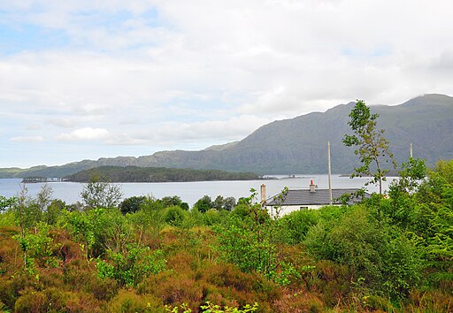
View of Loch Maree in the Scottish Highlands, from the car park for Victoria Falls. The island is Eilean Ruairidh Mòr and the peak of Beinn Àirigh Charr is visible on the far side of the loch.


