Loch Tay Walk
![]()
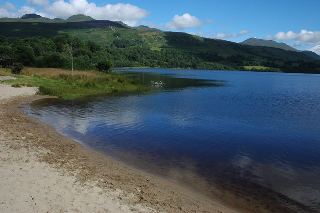
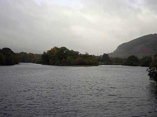
![]() Enjoy a short walk to Loch Tay from the town of Killin in the Loch Lomond and the Trossachs National Park. The walk starts at the parking area in Killin and crosses the River Lochay on an old railway bridge. You continue along the now disused railway line through woodland to the loch. From here you can enjoy pretty little beaches and wonderful views across the loch to the surrounding hills and mountains. You can return to the car park or extend your walk by heading along the River Dochart to the beautiful Falls of Dochart which is a short walk away. The Rob Roy Way also passes through Killin so you could also extend your outing on this long distance footpath.
Enjoy a short walk to Loch Tay from the town of Killin in the Loch Lomond and the Trossachs National Park. The walk starts at the parking area in Killin and crosses the River Lochay on an old railway bridge. You continue along the now disused railway line through woodland to the loch. From here you can enjoy pretty little beaches and wonderful views across the loch to the surrounding hills and mountains. You can return to the car park or extend your walk by heading along the River Dochart to the beautiful Falls of Dochart which is a short walk away. The Rob Roy Way also passes through Killin so you could also extend your outing on this long distance footpath.
Postcode
FK21 8UJ - Please note: Postcode may be approximate for some rural locationsLoch Tay Ordnance Survey Map  - view and print off detailed OS map
Loch Tay Open Street Map  - view and print off detailed map
Loch Tay OS Map  - Mobile GPS OS Map with Location tracking
Loch Tay Open Street Map  - Mobile GPS Map with Location tracking
Pubs/Cafes
If you head east along the loch you could visit The Boathouse. The pub sits in a fine location right next to the loch overlooking a marina. You could sit outside on the veranda and enjoy a wonderful view over the lake to the surrounding mountains. They serve a delicious fish and chips and can found on the northern side of the loch at postcode FK21 8TY.
They are notably dog friendly with a special nutritious dog-friendly menu developed by BBC Radio Scotland Resident Vet and Pets ‘n’ Vets partner Ross Allan.
Further Information and Other Local Ideas
You could follow the old railway line south through Glen Ogle to visit Loch Earn. The shared cycling and walking route runs for about 8 miles along a traffic free path following the course of the former Callander and Oban Railway from Killin to Loch Earn.
To the south east there's the lovely Glen Turret and Loch Turret. There's a fine circular walk around this remote loch visiting Ben Chonzie mountain.
Ben Lawers is just to the east and includes a lovely nature reserve with a visitor centre.
There's also the Killin Railway Viaduct Walk which starts near the Falls of Dochart and heads north east to the old viaduct and the ruins of Finlarig Castle.
Near Kenmore at the eastern end of the loch there's the delightful Falls Of Acharn to visit. The scenic spot includes a Victorian 'Hermit's Cave' and some great views back to Ben Lawers from Acharn village.
To the north you can explore the beautiful and peaceful Glen Lyon. The route takes you along the River Lyon to Loch Lyon with a visit to the lovely post office cafe in Bridge of Balgie at the start.
For more walking ideas in the area see the Loch Lomond and the Trossachs Walks page.


