Loch Turret
![]()
![]() This walk visits the stunning Loch Turret near Crieff in Perth and Kinross.
This walk visits the stunning Loch Turret near Crieff in Perth and Kinross.
You can start the walk from the car park at the southern end of the loch, next to the dam. From here you can pick up a walking trail heading along the eastern side. of the loch.
There is a circular walk which continues up to Ben Chonzie but this is a challenging hike so you will need to be prepared. The 786 metre high summit of Carn Chois sits just to the west.
Loch Turret Ordnance Survey Map  - view and print off detailed OS map
Loch Turret Open Street Map  - view and print off detailed map
Loch Turret OS Map  - Mobile GPS OS Map with Location tracking
Loch Turret Open Street Map  - Mobile GPS Map with Location tracking
Further Information and Other Local Ideas
If you head west you could visit Loch Earn and follow the Glen Ogle trail to nearby Loch Tay.
A few miles to the north east there's Loch Freuchie in Glen Quaich.
For more walking ideas in the area see the Loch Lomond and the Trossachs Walks page.
Cycle Routes and Walking Routes Nearby
Photos
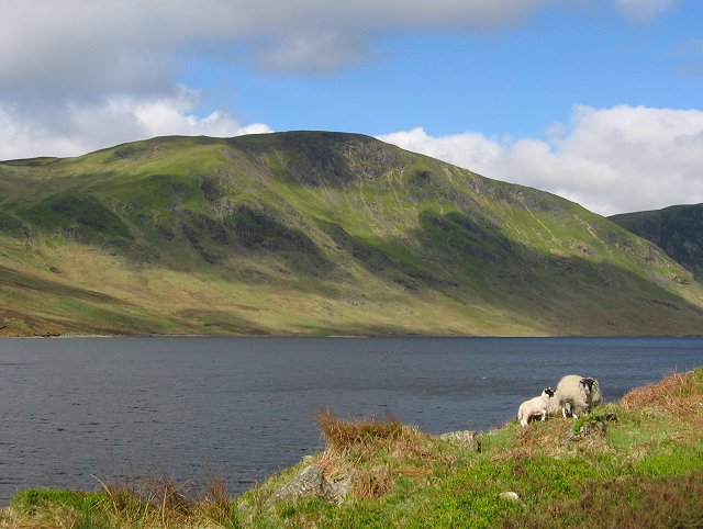
Ewe and lamb, Loch Turret. These hills are used for sheep farming, and the grazing is good. Beyond the sheep is Loch Turret, once a small natural loch at the head of the glen, supplying water to Crieff. In the 1960s, a large dam was built to form today's reservoir. The water is mostly used by the Grangemouth petrochemicals complex. There is a pipeline direct to Grangemouth.
Carn Chois. The summit of Charn Chois (786m) above the western side of the loch. Quite a sharp peak, it shows up well in views from Strathearn.


