Loch Vaa Walk
![]()
![]() This walk visits Loch Vaa near Boat of Garten and Aviemore in the Cairngorms.
This walk visits Loch Vaa near Boat of Garten and Aviemore in the Cairngorms.
You can start the walk from the parking area at the south western corner of the loch, just off the A95 and next to the Laggantygown Cemetery. From here you can pick up footpaths heading east along the southern part of the loch. The loch is very photogenic with beautiful clear waters and views of the surrounding hills. It also contains the remains of a crannog, a historic fortified structure constructed on an artificial island in the middle of the loch.
Postcode
PH24 3BT - Please note: Postcode may be approximate for some rural locationsLoch Vaa Ordnance Survey Map  - view and print off detailed OS map
Loch Vaa Open Street Map  - view and print off detailed map
Loch Vaa OS Map  - Mobile GPS OS Map with Location tracking
Loch Vaa Open Street Map  - Mobile GPS Map with Location tracking
Further Information and Other Local Ideas
If you head east from the site you could pick up the Speyside Way. Also to the east is the popular Loch Garten where there's an Osprey Centre and more fine waterside trails.
Just west of Aviemore there's the wonderful Craigellachie Nature Reserve. The reserve includes a series of lochans, fascinating plantlife and a wonderful viewpoint towards the nearby Cairn Gorm.
For more walking ideas in the area see the Cairngorms Walks page.
Cycle Routes and Walking Routes Nearby
Photos
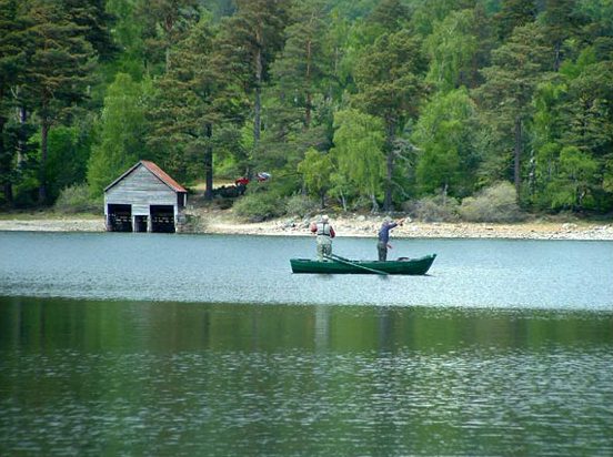
Boathouse. The loch has been described by one authority as, 'Mysterious Loch Vaa'. Set amidst forestry and little visited it certainly does have an aura. Although close to the A94 road it cannot be seen from it. Access is however simple by parking in Laggantygown cemetery car park and following a path 100 yards through the trees. From the boathouse one can follow a network of tracks through the forest some 2 miles to Boat of Garten but beware, do take a map & compass, the forest is vast and featureless.
Crannog. This beautiful loch is hidden in woodland unseen from the busy A95 road just a few yards away and consequently little visited. View is from the SE shore looking out to a crannog and to the red roofed boat house on the far shore beyond. Crannogs were artificial islands dating from perhaps 1st century AD onward and built to house people and provide some protection from wild animals and predatory man!


