Mardon Down
![]()
![]() Climb to Mardon Down on Dartmoor and enjoy wonderful far reaching views over the surrounding area. The hill is also home to a fascinating set of ancient stone circles and covered with lots of interesting plants and flowers. It's a really pretty spot and well worth the challenging climb.
Climb to Mardon Down on Dartmoor and enjoy wonderful far reaching views over the surrounding area. The hill is also home to a fascinating set of ancient stone circles and covered with lots of interesting plants and flowers. It's a really pretty spot and well worth the challenging climb.
The walk starts in the village of Moretonhmapstead about 1.5 miles south west of the hill. You then follow footpaths towards Yarningdale before crossing the down. You'll pass a cairn circle before coming to Mardon Down stone circle which is the biggest on Dartmoor. The walk climbs to well over 1000 ft so it is a fairly challenging ascent. You are rewarded with wonderful views towards the Devon coast, Hay Tor, Hound Tor and Exmoor. It's great for wildlife too with birds such as stonechats, skylarks and cuckoos to look out for. You might also see Dartmoor ponies and rabbits as you make your way across the hill.
You can continue across the down towards Cod Wood, Dunsford Nature Reserve and Meadhaydown Nature Reserve. These are all just a mile or so north east of Mardon Down.
Both the Dartmoor Way and the Dartmoor Ramble pass Moretonhampstead so it is easy to extend your walking in the area.
Mardon Down Ordnance Survey Map  - view and print off detailed OS map
Mardon Down Open Street Map  - view and print off detailed map
Mardon Down OS Map  - Mobile GPS OS Map with Location tracking
Mardon Down Open Street Map  - Mobile GPS Map with Location tracking
Further Information and Other Local Ideas
For more walking ideas in the area see the Dartmoor Walks page.
Cycle Routes and Walking Routes Nearby
Photos
The southern slopes of Mardon Down, with bracken, gorse and scattered trees, give a good view over Doccombe (in SX7786) in the valley below, with the B3212 climbing towards Cossick Cross.
The lane down to Clifford Bridge runs between Mardon Down on the right and the woods dropping into the Teign valley on the left.
North Kingwell from the Down. The road across the southern edge of the Down offers lovely views across the Kingwell valley and beyond. The nearer farm, part hidden by the hillside, is North Kingwell; South Kingwell, on the left, is largely in SX7786. On top of Hingston Down, above the farm, are Hingston Rocks, indiscernible at this distance.
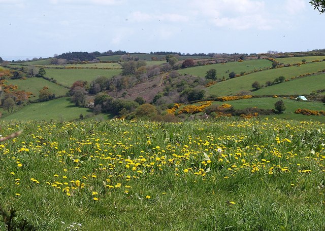
Dandelions near Doccombe Cross. The lane from Doccombe Cross to Mardon Down offers great views. Here, across a dandelion-filled meadow, is the countryside east of Doccombe.


