Masham Walks
![]()
![]() A circular walk exploring the countryside and rivers around the small town of Masham in North Yorkshire. The walk includes lovely riverside stretches along the River Burn and the River Ure. You'll also pass close to the Swinton Estate with its deer park and expansive parkland.
A circular walk exploring the countryside and rivers around the small town of Masham in North Yorkshire. The walk includes lovely riverside stretches along the River Burn and the River Ure. You'll also pass close to the Swinton Estate with its deer park and expansive parkland.
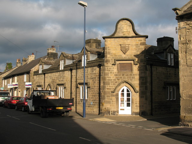
The route starts in the town centre which includes a nice Market Place and some fine Georgian architecture. You head east from the town to the River Ure, where you pick up a nice riverside footpath. After about half a mile you turn west to pick up a trail along the River Burn. The river passes close to the village of Swinton which includes Swinton Park. The country house is now a hotel set in 200 acres of parkland, lakes and gardens. You can visit the estate, explore the beautiful gardens and watch out for the resident fallow deer.
The walk continues past Swinton Moor before picking up a section of the Ripon Rowel long distance trail. You follow the waymarked trail through the countryside to return to the town.
To extend your walking around Masham follow footpaths north from the town to the nearby Marfield Wetlands Nature Reserve. The peaceful reserve is home to a variety of species of bird and includes several ponds located next to the River Ure. If you head south you can visit Hackfall Woods and the villages of Grewelthorpe and Kirkby Malzeard.
Other walks in the area include the splendid climb to the fascinating Druids Temple. You can follow the Ripon Rowel from the town to the site, where you will find an early 19th century replica of Stonehenge surrounded by attractive woodland.
Also near the town is Leighton Reservoir and Roundhill Reservoir.
These bodies of water are also located to the west of the town near the Druids Temple.
Masham Ordnance Survey Map  - view and print off detailed OS map
Masham Open Street Map  - view and print off detailed map
Masham OS Map  - Mobile GPS OS Map with Location tracking
Masham Open Street Map  - Mobile GPS Map with Location tracking
Walks near Masham
- Ripon Rowel - This is a circular walk around the Yorkshire city of Ripon, visiting South Stainley, Markington and Masham
- Masham Leaves Walk - A circular walk around the North Yorkshire town of Masham, visiting a series of stone sculptures.
- Leighton Reservoir - This circular walk visits Leighton and Roundhill Reservoirs before climbing into the surrounding moors for great views back down to the water
- Druids Temple - Visit this fascinating replica of Stonehenge, on this lovely circular walk from Masham
- Hackfall Woods - These peaceful woods near Grewelthorpe have miles of nice walking trails to try
- Aislabie Walk - This walk follows a circuit that connected the estates and gardens of the Aislabie family in the 18th century
- Studley Park and Fountains Abbey - This marvellous attraction boasts 800 acres of beautiful parkland set in the Yorkshire countryside
- Grewelthorpe - This circular walk around Grewelthorpe uses the Ripon Rowel long distance trail to visit Hackfall Woods and the River Ure
- West Tanfield - This attractive North Yorkshire village has some lovely riverside paths, a popular long distance trail and a delightful local woodland park to explore.
- Nosterfield Nature Reserve - This walk visits the lovely Nosterfield Nature Reserve near West Tanfield.
- Kirkby Malzeard - This North Yorkshire based village is located in the Harrogate district just south of Grewelthorpe.
Pubs/Cafes
Near Masham you could stop off at the Black Swan at Fearby. They do great food and also provide good quality accommodation if you need to stay over. Inside there's an attractive olde interior with a number of aerial photographs on the wall. Outside there's a lovely patio area where you can enjoy view across the Dale. You can find the inn at Fearby near Masham, with a postcode of HG4 4NF for your sat navs. The inn is also dog friendly if you have your canine friend with you.
Further Information and Other Local Ideas
The circular Masham Leaves Walk is a popular short route to try in the town. The circular walk takes you to 6 interesting limestone sculptures dotted around the town and surrounding countryside. There's also nice riverside stretches along the the River Ure and River Burn.
Just to the east you can visit the neighbouring village of West Tanfield. Here you'll find the 15th century Marmion Tower, a fine 17th century riverside pub and the lovely Nosterfield Nature Reserve.


