Meonstoke Walks

 This Hampshire based village has some lovely trails through the attractive countryside of the Meon Valley. There's also some fine listed buildings including the 13th century church and 18th century Meonstoke House which includes some excellent Georgian architecture.
This route from the village uses sections of The South Downs Way and the Monarch's Way to create a circular walk around the village. On the way you'll enjoy a climb to the splendid viewpoints on Old Winchester Hill to the east and Beacon Hill to the west of the settlement. The site is one of the highlights of the area with the hill and surrounding area a designated National Nature Reserve which includes a wide variety of butterflies and wildlife to see. These include buzzards, kites, roe deer and foxes. On Beacon Hill there's a round barrow cemetery dating to the Late Neolithic or Bronze Age, which is designated as a scheduled monument. There's also fine views towards the Solent on the coast. The route also visits the neighbouring villages of Wanford and West Meon which lies just to the north.
Meonstoke Ordnance Survey Map  - view and print off detailed OS map
Meonstoke Open Street Map  - view and print off detailed map
Meonstoke OS Map  - Mobile GPS OS Map with Location tracking
Meonstoke Open Street Map  - Mobile GPS Map with Location tracking
Walks near Meonstoke
- Old Winchester Hill - This walk takes you up the 197 metres (646 ft) Old Winchester Hill in the South Downs
- Meon Valley Trail - This peaceful cycling and walking trail runs along a disused railway track from West Meon to Wickham via Droxford
- Forest of Bere - Enjoy miles of cycling and walking trails in this lovely forest near Portsmouth
- Forest of Bere West Walk - Explore the West Walk section of the Forest of Bere on this woodland route near Portsmouth
- Butser Hill - Climb to the highest point on the South Downs on this walk near Petersfield.
There's a good sized car park off Limekiln Lane just to the west of the hill - West Meon - The village of West Meon is in a splendid location for exploring the lovely Meon Valley and the South Downs
- East Meon - This village in East Hampshire has some nice walks across the South Downs to try
- Beacon Hill Hampshire - This walk climbs to the lovely Beacon Hill Nature Reserve from Meonstoke in Hampshire.
- The South Downs Way - This beautiful 100 mile long trail runs from Winchester to the coastal town of Eastbourne
- Monarch's Way - This incredible 615-mile walk approximates the escape route taken by King Charles II in 1651 after being defeated in the Battle of Worcester
Pubs/Cafes
Head to the Bucks Head for some well earned refreshment after your walk. The quaint inn is located in a fine spot close to the river and boasts a lovely garden area. You can find them on Shoe Lane, Exton with a postcode of SO32 3NT for your sat navs.
Dog Walking
The country and woodland trails make for a fine dog walk. The Bucks Head mentioned above is also dog friendly.
Further Information and Other Local Ideas
You can continue your walking in the area by picking up the Meon Valley Trail, a shared cycling and walking route which explores the beautiful river valley.
For more walking ideas in the area see the Hampshire Walks, South Downs Walks page.
Photos
The Cross, West Meon. Cross, thatched cottages and daffodils. 'According to village tradition, the yew tree which survived until its stump was removed in 1861, was the very one under which St Wilfrid conducted his ministry in what is now West Meon. The memorial cross which may be seen today was built in its place.'
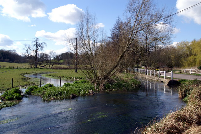
River Meon, Warnford. The Meon rises as a spring about 2km south of the village of East Meon. From there it flows north west towards Warnford where it turns south, flowing through the villages of Droxford, Soberton, Wickham and Titchfield entering the sea near Hill Head. It rises in chalk soil and continues as a chalk stream until it begins to flow over sand, silt and clay just south of Mislingford.


