Mersea Island Circular Walk
![]()
![]() Explore the coastline of the most easterly inhabited island in the United Kingdom island on this circular walk near Colchester. The route takes you along the coastline visiting beaches, Cudmore Grove Country Park and the settlements of West Mersea and East Mersea. Look out for wildlife including Marsh harriers, watervoles, red squirrels, and numerous wintering birds.
Explore the coastline of the most easterly inhabited island in the United Kingdom island on this circular walk near Colchester. The route takes you along the coastline visiting beaches, Cudmore Grove Country Park and the settlements of West Mersea and East Mersea. Look out for wildlife including Marsh harriers, watervoles, red squirrels, and numerous wintering birds.
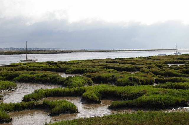
The route starts from West Mersea and passes along the Strood Channel with lovely views over the water to Ray Island Nature Reserve and Langenhoehall Marsh. You continue to Reeveshall Marsh where there are good views over the Pyfleet Channel to Pewit Island.
The route continues to the south side of the island to Cudmore Grove Country Park. Here you can stroll along the lovely sandy beach and enjoy views across Brightlingsea Reach towards Brightlingsea. There's also marshland and grassland which is perfect for picnics.
The walk then passes along the south side of the island with great views over the Mersea Flats to the Blackwater Estuary. The final section takes you along the coast through West Mersea to the finish point.
If you'd like to extend your walking in the area then you could head north to the lovely Abberton Reservoir. The reservoir is excellent for bird watching with thousands of wildlfowl to look out for on the water.
Our Blackwater Estuary Walk starts from nearby Maldon and runs to the Tollesbury Wick Nature Reserve.
Mersea Island Ordnance Survey Map  - view and print off detailed OS map
Mersea Island Open Street Map  - view and print off detailed map
*New* - Walks and Cycle Routes Near Me Map - Waymarked Routes and Mountain Bike Trails>>
Mersea Island OS Map  - Mobile GPS OS Map with Location tracking
Mersea Island Open Street Map  - Mobile GPS Map with Location tracking
Pubs/Cafes
There's lots of good choice for refreshments on your walk. One of the highlights is the Coast Inn, located on the western side of the island. There's a friendly atmosphere and stylish blend of traditional wooden floors, modern leather sofas and a cosy real log fire. You can sit outside on the terrace and enjoy fine views of the Blackwater estuary with your meal. You can find the pub at 108 Coast Rd, West Mersea, CO58NA.
Cycle Routes and Walking Routes Nearby
Photos
Sandstone cliffs on Mersea Island. The erosive effect of the sea can be clearly seen, with undercutting of the bottom of the cliffs.
Mersea Stone. The eastern tip of the island is known as Mersea Stone. This view across the sandy spit looks across Brightlingsea Reach to the town of that name.
View across Mersea Fleet. In the background at right the Strood causeway can be seen. It was first constructed in Roman times and presently is part of the B1025 that connects Mersea with Colchester. The causeway can become flooded during high tides; during particularly high tides the bridge is impassable by vehicles including the emergency services, except for those with high clearance, for over an hour. Mersea Island, located off the coast to the SE of Colchester, is the most easterly inhabited island in Great Britain.
The Strood causeway flooded at spring tide. The picture shows the causeway to Mersea Island, from the island. The Strood has been in use since the Roman occupation and regularly floods during spring tides. The vehicle shown was the last to go across. Subsequent vehicles turned back and had to wait for the tide to turn. Islanders rely on tide tables to plan their forays to the mainland.
View to Great Cob Island. This is the view across the Saltmarsh on Tollesbury Wick Nature Reserve towards Great Cob Island and West Mersea beyond. The reserve is managed by Essex Wildlife Trust


