Merthyr Tydfil Walk
![]()
![]() The town of Merthyr Tydfil is nicely positioned on the edge of the Brecon Beacons and next to the River Taff. There's some good walking trails along the river and up to the series of reservoirs and forests which lie just to the north of the town.
The town of Merthyr Tydfil is nicely positioned on the edge of the Brecon Beacons and next to the River Taff. There's some good walking trails along the river and up to the series of reservoirs and forests which lie just to the north of the town.
This circular walk visits some of the highlights of the area including Cyfarthfa Castle and the River Taff.
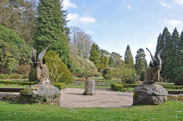
The walk starts at the Grade I listed Cyfarthfa Castle in the town. The castle is surrounded by attractive gardens, woodland paths, wide lawns and a pretty lake. There's also fine views of the town and the surrounding hills from the castle's elevated position.
Follow paths around the lake and you can cross the Taf Fechan and the River Taff to join with the Taff Trail.
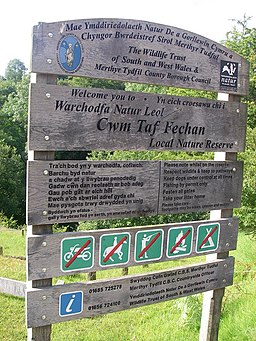
You can follow the shared cycling and walking path along the river and through the town towards Trefechan. Here you could follow the river north to the Taf Fechan nature reserve where there are opportunities to spot some water loving wildlife. This route crosses the river and follows the waterside path back to the castle grounds.
Merthyr Tydfil Ordnance Survey Map  - view and print off detailed OS map
Merthyr Tydfil Open Street Map  - view and print off detailed map
Merthyr Tydfil OS Map  - Mobile GPS OS Map with Location tracking
Merthyr Tydfil Open Street Map  - Mobile GPS Map with Location tracking
Walks near Merthyr Tydfil
- Taff Trail - Follow the River Taff, from Cardiff to Brecon, on this fantastic waterside cycling and walking route.
You start on the River Taff in Cardiff and head along the river northwards passing the Millennium Stadium and Cardiff Castle - Blaen y Glyn Waterfalls - This walk visits a series of beautiful waterfalls on the River Caerfanell near Talybont Reservoir in the Brecon Beacons
- Pen Y Fan - Climb the highest peak in South Wales and southern Britain on this stunning walk in the Brecon Beacons National Park.
This is a challenging climb to the 2906 feet (886m) summit but the footpaths are generally very good for most of the walk.
You start at the car park at Storey Arms about 10 miles north of Merthyr Tydfil - Pen y Fan Horseshoe Walk - This fantastic horseshoe ridge walk visits Pen Y Fan, Corn Du and the Cribyn in the Brecon Beacons National Park
- Taf Fechan Forest - Enjoy a series of beautiful waterfalls and delightful woodland trails on this walk in the Brecon Beacons National Park
- Pontsticill Reservoir - This circular walk takes you around the beautiful Pontsticill Reservoir in the Brecon Beacons National Park
- Upper and Lower Neuadd Reservoirs - These two pretty reservoirs are located on the edge of the Brecon Beacons National Park near to the town of Merthyr Tydfil
- Llwyn-on Reservoir - This circular walk takes you around the lovely Llwyn-on Reservoir on the edge of the Brecon Beacons
- Garwnant - This walk visits the Coed Taf Fawr and a series reservoirs near Merthyr Tydfil
- Cefn Coed Viaduct - This walk visits the impressive Cefn Coed Viaduct in the village of Cefn-coed-y-cymmer in Merthyr Tydfil.
- Llanwonno - This walk visits the waterfall near the hamlet of Llanwonno in St Gwynno Forest, in the heart of the South Wales Valleys
- Pentwyn Reservoir - This circular walk takes you around Pentwyn or Dol-y-gaer Reservoir in the Brecon Beacons.
- Trefil Quarry - This walk visits the Trefil Quarry in the small village of Trefil in Blaenau Gwent, south Wales.
Pubs/Cafes
The New Crown is a fine place to go for some refreshments after your walk. They do good food and also have a lovely beer garden for warmer weather. You can find the friendly pub on the High Street at postcode CF47 8DP for your sat navs.
Further Information and Other Local Ideas
Follow the Taff Trail north from the town and it will take you to Pentwyn Reservoir and Pontsticill Reservoir where there's a nice circular trail around the water. If you prefer you could also get the splendid Brecon Mountain Railway to Pontsticill station from Pant station, just to the east of the town.
Near the reservoir you'll also find the expansive Taf Fechan Forest where there are miles of good trails to try.
On the north western fringes of the town you could enjoy a climb to the Cefn Coed Viaduct. It is the third largest viaduct in Wales providing excellent views from the top.
Just to the south is Llanwonno where there's some peaceful trails through the St Gwynno Forest. The forest includes a secluded waterfall, a small resevoir and a forestry commission picnic area/car park.
Photos
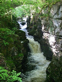
Taf Fechan beneath Pont Sarn. The Taf Fechan falls over rocks in a narrow limestone gorge beneath Pont Sarn just north of Merthyr Tydfil. The left bank is in Brecon Beacons National Park. The pool at the bottom of these falls is known locally as the Blue Pool
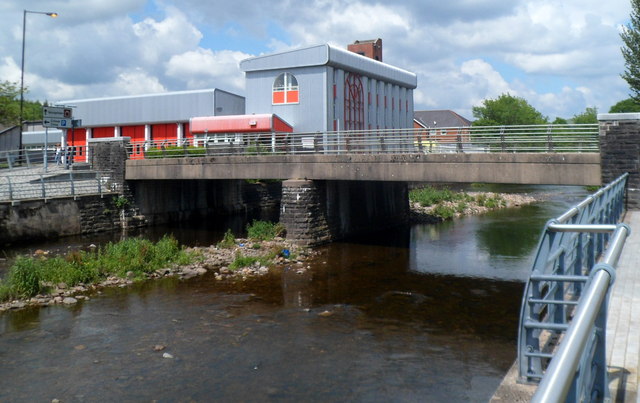
Bridge across the Taff, Merthyr Tydfil. The bridge connects Avenue de Clichy (A4054) on this side of the River Taff with Penry Street on the far side. Merthyr Tydfil Fire Station is in the background.


