Oakamoor Railway Walk
![]()
![]() The pretty Staffordshire village of Oakamoor makes a great base for exploring the beautiful Churnet Valley.
The pretty Staffordshire village of Oakamoor makes a great base for exploring the beautiful Churnet Valley.
The Staffordshire Moorlands Way and the Staffordshire Way can be used to explore the wooded valleys surrounding the village. Other local highlights include Dimmingsdale where there's a waymarked trail to follow along a series of streams and pools. There's also the National Trust's Hawksmoor Wood Nature Reserve. The ancient woodland is located just to the west of the village and is a great place for wild flowers and wildlife spotting.
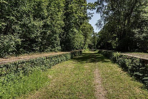
This walk takes you along the old Churnet Valley Railway and is also suitable for cyclists. On the walk you'll enjoy nice views of the River Churnet and miles of peaceful woodland trails. The area looks particularly stunning in the autumn months.
To explore the Churnet Valley further head north to Froghall on the Staffordshire Way and you can pick up the towpath of the Caldon Canal. You could also visit the nearby village of Alton, home to the famous Alton Towers and the interesting Alton Castle.
Postcode
ST10 3AB - Please note: Postcode may be approximate for some rural locationsOakamoor Ordnance Survey Map  - view and print off detailed OS map
Oakamoor Open Street Map  - view and print off detailed map
*New* - Walks and Cycle Routes Near Me Map - Waymarked Routes and Mountain Bike Trails>>
Oakamoor OS Map  - Mobile GPS OS Map with Location tracking
Oakamoor Open Street Map  - Mobile GPS Map with Location tracking
Pubs/Cafes
Head to the Cricketers Arms for some refreshment after your walk. The pub is in a delightful riverside spot with views of the weir and waterfall from the lovely garden area. You can find them near the village church at a postcode of ST10 3AB for your sat navs.
Dog Walking
The woodland and river trails on the route are ideal for a dog walk. The Cricketers mentioned above is also very dog friendly with water and treats available.
Further Information and Other Local Ideas
The village is also located close to the market town of Cheadle and the lovely Consall Nature Park where there's ponds, streams, easy woodland trails and fine views over the valley from the high points .
For more walking ideas in the area see the Staffordshire Walks page.
Cycle Routes and Walking Routes Nearby
Photos
Oakamoor Village Centre. The village lies in a steep wooded valley in the Staffordshire moorlands. At one time it was served by both a canal and a railway. The canal has long since gone but the railway track bed still exists. To the south the track is now a pleasant multi-user trail to Alton. To the northwest the it connects to the Churnet Valley preserved railway with the prospect that one day the line might be extended once more into the village.
Oakamoor Station, Churnet Valley Line (Closed 1965). The station was opened in 1849 as part of the Churnet Valley Line constructed by the North Staffordshire Railway. The station remained open until 1965 when all services were withdrawn.


