Cheadle Walks
![]()
![]() This market town is located in the Staffordshire Moorlands area of the county. It's proximity to the scenic Churnet Valley and the Peak District National Park make it a fine base for walkers.
This market town is located in the Staffordshire Moorlands area of the county. It's proximity to the scenic Churnet Valley and the Peak District National Park make it a fine base for walkers.
This walk from the town heads east to explore the aforementioned Churnet Valley. You'll visit the Hawksmoor Nature Reserve, the beautiful Dimmingsdale and the village of Oakamoor on the way.
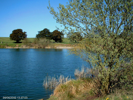
Start the walk on the eastern side of the town where you can pick up footpaths heading east through the countryside to the Hawksmoor Nature Reserve. This National Trust owned reserve has ancient woodland, wildflowers and wildlife including spot green woodpeckers, spotted flycatchers and ravens. Here you can pick up the Staffordshire Way and follow it south east into Dimmingsdale. This is another peaceful area of woodland which includes a series of picturesque ponds.
The route then crosses the river near Alton, close to the famous Alton Towers theme park. You then follow a trail along a dismantled railway north west to the village of Oakamoor.
Country lanes then lead you west to Stoney Dale before returning to Hawksmoor and following the same paths back to Cheadle.
Cheadle Ordnance Survey Map  - view and print off detailed OS map
Cheadle Open Street Map  - view and print off detailed map
Cheadle OS Map  - Mobile GPS OS Map with Location tracking
Cheadle Open Street Map  - Mobile GPS Map with Location tracking
Pubs/Cafes
The Baker's Arms in the town is a cosy pub on the High Street. They do a very good selection of real ales and can be found at postcode ST10 1AF. At Dimminsdale there's the excellent Rambler's Retreat tea rooms. Inside there's a fine conservatory while outside there are beautiful woodland gardens for warmer days. They have a varied menu and do particularly fine home made cakes.
Dog Walking
The woodland trails on the walk are ideal for dog walking so expect to see other owners on your way. The Baker's Arms pub and the Rambler's Retreat mentioned above are also dog friendly.
Further Information and Other Local Ideas
Just of the north of the town is the Consall Nature Park. In the park you will find two large ponds, streams, easy woodland trails and fine views over the area from the high points. Also near the town you can pick up the Caldon Canal in the Churnet Valley and enjoy an easy waterside stroll.
Also of interest is the Cecilly Brook Local Nature Reserve near the centre of town. The reserve is a nice local place to go for an easy stroll and is one of the most important breeding sites for water voles in Staffordshire.
About three miles south east of the town you will find the remains of the 12th century Croxden Abbey. There are nice trails to follow around the substantial abbey ruins with information boards detailing the history of the site. It's an interesting area and run by English Heritage with no charge for your visit.
For more walking ideas in the area see the Staffordshire Walks page.


