Old Harry Rocks Walk
![]()
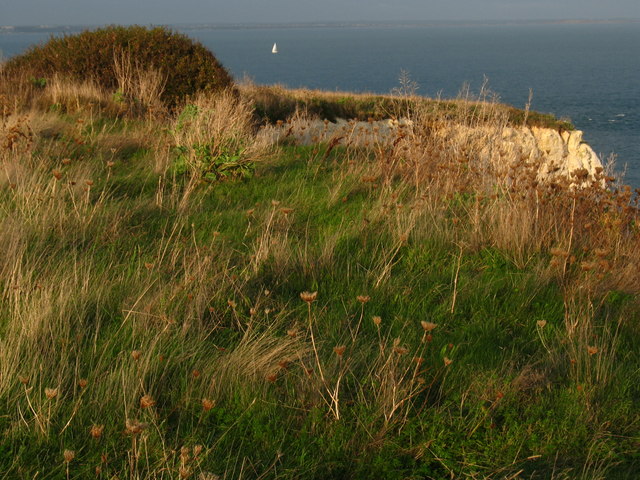
![]() This circular walk visits the local landmark of Old Harry Rocks on the Dorset coast, near Studland. It's a popular walk with wonderful views towards Sandbanks, Poole Harbour and the Isle of Wight.
This circular walk visits the local landmark of Old Harry Rocks on the Dorset coast, near Studland. It's a popular walk with wonderful views towards Sandbanks, Poole Harbour and the Isle of Wight.
The three striking chalk formations mark the most easterly point of the Jurassic Coast. The rocks are thought to be named after Harry Paye, the infamous Poole pirate. His ship would lay in wait for passing merchant ships, using the rocks as cover.
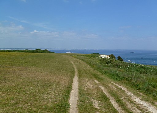
You can park at the South Beach car park in Studland to start your walk. From here you pick up a nice flat footpath along the South West Coast Path to take you to the rocks. It's about a one mile stroll from the parking area to the rocks, with a seated viewpoint along the way. The path passes through chalk grassland with lots of pretty wildflowers to look out for in the summer months.
From the rocks you can then climb towards Ballard Point where you pick up a section of the Purbeck Way to take you across Ballard Down. You then descend back into Studland on a country lane, passing the Glebeland Estate. The route then heads to the pretty Norman Church of St Nicholas which dates from the 12th century, although there has been a church on this site from Saxon times. You can follow a public footpath through the church grounds which leads you back to the car park.
At the end of your walk you can enjoy refreshments at the Bankes Arms pub on Manor Road. It has a great beer garden overlooking Studland Bay.
To extend your walking in the area you could head north and explore the lovely Studland Heath Nature Reserve. Here you will find way marked trails taking you through sand dunes and heathland with a variety of wildlife to look out for. The heath leads into Godlingstone Heath where you can visit the impressive Agglestone Rock. The large sandstone block sits in an elevated position and commands wonderful views across the heaths to the coast.
Continuing west along the Purbeck Way from Ballard Down will take you to the village of Corfe Castle with its ruined castle and pretty cottages.
You can virtually explore the area around Old Harry by clicking on the Google Street View link below.
Postcode
BH19 3AU - Please note: Postcode may be approximate for some rural locationsOld Harry Rocks Ordnance Survey Map  - view and print off detailed OS map
Old Harry Rocks Open Street Map  - view and print off detailed map
Old Harry Rocks OS Map  - Mobile GPS OS Map with Location tracking
Old Harry Rocks Open Street Map  - Mobile GPS Map with Location tracking
Explore the Area with Google Street View 
Pubs/Cafes
The Bankes Arms Inn in Studland is a nice place for some post exercise refreshments. The Inn has a wonderful garden area with glorious views across Studland Bay towards Poole, Bournemouth and the Isle of Wight. There's some interesting history too as the pub dates all the way back to the 16th century and is made of Purbeck Stone.
You can find them at postcode BH19 3AU for your sat navs.
Dog Walking
It's a lovely bracing walk to do with your dog. Do be carefull near the cliff edges though - it is probably best to keep them on leads in these areas.
The Bankes Arms mentioned above is dog friendly.


