Old Sarum Castle
![]()
![]() Visit the site of the earliest settlement of Salisbury on this fascinating walk in Wiltshire. Here you can see the exposed foundations of the former cathedral and climb the mighty ramparts for splendid views of the surrounding Wiltshire Plains. There's 29 acres of beautiful rare grass chalkland to explore on a number of good footpaths. Look out for butterflies and kestrels, which can often be seen hovering over the outer bailey.
Visit the site of the earliest settlement of Salisbury on this fascinating walk in Wiltshire. Here you can see the exposed foundations of the former cathedral and climb the mighty ramparts for splendid views of the surrounding Wiltshire Plains. There's 29 acres of beautiful rare grass chalkland to explore on a number of good footpaths. Look out for butterflies and kestrels, which can often be seen hovering over the outer bailey.
The Old Sarum Way long distance footpath runs past the site so you can pick this up to extend your walk.
You can virtually explore the site using the google street view link below!
Postcode
SP1 3SD - Please note: Postcode may be approximate for some rural locationsPlease click here for more information
Old Sarum Castle Ordnance Survey Map  - view and print off detailed OS map
Old Sarum Castle Open Street Map  - view and print off detailed map
Old Sarum Castle OS Map  - Mobile GPS OS Map with Location tracking
Old Sarum Castle Open Street Map  - Mobile GPS Map with Location tracking
Explore the Area with Google Street View 
Further Information and Other Local Ideas
Just a few miles south east of the city you can enjoy a climb to Pepperbox Hill. The National Trust owned area includes a distinctive 17th century and some fine views over the Wiltshire countryside to the city. Near here there's also Figsbury Ring. The Iron Age hill fort is another National Trust owned site with good footpaths around the ramparts and more tremendous views.
The Sarsen Way passes the site. The long distance trail runs through Wiltshire from Coate Water Country Park in Swindon to Salisbury Cathedral. It passes many fascinating ancient sites including the hill fort at Barbury Castle and the Alton Barnes White Horse on Milk Hill.
Cycle Routes and Walking Routes Nearby
Photos
Remains of Medieval Castle of Old Sarum. Keep (middle) and part of Royal Palace (right). View to north-west.
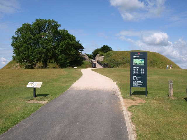
Bridge into Old Sarum castle. Having crossed this bridge and passed the ruins of the gatehouse, you will be asked to pay to enter the castle.
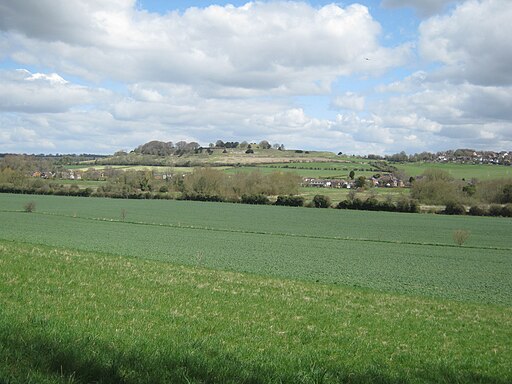
A view of Old Sarum looking north east across the River Avon valley from below Devizes Road, Salisbury. The small plane in the top right quarter has just left Old Sarum airfield just over the hill on the right. The River Avon runs left to right in the meadow in the middle distance. The suburb of Stratford-sub-Castle is visible across the upper/middle of the image


