GPS Cycle and Walking Routes

Perranporth to Holywell Bay Coastal Walk

4 miles (6.7 km)

This popular walk follows a section of the South West Coast Path from Perranporth to Holywell Bay on the Cornish Coast.
The route runs for 4.6 miles, with flat sections along the beach mixed with some small cliff top climbs.
Start the walk from the public car park near Droskyn Point in the pretty village of Perranporth. You then head east and then north to Perranporth Beach, where there is a long expanse of beach and sand dunes. The walk then proceeds to Ligger Point and Penhale Point before descending into the little village of Holywell. From here it is a short stroll to the lovely National Trust owned bay and beach.
The walk can be extended by continuing north to Crantock Beach and the popular tourist town of Newquay. Heading south will take you along the Perranporth to St Agnes Walk where there are more excellent views to enjoy.

Perranporth to Holywell Bay Coastal Walk OS Map - Mobile GPS OS Map with Location tracking

Perranporth to Holywell Bay Coastal Walk Open Street Map - Mobile GPS Map with Location tracking

Photos

Boscawen Gardens, Perranporth - geograph.org.uk - 2010429

Boscawen Gardens, Perranporth

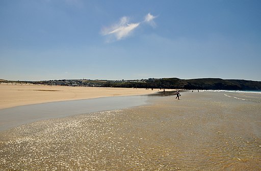
Perranporth , Perranporth Beach - geograph.org.uk - 2503091

Perranporth Beach. At the south end of the beach are cliffs with natural arches, natural stacks and tin-mining adits. The sand dunes here are a valuable resource for wildlife, with many rare plants and insects including Cornwall's largest colony of the silver-studded blue, a Red Data Book species.

Carrick , Shoreline ^ Perranporth - geograph.org.uk - 2504234

Carrick, Shoreline, Perranporth

The coastline north of Ligger Point - geograph.org.uk - 1210049

The coastline north of Ligger Point. Carter's or Gull Rocks on the left of the view, just off Penhale Point.

View along the coast towards Ligger Point from Penhale Sands - geograph.org.uk - 780192

View along the coast towards Ligger Point from Penhale Sands

A Glorious day at Holywell Bay - geograph.org.uk - 270333

A Glorious day at Holywell Bay. On the north side of Holywell beach Holywell Cave is accessible at low tide and contains many pools formed by natural buildup of minerals. In the cave is St Cubert's holy well. On the east of the beach, there is a 5,000 year old sand dune system that is one of the largest in Britain. During the summer, tourists can use these dunes for Sandboarding.

Video

GPS Files

GPX File

Perranporth to Holywell Bay Coastal Walk.gpx (On Desktop:Right Click>'Save As. On Ipad/Iphone:Click and hold>Share>Save to Files')