Precipice Circular Walk Dolgellau
![]()
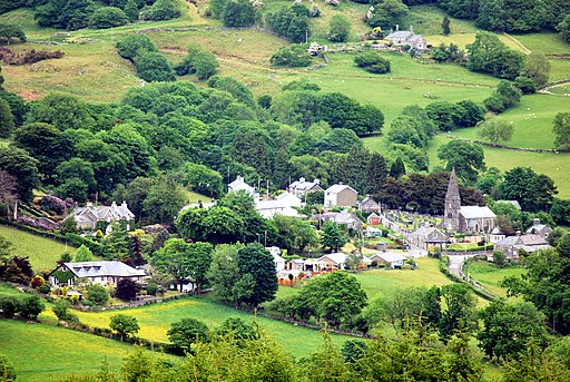
![]() A lovely circular walk through the hills surrounding Llyn Cynwch in the Snowdonia National Park. From the elevated position of the trail there are fabulous views over the Mawddach River and the surrounding mountains. The walk takes place on good, signed paths with an easier path along the reservoir for those looking for a more sedate stroll.
A lovely circular walk through the hills surrounding Llyn Cynwch in the Snowdonia National Park. From the elevated position of the trail there are fabulous views over the Mawddach River and the surrounding mountains. The walk takes place on good, signed paths with an easier path along the reservoir for those looking for a more sedate stroll.
You can start your walk from the car park a few miles north of Dolgellau, near to Nannau Farm and the Foel Offrwm Hill Fort. From here you can pick up the trails heading west towards the lake. Follow the paths above the water, taking you round to Foel Cynwch and the Foel Faner Iron Age Hillfort. The route then descends to the lake where you enjoy an easy waterside stretch before returning to the car park.
In Dolgellau you can pick up the Mawddach Trail to take you along the river to Barmouth. Here you can try climb to the Dinas Oleu hill fort on the popular Panorama Walk for more great views over the river estuary.
Postcode
LL40 2NG - Please note: Postcode may be approximate for some rural locationsPrecipice Walk Dolgellau Ordnance Survey Map  - view and print off detailed OS map
Precipice Walk Dolgellau Open Street Map  - view and print off detailed map
*New* - Walks and Cycle Routes Near Me Map - Waymarked Routes and Mountain Bike Trails>>
Precipice Walk Dolgellau OS Map  - Mobile GPS OS Map with Location tracking
Precipice Walk Dolgellau Open Street Map  - Mobile GPS Map with Location tracking
Pubs/Cafes
Head into Dolgellau and you could enjoy some post walk refreshments at the Royal Ship Hotel. The 19th century coaching inn does good food and also has a nice beer garden for warmer days. You can find the pub on Queen's Square at a postcode of LL40 1AR for your sat navs.
Dog Walking
The route is a fine place to take fit dogs for a walk though there are some areas where it's probably best to keep them on leads. The Coed Y Brenin Forest just to the north is another excellent spot for dog walking near the town. The Royal Ship Hotel mentioned above is also dog friendly.
Further Information and Other Local Ideas
The walk gives fine views over the expansive Coed Y Brenin Forest Park which lies just to the north of the walk. The forest is a great place to continue your exercise with miles of great cycling and walking trails.
Just to the south west of the route you could visit the interesting Cymer Abbey. This ruined Cistercian abbey is located near the village of Llanelltyd just north of Dolgellau. The abbey was founded in 1198 and substantial remains survive from the simple abbey church. You can find it at postcode LL40 2HE.
Just to the east of Dolgellau you can pick up the circular Torrent Walk which explores the Afon Clywedog gorge with its old mills, pretty waterfalls and rushing weirs.
There is also the New Precipice Walk which can be picked up to the north west in the little village of Llanelltyd. It's another circular, waymarked walk with more amazing views from the elevated path.


