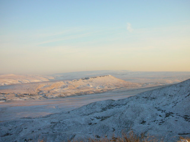
Pule Hill
![]()
![]() This circular walk climbs to Pule Hill on the wonderful Marsden Moor Estate in the South Pennines. The route runs for about 5 miles with a fairly challenging climb on the way.
This circular walk climbs to Pule Hill on the wonderful Marsden Moor Estate in the South Pennines. The route runs for about 5 miles with a fairly challenging climb on the way.
Start the walk from Marsden train station and then pick up footpaths heading west along the canal towards the Standedge Tunnels. Here you can pick up a section of the Standedge Trail and follow it south, crossing the route of the Huddersfield Narrow Canal as you go. From the high points there are some splendid views across the Pennines and down to Redbrook Reservoir below.
You continue round to the east and north along the trail before coming to Netherley where you can visit Butterley Reservoir. The route then picks up the Kirklees Way and follows the waymarked trail back to the train station.
Pule Hill Ordnance Survey Map  - view and print off detailed OS map
Pule Hill Open Street Map  - view and print off detailed map
Pule Hill OS Map  - Mobile GPS OS Map with Location tracking
Pule Hill Open Street Map  - Mobile GPS Map with Location tracking
Pubs/Cafes
Back in Marsden head to the Riverhead Brewery Tap for some refreshments after your walk. It does good food and is an excellent place for real ale connsiseurs. On the ground floor in the bar, there are 10 real ale hand pumps several of which are permanently dedicated to the popular Riverhead beers brewed on-site. The famous Riverhead micro-brewery is housed downstairs in the cellar. Here they brew a wide range of beers all with a local connection. Hot and cold food is served regularly with all dishes freshly prepared on site. You can find the pub in the picturesque village, next to the River Colne, on Peel Street with a postcode of HD7 6BR for your sat navs.
Further Information and Other Local Ideas
Head west and you can enjoy a walk around Castleshaw Reservoir or north to visit the lovely Scammonden Reservoir.
Just to the south there's the walk to Redbrook Reservoir and Black Moss Reservoir.
For more walking ideas in the area see the South Pennines Walks page.
Cycle Routes and Walking Routes Nearby
Photos
Railway and canal from the hill. The railway and canal enter their tunnels below the A62 and the hill
Track past the air shafts, Pule Holes, Marsden. This is the easiest way up onto Pule Hill; it climbs relatively gently up the edge of the escarpment and then continues to the air shaft at SE036115, but turning southwards along the edge, the summit is soon reached.


