South Pennines Walks

This expansive area of moorland has lots of excellent waymarked walking trails, reservoirs, canals and hill climbs with wonderful views.
For other walks in the Pennines see the North Pennines Walks and the West Pennines Walks pages.
Use the links to view full route information including elevation profiles, interactive maps and GPS downloads.
You can also view an overview map of all the routes in the using the South Pennines Walk Map>>
*New* - Walks and Cycle Routes Near Me Map - Waymarked Routes and Mountain Bike Trails>>
| Route Name | Photo | Distance | Description |
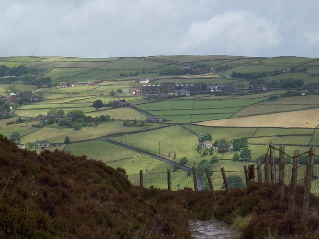
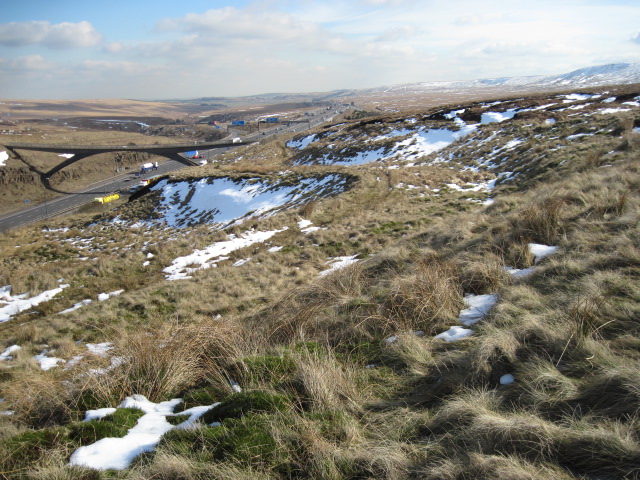
| Ashworth Valley | 5 miles (8 km) | This circular walk explores the Ashworth Valley area of Rochdale. On the route you'll enjoy riverside paths, woodland trails, attractive countryside and hill climbs with fine views over Manchester. The walk starts in Norden on the western fringes of Rochdale. Here you can pick up the Rochdale Way and follow it south along the Naden Brook through Ashworth Wood. You continue through Carr Wood where you will pass a pretty waterfall and lots of bluebells in the spring. The route continues south through Gelder Wood and Bamford Wood before coming to Simpson Clough. Here you turn north west to follow the pretty Cheesden Brook to Heywood's Farm and Greengate Hill. This section climbs high above the valley to expose you to some fine, far reaching views over the surrounding area. At Greengate Hill the route then turns east along the Rochdale Way to return you to Norden where the walk finishes. It's easy to extend the walk if you have time. You could head a short distance north of Norden to visit Greenbooth Reservoir or follow the Rochdale Way north west to Ashworth Moor Reservoir. Here you'll find the 18th century Owd Betts pub which is a great place for refreshments after your walk. View Full Details>> | |
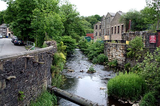
| Bacup | 4.2 miles (6.8 km) | This Lancashire based town is located in the Rossendale Valley area of the South Pennines. The historic town has an interesting industrial past with many old buildings surviving today. In fact, English Heritage has classified Bacup town centre as a protected area for its special architectural qualities. View Full Details>> | |
| Blackmoorfoot Reservoir | 1.9 miles (3 km) | This short walk visits Blackmoorfoot Reservoir in Huddersfield. View Full Details>> | |
| Boulsworth Hill | 7.5 miles (12 km) | Climb to Lad Law, the 1,696 ft (517 m) summit of Boulsworth Hill on this challenging walk in the South Pennines. The walk starts in the historically fascinating village of Wycoller and makes use of the Bronte Way and the Pendle Way footpaths to take you to Boulsworth Dyke where you begin the serious climbing to the hill summit. The views are far reaching with the Lake District Peaks, the Peak District, Pendle Hill and Blackpool Tower all visible on a clear day. You then descend via Bedding Hill Moor and return to Wycoller on the same paths. It's a fine walk with some wonderful moorland scenery and a nice waterside section along the Wycoller Beck at the start. The beck is crossed with ancient Clapper and Pack-horse bridges one of which is over 1,000 years old. You'll also pass the ruined Wycoller Hall thought to be the inspiration for 'Ferndean Manor' in Charlotte Bronte's novel Jane Eyre. If you would like to extend your walk you could head to the nearby Widdop Reservoir. View Full Details>> | |
| Bronte Way | 44.1 miles (71 km) | Follow the Bronte Way through Lancashire and Yorkshire and visit many of the places associated with writings and lives of the Bronte Sisters. Highlights on the walk include: Gawthorpe Hall - visited by Charlotte Bronte on several occasions, the impressive Gawthorpe Hall is the start point of the walk Wycoller Country Park - Wycoller Hall is believed to have inspired Ferndean Manor in Charlotte Bronte's "Jane Eyre". Top Withens - the inspiration for the location of Wuthering Heights Ponden Hall - situated near the village of Stanbury it inspired Thrushcross grange in Wuthering Heights. It sits next to the pretty Ponden Reservoir. Haworth - this Yorkshire village is where the Bronte sisters wrote many of their works and includes the Haworth Parsonage Museum Thornton - birthplace of the Brontes Oakwell Hall - inspiration for 'Fieldhead' in Charlotte Bronte's novel Shirley and also the end point of the route Bronte Waterfall - this beautiful waterfall is located in Bronte Country on Haworth Moor. It was a popular spot for the Bronte sisters who loved visiting the waterfall. There is a pretty little bridge called Bronte Bridge next to the falls. Oxenhope - the trail passes through the village and along the Leeming and Thornton Moor Reservoirs. View Full Details>> | |
| Calderdale Way | 49.7 miles (80 km) | The Calderdale Way is a walking circuit around the beautiful district of Calderdale in West Yorkshire. The walk passes through exposed moorland and woodland paths, while there are also waterside sections along the Rochdale Canal, the River Calder and around Withens Clough Reservoir and Warlands Reservoir. The walk officially starts at Greetland and passes through Ripponden, Mankinholes, Todmorden, Heptonstall, Holdsworth, Shelf and Brighouse. Highlights on the route include the beautiful wooded valley at Hardcastle Crags and the attractive heathland on Norland Moor near Sowerby Bridge. View Full Details>> | |
| Cant Clough Reservoir | 3.4 miles (5.5 km) | This circular walk visits Cant Clough Reservoir in the South Pennines. The small reservoir is in a remote location making it a peaceful place for a walk. View Full Details>> | |
| Cowm Reservoir | 1.4 miles (2.2 km) | This short circular walk visits Cowm Reservoir in the Whitworth area of Rossendale. The reservoir was created with nearby Spring Mill Reservoir to augment Rochdale's water supplies during the 19th century. Today it makes for a scenic walk with fine views across the water to the surrounding moorland scenery. View Full Details>> | |
| Cragg Vale | 4 miles (6.5 km) | The small village of Cragg Vale is located near Mytholmroyd in the Calderdale area of the South Pennines. View Full Details>> | |
| Deer Hill Reservoir | 0.9 miles (1.5 km) | This small reservoir is located near Meltham and Huddersfield in Kirklees. View Full Details>> | |
| Dovestone Reservoir | 3.7 miles (6 km) | Enjoy an easy circular walk around this lovely reservoir on Saddleworth Moor. The reservoir is located a few miles east of Oldham on the edge of the Peak District. There is a well maintained footpath running around the reservoir. There is also the option of continuing north along the water to Yeoman Hey Reservoir and Greenfield Reservoir where there are views of the Greenfield Brook. You can also follow the Oldham Way east to the nearby Chew Reservoir. The area is very popular with walkers as the reservoir is surrounded by attractive countryside, woodland and gritstone crags. Also look out for pretty waterfalls at Dovestone Clough near the dam. There is some climbing on the Chew Hills at the southern end of the water but you are rewarded with great views across the reservoir. This route starts from the car park at the south western end of the reservoir but you could also catch the train to nearby Mossley and follow the Oldham Way to the water. If you would like to extend your walk then you could climb to Great Dovestone Rocks located on the eastern side of the reservoir. The rocks are a fascinating geological feature and give great views over the Peak District. Our Dovestone Rocks circular walk starts from the same car park and also visits Chew Reservoir. View Full Details>> | |
| Folly Dolly Falls | 1 mile (1.6 km) | This walk visits the pretty Folly Dolly Falls in Meltham in Yorkshire. You can reach the falls by picking up the Meltham Greenway on the eastern side of the town, parking at the Morrisons supermarket nearby. Follow the woodland trail east for just over half a mile and you will come to the waterfall on your left, through a gap in the fence. View Full Details>> | |
| Gaddings Dam | 1.9 miles (3 km) | This circular walk visits the Gaddings Dam reservoir near Todmorden. View Full Details>> | |
| Goit Stock Waterfall | 1.2 miles (2 km) | This circular walk takes you to the lovely Goit Stock Waterfall near Cullingworth in West Yorkshire. The falls are something of a hidden gem, located in the secluded Goit Stock Wood on the edge of the South Pennines. View Full Details>> | |
| Greenbooth Reservoir | 1.9 miles (3 km) | Enjoy a circular walk around Greenboth Reservoir and the Naden Reservoirs on this route in the Rochdale area of Greater Manchester. It's a lovely, peaceful area with nice views towards Manchester and the nearby Scout Moor Wind Farm, the highest point of the Rossendale Valley. With four reservoirs to walk to and great views of the surrounding moorland scenery there's plenty to see in the area. View Full Details>> | |
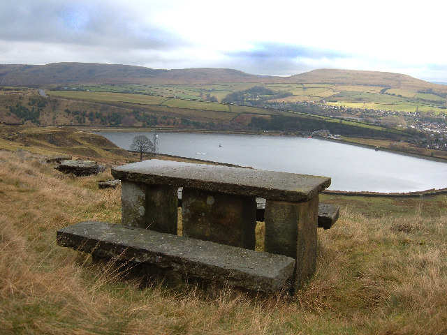
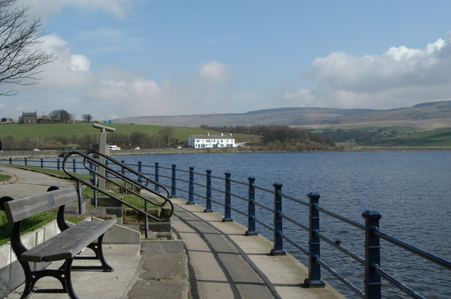
| Hollingworth Lake | 1.9 miles (3 km) | Enjoy a lovely circular walk around this 130 acre reservoir in Littleborough. There is some beautiful scenery surrounding the lake and a nature reserve with a bird hide. You can also try kayaking and windsurfing on the lake with equipment available for hire. View Full Details>> | |
| Hurstwood Reservoir | 1.9 miles (3 km) | This circular walk takes you around Hurstwood Reservoir in Burnley. Start the walk from the public car park in the village of Hurstwood just to the west of the reservoir. It's located just over 2 miles south east from Burnley town centre. From here you can pick up footpaths heading around the water for a distance of just under 2 miles. It's a peaceful spot with lovely views over the water to the surrounding Pennine Moors and hills. View Full Details>> | |
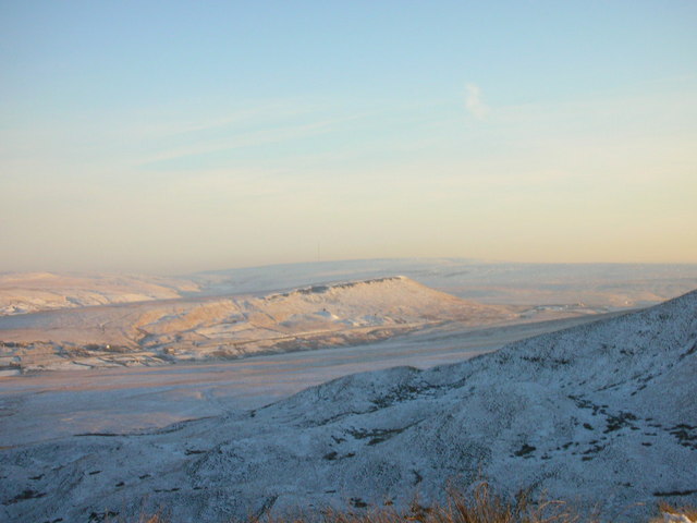
| Littleborough | 10.6 miles (17 km) | The town of Littleborough has a lot of great options for walkers visiting the region. It is nicely located in the upper Roch Valley by the foothills of the South Pennines. There's several waymarked trails, hill climbs, reservoirs and a canal running through the area. This circular walk visits several of the highlights of the area using a some of the waymarked trails that circle the town. The walk starts at the train station which lies on the Caldervale Line 13ľ miles (22 km) north of Manchester Victoria towards Halifax, Bradford Interchange and Leeds. From here you can pick up the Station Walk and follow it south to visit Hollingworth Lake. The lake is a popular local attraction with a waterside trail and lots of wildlife to look out for on the water. The route then picks up a section of the Pennine Bridleway, following it east towards Longdon Clough. The route then follows a different bridleway up to Windy Hill and Rook Stone Hill, where you pick up the Pennine Way National Trail. This will take you north to another highlight of the area at Blackstone Edge. This geologically significant gritstone escarpment commands wonderful views over Greater Manchester and Yorkshire. The path will take you north along the Edge to Blackstone Edge Reservoir where there's some more nice waterside trails. At the resevoir you continue west and then north around the Chelham Reservoirs before picking up the Rochdale Canal. You can then follow the towpath south back to the train station. View Full Details>> | |
| Meltham | 8.7 miles (14 km) | This West Yorkshire based town sits in a nice position on the edge of the Peak District. There's some fine moorland scenery, a series of pretty reservoirs and several local hill climbs to enjoy around the town. View Full Details>> | |
| Mossley | 11.6 miles (18.7 km) | This town in Greater Manchester has some fine local waterside walks along the river and canal which run through the area. There's also a number of lovely reservoirs on the surrounding Pennine Moors to visit. View Full Details>> | |
| Nelson | 8.1 miles (13 km) | The Lancashire town of Nelson is located in the Pendle area of the county. Walking highlights include the popular Pendle Hill and easier paths along the towpath of the Leeds and Liverpool Canal. There's also a number of reservoirs and great views of the Pennine Hills in the area. This route from the town uses sections of the Pendle Way, Burnley Way and Bronte Way to create a circular walk around the countryside to the east of the town. The waymarked paths will take you to a series of picturesque reservoirs with fine views over the surrounding moors. The route runs for a distance of about 8 miles with some moderate hill climbs on the way. The walk starts from Walverden Reservoir on the south eastern fringes of the town. It's located just over half a mile south east of the train station. From here you can pick up the Pendle Way and follow it east to Catlow and the Coldwell Reservoirs. There's good views over the water to Boulsworth Hill here. The hill can be climbed for wonderful views over the South Pennines. View Full Details>> | |
| Ogden Reservoir and Piethorne Reservoir | 3.1 miles (5 km) | Explore this area of the Piethorne Valley on this circular walk in the Metropolitan Borough of Rochdale, Greater Manchester. There's a nice walking trail taking you around Ogden Reservoir, Kitcliffe Reservoir and Piethorne Reservoir. You'll climb above the reservoirs and enjoy wonderful views over the surrounding countryside. There's also waterfalls, woodland and lots of wildlife to look out for on the way. View Full Details>> | |
| Owd Betts Ashworth Moor Reservoir | 1.2 miles (2 km) | Enjoy a short, waterside walk around Ashworth Moor Reservoir from Owd Betts pub in Rochdale. The walk starts from the Owd Betts car park on the Edenfield Road, just to the north west of Rochdale. The 18th century pub has an interesting history and is a great place for refreshments after your walk. From the car park you can pick up an easy footpath leading around the water for just over a mile. After you finish your exercise you can enjoy a lovely pub lunch at Owd Betts where there's outdoor seating with wonderful views over the surrounding hills of the South Pennines. View Full Details>> | |
| Pule Hill | 5 miles (8 km) | This circular walk climbs to Pule Hill on the wonderful Marsden Moor Estate in the South Pennines. The route runs for about 5 miles with a fairly challenging climb on the way. View Full Details>> | |
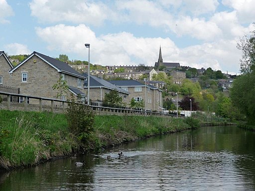
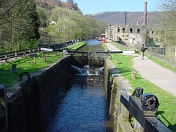
| Rochdale Canal | 32.9 miles (53 km) | Follow the Rochdale canal from Manchester to Sowerby Bridge on this waterside route through Greater Manchester and Yorkshire. It starts in the city centre of Manchester and runs for about 33 miles through the Pennine Hills. The canal is an excellent way to see the Pennines without too much effort as the towpath is largely flat. You start off in Manchester just to the north of Piccadilly train station at the Castlefield Basin. The canal then heads to Rochdale passing through Failsworth and Chadderton on the way. Near Rochdale you will pass the lovely Hollingworth Lake which is worth a small detour. The route continues through Littleborough to Todmorden where there is the opportunity to visit Stoodley Pike. The challenging climb to the monument gives gives great views over the surrounding area. The next section runs from Todmorden to Hebden Bridge giving wonderful views of Calderdale and the Pennine Hills. If you have time you could visit the wonderful Hardcastle Crags just north of Hebden Bridge. Here you will find streams, beautiful waterfalls and the fantastic Gibson Mill. The final stretch runs from Hebden Bridge to Sowerby Bridge passing the pretty village of Mytholmroyd. The canal then joins the Calder and Hebble Navigation Canal which is also great for a walk or cycle. View Full Details>> | |
| Rochdale Way | 44.7 miles (72 km) | A fabulous circular walk around Rochdale which visits a series of lovely reservoirs and includes a section along the River Roch. The walk visits Blackstone Edge, Healey Dell, Knowl Hill, Ashworth Moor Reservoir, Greenbooth Reservoir and the Ashworth Valley where there's nice trails along the Naden Brook and the Cheesden Brook. Other highlights include Tandle Hill Country Park, Alkrington Woods, Queens Park and the Ogden and Piethorne Reservoirs in the Piethorne Valley. View Full Details>> | |
| South Pennine Water Trail | 5 miles (8 km) | This circular walk around Littleborough includes waterside trails along Hollingworth Lake and the Rochdale Canal. There's lovely views of the Ealees Valley and the hills of the South Pennines to enjoy on the way. It's a fairly flat walk with some moderate climbing toward the end, so a reasonable level of fitness is required. The walk starts from the car park and visitor centre at Hollingworth Lake but you could also start from Littleborough or Smithy Bridge train stations which are also on the route. The first section follows part of the Rochdale Way around the lake. The 130 acre reservoir is a scenic spot and also a nature reserve with lots of wildlife to look out for on the water. The route then heads south into the countryside around Bib Knowl where you turn west toward Clegg Hall and the canal. The striking 17th-century hall is a Grade II listed building and sits next to the canal in a picturesque location. Here you pick up the canal towpath and follow it north past Smithy Bridge toward Littleborough. The little town is well worth exploring, with a number of interesting buildings and shops to see. At Littleborough you leave the canal and turn east, following a path along the Ealees Brook in the pretty Ealees Valley. You'll pass the little hamlet of Whittaker where there are a number of interesting stone houses and fine views up to the dramatic escarpment of Blackstone Edge. The final section runs south past Clegg's Wood to return you to the car park. View Full Details>> | |
| Stoodley Pike | 6.8 miles (11 km) | This circular walk takes you to the Stoodley Pike monument from Todmorden. It makes use of the Calderdale Way and the Pennine Way to take you to the monument before returning to Todmorden along the Rochdale Canal. The walk starts in Todmorden near the train station. You then follow the Calderdale Way to the little village of Lumbutts where you will find an old church, a mill house and pretty cottages. The walk continues past the Heeley Dam reservoir to Withens Gate where you pick up the Pennine Way. This takes you across Higher Moor to the Stoodley Pike summit. Here you will find the impressive monument, built in 1856 at the end of the Crimean War. You can climb the stairs of the monument to a viewing platform and enjoy wonderful views over Calderdale. From the summit you descend to the Rochdale Canal where a long waterside section leads back to Todmorden. It's a lovely section of the canal with old bridges, mills and locks. The surrounding hills and countryside make a splendid backdrop. You can also reach the hill from nearby Hebden Bridge by following the Pennine Bridleway. If you'd like to extend your walk then you could follow Pennine Way the to the nearby Withens Clough Reservoir. There is a nice waterside footpath with good views of the surrounding moorland and back to the monument. View Full Details>> | |
| Uppermill | 10.2 miles (16.4 km) | The pretty village of Uppermill is in a lovely location on the Huddersfield Narrow Canal and the River Tame. It's also located close to the South Pennines and the Peak District making it an excellent base for walking. View Full Details>> | |
| Warland Reservoir | 5.9 miles (9.5 km) | This walk takes you to a series of reservoirs in the Calderdale area of West Yorkshire. On the route there's lovely views across the picturesque lakes to the heather moors and rolling hills beyond. View Full Details>> | |
| Waugh's Well | 5.6 miles (9 km) | This walk visits Waugh's Well in the Rossendale Valley area of Lancashire. View Full Details>> | |
| Weighver's Way | 8.7 miles (14 km) | This is a terrific, challenging walk from Littleborough to Catley Lane Head, Rochdale. The path begins at the lovely Hollingworth Lake and heads through Littleborough along the Rochdale Canal. The next section climbs to the beautiful Watergrove Reservoir which is a lovely place to stop for a picnic. You then pass Whitworth on your way to the splendid Healey Dell Nature Reserve. View Full Details>> | |
| Withens Clough Reservoir | 1.9 miles (3 km) | Enjoy an easy circular walk around this attractive reservoir in the south Pennines. There is a good footpath running around the perimeter of the water with great views of the pretty countryside of Withens Clough and the Stoodley Pike Monument. There is a parking area just to the east of the reservoir. Park here and then follow the Calderdale Way to the reservoir. The walk can be extended by following the Pennine Way to Stoodley Pike. Here you will find the Stoodley Pike monument, built in 1856 at the end of the Crimean War. You can climb the stairs of the monument to a viewing platform and enjoy wonderful views over Calderdale. You could also follow the Pennine Way south west and visit the nearby Warland Reservoir and White Holme Reservoir. The reservoir is located near to the towns of Todmorden and Hebden Bridge, a mile to the west of Cragg Vale. View Full Details>> | |
| Wycoller Country Park | 2.7 miles (4.4 km) | Enjoy a lovely walk through the beauitful Wycoller Country Park in Pendle. The park has a number of footpaths taking you along Wycoller Beck to Bank House and the remains of Wycoller Hall. There are great views of the Pendle Hill and a stroll through the delightful Wycoller Village to enjoy. No cars are allowed in the village and many of the old buildings remain preserved, making it a particularly peaceful and special place. The area has strong links with the Bronte sisters who referred to many of the nearby landmarks in books such as 'Wuthering Heights' and 'Jane Eyre'. The park is located just a couple of miles east of Colne. If you wish to continue your walk both the Pendle Way and Bronte Way walking routes run through the park. View Full Details>> |