GPS Cycle and Walking Routes

Rhayader Riverside, Waterfalls And Dams Walk

14 miles (22 km)

This popular walk takes you from the town of Rhayader to the wonderful Elan Valley Reservoirs and the series of imposing dams.
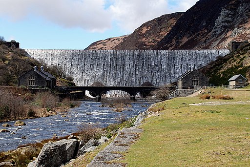
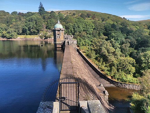
The circular walk starts in Rhayader and first follows a shared cycling and walking route along the River Elan to the dam at the Caban-coch Reservoir. You can then follow waterside paths north along the water to the dams at the Penygarreg Reservoir and the Craig Goch Reservoir. The huge dams are a spectacular sight with the surrounding mountains making a wonderful backdrop.
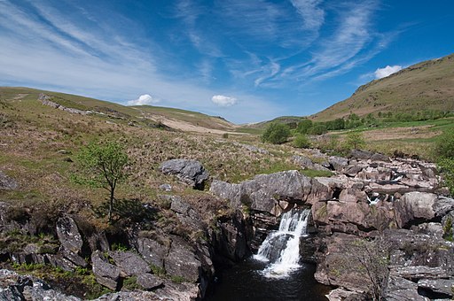
At Craig Goch you turn east along a bridle track to the Roman Camp and waterfall around the hills of Esgair Perfedd and Esgair Dderw. You then descend to the south east to return to Rhayader.

Rhayader Dams OS Map - Mobile GPS OS Map with Location tracking

Rhayader Dams Open Street Map - Mobile GPS Map with Location tracking

Cycle Routes and Walking Routes Nearby

Photos

Afon Elan west of Rhayader - geograph.org.uk - 4257849

River Elan west of Rhayader, approaching the reservoirs.

Caban Coch Dam over flowing

Caban Coch Dam over flowing

Penygarreg Dam & Valve Tower J02

Penygarreg Dam & Valve Tower J02

Dam to Penygarreg Reservoir - geograph.org.uk - 3631627

Dam to Penygarreg Reservoir

Craig Goch Dam - geograph.org.uk - 3850279

Craig Goch Dam

Path beside Penygarreg Reservoir - geograph.org.uk - 3657754

Path beside Penygarreg Reservoir

Waterfall on the Afon Claerwen - Elan Valley - geograph.org.uk - 2976497

Waterfall on the Afon Claerwen

Waterfall near Garreg-Ddu Reservoir, Elan Valley Reservoirs, Wales - geograph.org.uk - 3156867

Waterfall near Garreg-Ddu Reservoir, Elan Valley Reservoirs, Wales

Video

GPS Files

GPX File

Rhayader Dams.gpx (On Desktop:Right Click>'Save As. On Ipad/Iphone:Click and hold>Share>Save to Files')