Rhayader Walks
![]()
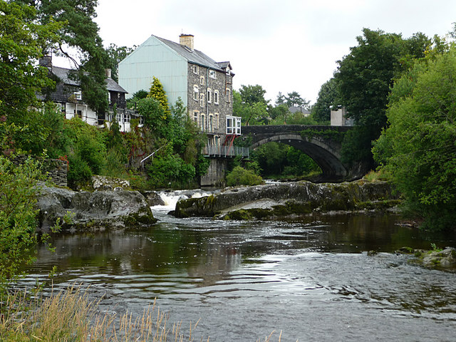
![]() This mid Wales town in the Cambrian Mountains has some lovely walking through the Wye and Elan Valleys. Rhayader is the first town on the banks of the River Wye, 20 miles (32 km) from its source on the Plynlimon range of the Cambrian Mountains. The Wye Valley Walk long distance trail passes through the town and is a great way of exploring the area. This circular walk makes use of the trail to climb to a viewpoint south of the town before enjoying an easy riverside stroll at the end.
This mid Wales town in the Cambrian Mountains has some lovely walking through the Wye and Elan Valleys. Rhayader is the first town on the banks of the River Wye, 20 miles (32 km) from its source on the Plynlimon range of the Cambrian Mountains. The Wye Valley Walk long distance trail passes through the town and is a great way of exploring the area. This circular walk makes use of the trail to climb to a viewpoint south of the town before enjoying an easy riverside stroll at the end.
The walk starts in the town and heads south along the waymarked trail to Glan-Elan and the Glyn Bridge where you cross the river. The trail then climbs through a pretty nature reserve towards Bwlch Goch. This section is quite steep and you will reach a height of over 1200ft. You'll be rewarded with fine views over the surrounding countryside though.
The route then descends back to the Glyn Bridge which you cross again. Head north east from here and you can follow woodland paths back to the river, before a final riverside stretch takes you back into the town centre.
One of the highlights of the area can be found just to the south west of the town at the beautiful Elan Valley Reservoirs. It's a very beautiful area with the series of lakes surrounded by lush countryside, attractive woodland, wildflower meadows, streams, waterfalls and the Welsh hills and mountains. The circular Rhayader Dams Walk visits the reservoirs from the town by following the River Elan to the dam at the Caban-coch Reservoir.
Rhayader Ordnance Survey Map  - view and print off detailed OS map
Rhayader Open Street Map  - view and print off detailed map
Rhayader OS Map  - Mobile GPS OS Map with Location tracking
Rhayader Open Street Map  - Mobile GPS Map with Location tracking
Pubs/Cafes
Head to the noteworthy Triangle Inn which dates from the 16th century. There’s a cosy restaurant offering a dog-friendly bar, a wood-burning stove, and an outdoor area with views of the River Wye. You can find the pub next to the River Wye at postcode LD65AR.
Further Information and Other Local Ideas
The Red Kite feeding station is a lovely place to visit in the town. Hundreds of Red Kites feed at the 200 acre family-run working farm every day. It's a wonderful sight with breathtaking feats of aerial piracy the red kites compete with buzzards and ravens for choice pickings. Feeding takes place at 2pm GMT (this changes to 3pm when the clocks change at the end of March, and reverts to 2pm at the end of October when the clocks revert to GMT). There is also a coffee shop & gift shop, a picnic site, and farm trail. You can find the feeding station at Gigrin Farm, South Street with a postcode of LD6 5BL for your sat navs.
The town is located a few miles away from Llandrindod Wells. There's some nice trails here to follow around the town's pretty lake and the River Ithon.


