GPS Cycle and Walking Routes

Risley Moss Walk

1 miles (1.6 km)

This circular walk visits a wildlife rich nature reserve and country park in Birchwood, Warrington.
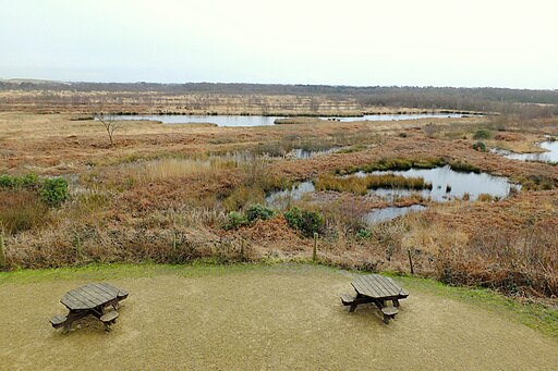
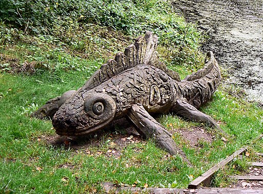
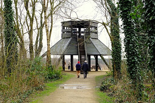
The reserve includes some pleasant nature trails taking you around the large areas of peat bog. There's bird hides, a watchtower and a number of sculptures to see on the walk.
Other habitats includes peaceful woodland paths, wildflowers with butterflies and ponds where you can see toads and newts. There's also good facilities with a car park and visitor centre with a wealth of information on the site.
The reserve lies right next to Birchwood Forest Park where there are some more good walking trails and a cycle path.
To continue your walking in the area you could head to the Rixton Clay Pits reserve which lies just to the south. Near here you can also pick up the Mersey Way and enjoy a riverside walk. Following the trail towards Warrington will take you to the Paddington Meadows reserve where there's wildflower meadows, an orchard and rare breed longhorn grazing cattle.

Postcode

WA3 6QX - Please note: Postcode may be approximate for some rural locations

Risley Moss OS Map - Mobile GPS OS Map with Location tracking

Risley Moss Open Street Map - Mobile GPS Map with Location tracking

Photos

Risley Moss from The Tower - geograph.org.uk - 4367828

Risley Moss from The Tower

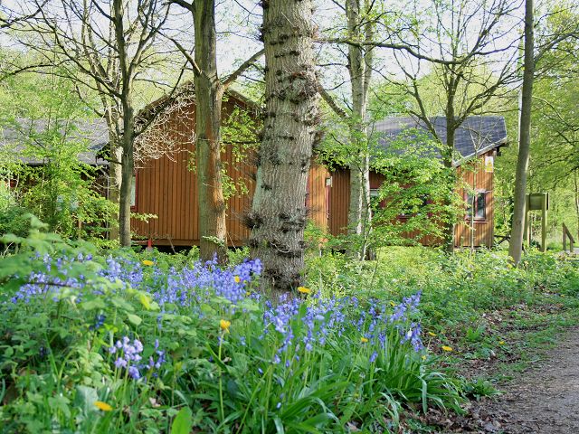
Risley Moss Visitor Centre - geograph.org.uk - 4860412

Risley Moss Visitor Centre

Risley Moss, on the mossland - geograph.org.uk - 1389194

Looking at one of the scrapes from the path between the railway and the Mossland Hide.

Risley Moss Nature Reserve - geograph.org.uk - 2940436

Risley Moss Nature Reserve

Flickr - ronsaunders47 - RISLEY MOSS 8

Fish sculpture

Risley Moss Visitor Centre in springtime - geograph.org.uk - 1389246

Risley Moss Visitor Centre in springtime. The Visitor Centre and springtime bluebells from the path from the main entrance gates

The Tower, Risley Moss Nature Reserve - geograph.org.uk - 4367196

The Tower

Risley Moss Picnic Area - geograph.org.uk - 1389210

The picnic area adjacent to the main entrance, taken from alongside the Ranger Centre after an early morning walk.

Video

GPS Files

GPX File

Risley Moss.gpx (On Desktop:Right Click>'Save As. On Ipad/Iphone:Click and hold>Share>Save to Files')