Sankey Valley Park
![]()
![]() Enjoy a super, waterside cycle or walk in this country park in Warrington. The valley follows the course of Sankey Brook and the now disused Sankey Canal. The park also contains children's play areas, a maze and a lawned area for families. There is also a meadow, mature woodland and a wetland nature reserve with a variety of birdlife.
Enjoy a super, waterside cycle or walk in this country park in Warrington. The valley follows the course of Sankey Brook and the now disused Sankey Canal. The park also contains children's play areas, a maze and a lawned area for families. There is also a meadow, mature woodland and a wetland nature reserve with a variety of birdlife.
The path along the Sankey Canal continues all the way to St Helens so you could continue your outing for several more miles if you have time. The Trans Pennine Trail also runs past the park so there is another option here.
Our circular walk around Warrington takes you along the River Mersey and the Manchester Ship Canal, with a visit to the pretty Paddington Meadows Nature Reserve. The riverside reserve is located close to Sankey Valley Park and includes meadows, grazing cattle and a wildflower meadow.
Postcode
WA5 0AW - Please note: Postcode may be approximate for some rural locationsSankey Valley Park Ordnance Survey Map  - view and print off detailed OS map
Sankey Valley Park Open Street Map  - view and print off detailed map
Sankey Valley Park OS Map  - Mobile GPS OS Map with Location tracking
Sankey Valley Park Open Street Map  - Mobile GPS Map with Location tracking
Pubs/Cafes
The Maltings pub is located right next to the park and a good choice for some post walk refreshments. They do a good range of meals and snacks in a friendly atmosphere. You can find the pub at Bewsey Farm Cl, Old Hall with a postcode of WA5 9PB for your sat navs.
Dog Walking
The park is a popular place for dog walkers so you're bound to see other owners and their pets on your visit. The Maltings pub mentioned above is also very dog friendly. They will provide water, treats and they even has a doggy menu!
Further Information and Other Local Ideas
Just to the west there's Sutton Manor Park to explore. The popular park includes the iconic Dream Sculpture which is a local highlight and well worth seeing. There's also a great viewpoint and the adjacent Clock Face Country Park to visit here.
To the south there's the picturesque Moore Nature Reserve. It's a lovely place for a walk with lakes, peaceful woodland and attractive meadows to explore. The reserve is also great for wildlife with a wide range of birds to look out for on the water. You can find them on the south western side of Warrington, next to the Manchester Ship Canal at postcode WA4 6XE for your sat navs.
Cycle Routes and Walking Routes Nearby
Photos
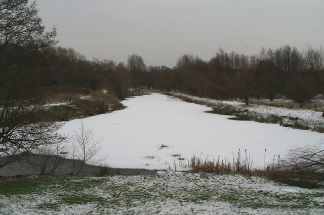
This fishing lake is within Sankey Valley Park. This is a view looking due east down one of two spurs that run from the old disused Sankey St.Helens Canal. It looks as if, looking at the historical map of this area, that the canal and spurs (I'm calling them spurs because they look to be sticking out from the side of the canal) where separated by land at some point but they now form one large fishing lake.
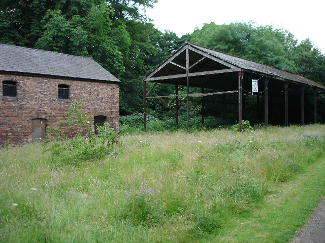
Disused Barn. Right on the border with grid square SJ5889 to the West, are these disused buildings. A large derelict house also lies nearby - otherwise, apart from the park, the area is all new housing estates.
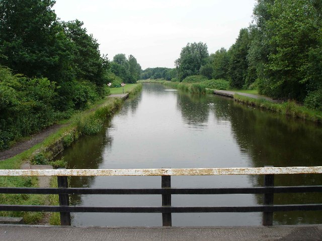
Bradlegh Swing Bridge and the Sankey Valley The gap through the trees leads to the footbridge over the Sankey Brook, while the canal towpath gives access North and South to the Sankey Valley Linear Park along the line of the Sankey Canal.
Swan and cygnets, Sankey Canal. The Act authorising the Sankey Brook Navigation was passed in 1755. The Canal which was cut subsequently was carrying coal by 1757, making the Sankey England’s First Canal of the Industrial Revolution, built to bring coal down to the growing chemical industries of Liverpool which rapidly expanded and spread back along the line of the Canal to St Helens, Earlestown and Widnes which were small villages until this period. The Sankey can thus be credited with the industrial growth of the region, it was built for Mersey Flats, the sailing craft of the local Rivers. It now forms the heart of the Sankey Valley Park a haven for wildlife and well worth a afternoon stroll or cycle.


