Rockingham Castle

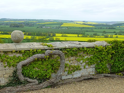
 The grounds and pretty gardens surrounding this castle near Corby are ideal for an easy afternoon stroll. The castle is in an elevated position giving wonderful views over the Welland Valley and five surrounding counties of England. There are 18 acres of beautiful gardens to explore with herbaceous borders, a rose garden, ornamental statues, yew hedges and yew pillars. There are also woodland trails, a pond and a tea room for refreshments. You can purchase a ticket for the grounds and gardens only to enjoy the walk. See website below for details.
If you would like to continue your walk then you could pick up the long distance Jurassic Way trail and follow it to the nearby East Carlton Park.
Postcode
LE16 8TH - Please note: Postcode may be approximate for some rural locationsPlease click here for more information
Rockingham Castle Ordnance Survey Map  - view and print off detailed OS map
Rockingham Castle Open Street Map  - view and print off detailed map
Rockingham Castle OS Map  - Mobile GPS OS Map with Location tracking
Rockingham Castle Open Street Map  - Mobile GPS Map with Location tracking
Dog Walking
Only assistance dogs are permitted inside the castle. They are allowed in the gardens on a lead though. A water bowl is available in the Courtyard.
Further Information and Other Local Ideas
A few miles to the east you can try the Rockingham Forest Walk which will take you from King's Cliffe to Barrowden through the ancient woodland of Fineshade Woods and Wakerley Woods. Near the woods there's also the noteworthy Harringworth Welland Viaduct. The Grade II listed viaduct is about a kilometre long, and was completed in 1878. It contains 82 arches and is notable as the longest masonry viaduct across a valley in Britain.
Just to the east of Fineshade you'll find the pretty village of King's Cliffe where you can pick up the Kings Cliffe Railway Walk. The easy trail runs along a now disused railway line to the east of the village. King's Cliffe is also a pleasant place for a stroll with a Norman church, picturesque 17th century almshouses and nice views of the Willow Brook, a tributary of the River Nene. There's also a fine old 18th century pub for refreshments afterwards. Near here there's also Blatherwycke Lake to explore. There's some lovely waterside trails with lots of birdlife to see on the water at this scenic spot.
To the north there's some nice waterside trails to follow around the pretty Eyebrook Reservoir near Uppingham.
A few miles to the west there's Hallaton to explore. The village includes a particularly picturesque pond, a 13th century church and quaint thatched cottages. Hallaton is also the location for the famous annual bottle kicking contest which takes place on Easter Monday.
For more walking ideas in the area see the Northamptonshire Walks page.


