Northamptonshire Walks

Use the filter to show walks of a certain type such as woods, reservoirs, hills, long distance, country parks, canals and rivers.
In the spring walkers flock to the beautiful bluebell woods in the Northamptonshire area. Click the 'Woodland' button below to see these.
Use the links to view full route information including elevation profiles, interactive maps and GPS downloads.
You can also view an overview map of all the routes in the using the Northamptonshire Walk Map>>
| Filter: |
| Route Name | Photo | Distance | Description |
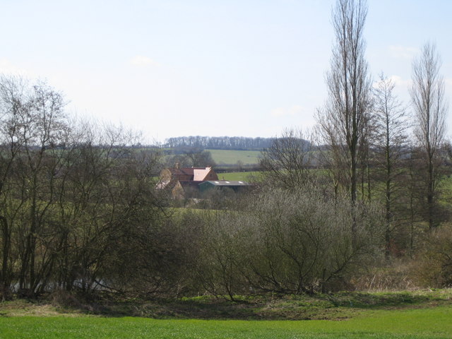
| Arbury Hill | 3 miles (5.5 km) | A nice walk from Badby to Hellidon, passing Arbury Hill, the joint highest point of Northamptonshire. You can follow a series of quiet country lanes and other tracks between the two villages with nice views of the hill and the surrounding countryside. The walk starts in the centre of Badby and heads west along Bunkers Hill for nearly a mile. You can then pick up a footpath taking you toward the hill which stands at a height of 225 m (738 ft). You continue west along bridleways to Hellidon, passing some lovely countryside and pretty ponds on the way. View Full Details>> | |
| Around Corby | 31 miles (50 km) | This is a delightful 31 mile circular walk which visits a number of pretty villages and parks around the town of Corby in Northamptonshire. You start off at East Carlton Park on the edge of the Welland Valley and follow the path through a series of pretty villages including Wilbarston, Geddington, Great Oakley, Gretton, Rockingham, Stanion and Brigstock. View Full Details>> | |
| Ashby St Ledgers | 8 miles (12.8 km) | This attractive village in Northamptonshire is famous for being the location for the planning of the Gunpowder Plot in 1605. The historic settlement is located close to the larger towns of Rugby and Daventry in the western part of the county. View Full Details>> | |
| Aynho | 3 miles (5.6 km) | This Northamptonshire based village lies close to the border with Oxfordshire and the town of Banbury. View Full Details>> | |
| Badby Woods | 2 miles (4 km) | These pretty woods near Daventry have miles of good woodland trails to try. The woods are located just to the south of the village of Badby and are famous for carpets of bluebells in the spring months. You could follow the waymarked Knightley Way to the western edge of the woods and then pick up the trails. View Full Details>> | |
| Barnwell Country Park | 1 miles (2 km) | Enjoy lovely waterside walking trails in this country park in Oundle, Northamptonshire. At Barnwell you will find several pretty lakes and meadows while the River Nene also runs through the park. Follow the nature trail and look out for Coot, Mallard, Mute Swan and Great Crested Grebe on the water. In the meadow you will find a variety of plantlife including Yorkshire Fog and Crested Dogs Tail and flowers such as Ox-Eye Daisy, Cowslip, Tufted Vetch, Knapweeds and Greater Burnet. The park has a visitor centre, cafe and play area. View Full Details>> | |
| Battlefields Trail | 20 miles (32 km) | This interesting walking trail links three of England's most significant Battlefields: Edgcote (1469) in Northamptonshire Cropredy Bridge (1644) in Oxfordshire Edgehill (1642) in Warwickshire It runs from Chipping Warden, Northamptonshire and ends in Kineton, Warwickshire, passing through some beautiful countryside along the way. The first section of the walk takes you from Chipping Warden to Upper Wardington. On the way you will pass the site of the Battle of Edgecote Moor which was fought during the Wars of the Roses in July 1469. The battle pitted the forces of Richard Neville, 16th Earl of Warwick, against those of King Edward IV. From Upper Wardington you continue west to Warmington, passing Cropedy where the Battle of Cropredy Bridge was fought on 29th June 1644 between a Parliamentarian army under Sir William Waller and the Royalist army of King Charles. This section also includes views of the Oxford Canal Walk and the River Cherwell. The final section then runs from Warmington to Kineton, passing through the beautiful Edghill Country Park. The park is set in the Cotswolds Area of Outstanding Natural Beauty and includes sixteen acres of mixed grass and primary Bluebell woodland. After passing through Ratley you soon come to the site of Battle of Edgehill. The battle was fought on Sunday, 23rd October 1642 and was the first pitched battle of the First English Civil War. Shortly after the walk then comes to at an end at the village of Kineton in Warwickshire. The Battlefields Trust Website has a wealth of information on this route and the history of the Battlefields of Britain. View Full Details>> | |
| Boddington Reservoir | 2 miles (2.5 km) | Enjoy a peaceful walk around this pretty reservoir near Banbury. There's a car park at the northern end of the water where you can start your walk. It's less than a mile east of Upper Boddington and also very close to the village of Byfield. You could easily start the walk from there if you prefer. A footpath then leads you around the reservoir to the smaller Byfield Reservoir on the eastern side of Boddington Reservoir. Around here there is some woodland and footpaths heading east to Byfield. As you make your way round the water there are lovely views of the surrounding Northamptonshire countryside and lots of wildlife to see. Look out for ducks, green woodpeckers and dragonflies as you make your way along the 1.5 mile trail. You should also see lots of fishermen as it is a great location for carp fishing. The site is located a few miles north of Chipping Warden where you can pick up the Macmillan Way long distance trail. This links with the Oxford Canal Walk where you can further explore the Cherwell Valley and head towards Banbury. View Full Details>> | |
| Borough Hill Daventry | 2 miles (3 km) | This circular walk follows a footpath around Borough Hill in Daventry. The hill lies just to the east of the town, dominating the area at a height of 200 metres (660 ft). The trail provides some excellent views over the surrounding Northamptonshire countryside. You can start the walk from the car park at the south western side of the hill. From here you can pick up a trail around the hill, passing the last remaining radio mast from the former Daventry transmitting station. The station operated from 1925 until 1992, carrying long-wave, medium-wave, and short-wave broadcasts at different times in its history. Since 1992, only DAB services have been broadcast from the site using a single mast. The trail runs for a distance of about 2 miles, passing the site of two Iron Age hill forts and two Bronze Age barrows. Antiquities from a Roman Villa were discovered in the 19th century and are now kept in the British Museum. The hill is also has an interesting military history with Charles I Royalist army using the hill as a base just before the Battle of Naseby in 1645. View Full Details>> | |
| Brackley | 11 miles (18 km) | The Northamptonshire town of Brackley lies on the on the borders with Oxfordshire and Buckinghamshire. The market town is close to the famous Silverstone racing track and includes a noteworthy Parish church with parts dating from the 11th century. This circular walk from the town takes you through the countryside to the National Trust's Stowe Park. The route runs for just over 11 miles, exploring the farmland, woodland and villages to the east of the town before skirting the edge of the historic park. The walk starts to the east of the town centre and follows country paths east towards Turweston. Here you pick up the waymarked Westbury Circular Ride, a shared cycling and walking footpath running through the area. View Full Details>> | |
| Brampton Valley Way | 14 miles (23 km) | This walk and cycle trail runs from the outskirts of Northampton to Market Harborough along the trackbed of a disused railway line and National Cycle Route 6. The route passes Brixworth, Maidwell and Great Oxendon with the popular Brixworth Country Park just off the route. This is well worth a small detour as you will find the lovely Pitsford Reservoir which has a fine waterside cycling and walking trail to try. Cycles can also be hired here at the Brixworth visitor centre. As well as the beautiful rural scenery you will also pass Northampton & Lamport Railway with its old steam railway on this pleasant trail. View Full Details>> | |
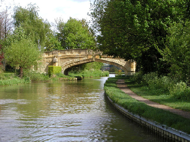
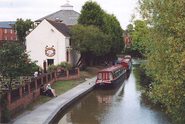
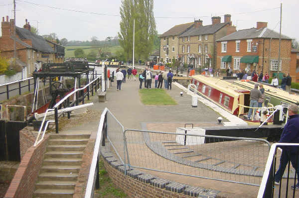
| Braunston to Whilton Locks | 11 miles (17 km) | This walk visits the Whilton Locks flight on the Grand Union Canal near Daventry. The flight of seven locks is also known as Buckby Locks and is a popular place for a walk. The route starts in the Northamptonshire village of Braunston at the pretty marina. From here you can pick up the canal towpath and follow it east to Braunston Tunnel, passing a series of pretty locks on the way. You then walk over the tunnel before continuing along the towpath to Buckby Top Lock and Whilton Locks. The locks are numbered from 7 at the top of the flight to 13 at the bottom. To the south of the flight is a long level pound, which runs to the Stoke Bruerne Canal Museum and the top of the Stoke Bruerne flight of seven locks. Towards the southern end of this section are Blisworth Tunnel and Gayton Junction, where the Northampton Branch turns off to join the River Nene at Northampton. View Full Details>> | |
| Brixworth Country Park | 11 miles (18 km) | A circular cycle or walk around the expansive Brixworth Country Park in Northamptonshire. Pitsford Reservoir is the main feature of the park. It is the 34th largest body of water in England and Wales and has a fabulous cycle and walking path running around the perimeter and a Nature Reserve at the northern end. There is also a sensory garden and a sculpture trail. The route below visits the pretty villages surrounding the reservoir including Brixworth, Walgrave and Scaldwell. Cycle hire is available at the western end of the park and there is also a cafe for refreshments. View Full Details>> | |
| Bucknell Woods | 3 miles (4.4 km) | Enjoy peaceful woodland walks in this forested area near Silverstone and Abthorpe. There's a good sized car park on the eastern side of the woods, about half a mile north west of Silverstone village. From here you can pick up wide bridleways and other footpaths to take you around the site. There's hundreds of acres of ancient woodland and a variety of butterflies to look out for on the way. You can also see lots of pretty bluebells during the spring months. View Full Details>> | |
| Canons Ashby | 6 miles (9 km) | This circular walk explores the gardens, parkland and countryside surrounding this Elizabethan manor house near Daventry. View Full Details>> | |
| Castle Ashby | 1 miles (2 km) | This circular walk takes you around the village of Castle Ashby and its associated gardens. View Full Details>> | |
| Crick | 12 miles (19.5 km) | This Northamptonshire based village is located near Rugby in the western part of the county. View Full Details>> | |
| Daventry Country Park | 2 miles (3.5 km) | Enjoy woodland, meadows and the lovely Daventry Reservoir on this waterside route in Northamptonshire. The southern part of the reservoir is a designated nature reserve with bird hides. There is also a delightful nature trail through the sensory garden to the pond, with useful information boards along the way. The park has a Visitor Centre, fitness equipment and a cafe. It is located just north of Daventry town centre. View Full Details>> | |
| Delapre Abbey Park | 1 miles (1.5 km) | Explore the grounds of a neo-classical mansion on this walk in Northampton. View Full Details>> | |
| East Carlton Park | 1 miles (2 km) | This popular country park near Corby has a number of nature trails taking you through the mature woodland and grasslands surrounding the 19th century East Carlton Hall. The park is surrounded by the beautiful countryside of the Welland Valley and is also a great place for bird watching. There are also good facilties with extensive parking, a play park and a delightful tea shop with a wide range of refreshments. Cyclists can reach the park on a regional cycle route running from the centre of Corby. If you'd like to extend your walk then you could pick up the Jurassic Way which runs past the northern end of the park. You could follow it through the countryside to the nearby Rockingham Castle where you will find beautiful gardens and woodland to walk through. View Full Details>> | |
| Everdon Stubbs | 1 miles (2 km) | These pretty woods near Daventry Country Park are a great place to see bluebells in the springtime. There's a good circular walking trail with ancient woodland including birch, sweet chestnut and sycamore. There's also nice views of the surrounding Northamptonshire countryside. You can park in the parking area off Stubbs Road where you can pick up the trails across the site. The Nene Way long distance trail passes just to the north of the woods. You could pick up the trail and follow it to Upper Weedon where it joins with the Grand Union Canal Walk. Just to the south of the woods in Farthingstone you can pick up the Macmillan Way and further explore the countryside. View Full Details>> | |
| Fawsley Hall | 1 miles (2.2 km) | This walk visits the Grade I listed Fawsley Hall in Northamptonshire. View Full Details>> | |
| Fermyn Woods | 2 miles (2.5 km) | This country park and forest has a number of walking trails and two bridleways for cyclists. Formerly known as Brigstock Country Park, it is located a few miles north east of Kettering. For walkers there are three waymarked trails to enjoy: The Skylark Nature trail is an all abilities trail on good surfaced paths. It takes you around the ponds and woods located next to the car park. The Woodland walk is about a mile long and takes you a little further into the woods on good footpaths. The Fermyn Forest Walk is just over two miles taking you deep into the woodland on a mixture of hard and soft tracks. In the park you will find semi-natural oak and ash woodland, ponds, a visitor centre and cafe. It's a splendid area for wildlife watching - look out for Red kites, bullfinch, hawfinch, nightingales, skylark and green woodpeckers. You may also see badgers, fallow deer and Purple emperor butterflies. View Full Details>> | |
| Fineshade Woods | 5 miles (8 km) | Top Lodge in Fineshade Woods has several waymarked cycling and walking trails. For cyclists there is a green graded easy route running through the main woodland block. It is a gentle ride perfect for families on largely flat paths. Running alongside the green route are 7 alternative blue grade sections. These are great for mountain bikers looking for more of a challenge. Walkers can enjoy three colour coded, waymarked trails of varying difficulty. The Smelters' Walk is an easy trail for abilities. It runs for 2 miles on flat well surfaced paths. The moderate Dales Wood Trail visits the Wildlife Hide where can you look out for birds on the feeders and deer in the woodland. There is also a short climb to a viewpoint with great views over Rockingham Forest. For a more challenging walk you can try the Mill Wood Trail which involves a few harder climbs. Along the way you can look out for lots of wildlife including red kite, nightingale, nightjar, woodcock, grasshopper warbler, tree pipit, marsh and willow tits. View Full Details>> | |
| Fotheringhay | 11 miles (18 km) | This pretty Northamptonshire village has some picturesque thatched cottages, an old castle motte and splendid views of the River Nene. View Full Details>> | |
| Grafton Way | 13 miles (21 km) | Follow the Grafton Way from Wolverton, Milton Keynes to Greens Norton in Northamptonshire. The walk starts following the Grand Union Canal to Cosgrove before heading into the countryside and passing the villages of Yardley Gobion, Paulerspury and Towcester. View Full Details>> | |
| Grand Union Canal Walk | 145 miles (234 km) | Follow the towpath of Britain's longest canal from London to Birmingham on this fabulous waterside walk. You start in West London in a lively and attractive area with canalside bars and restaurants, before heading towards the Chiltern Hills, on through rural Northamptonshire and Warwickshire and into the Birmingham suburbs. Highlights include:
| |
| Harlestone Firs Forest Walk | 2 miles (3.3 km) | This circular walk visits the popular Harlestone Firs in Northamptonshire. The woods are located just a few miles north west of Northampton, near Dallington. View Full Details>> | |
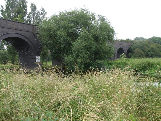
| Harringworth Welland Viaduct | 4 miles (6.7 km) | This circular walk visits the impressive Harringworth Viaduct or Welland Viaduct in North Northamptonshire. View Full Details>> | |
| Harrold Odell Country Park | 3 miles (5 km) | This park has two pretty lakes set in 144 acres of country park. It is located between Bedford and Northampton on the River Great Ouse near the villages of Harrold and Odell in Bedfordshire. You will find river meadows, a nature reserve, two picturesque lakes and a range of managed habitats. There is also free parking and refreshments in the Tea-Zels Cafe. There are a number of well maintained walking paths around the lakes and through the nature reserve while cycling is permitted along the lakeside bridleway. The North Bedfordshire Heritage Trail also runs through the park so there is scope for continuing your walk if you have time. View Full Details>> | |
| Hazelborough Wood | 3 miles (4.4 km) | These ancient woods near the village of Silverstone have some nice footpaths to try. The site includes oak and conifer plantations with plenty of birds and butterflies to look out for as you make your way through the woods. You can access the woods from the car park just off the A43, south west of Silverstone. View Full Details>> | |
| Hereward Way | 110 miles (177 km) | Starting in Oakham, in Rutland, follow the Herward Way through Stamford, Peterborough, Ely, and the Breckland forests to Thetford, in Norfolk.
Highlights on the walk include
| |
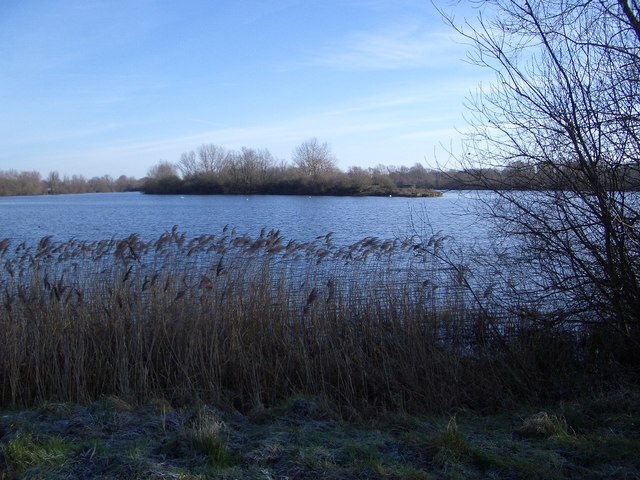
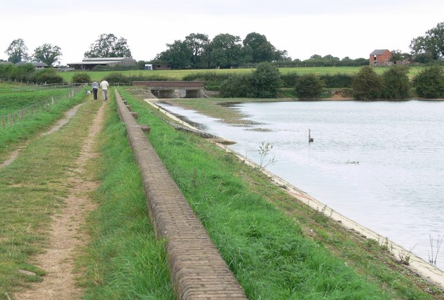
| Hollowell Reservoir | 2 miles (4 km) | Enjoy a circular walk around this pretty reservoir and nature reserve in Northamptonshire. The 140 acre reservoir is a peaceful place for a walk and also has some good bird watching opportunites. Birds you may see include grey phalarope, dunlin, and ringed plover. To use the car park and do go bird watching at the lake you can purchase a permit from the Pitsford Fishing Lodge. See the link below for more details. View Full Details>> | |
| Hunsbury Hill Country Park | 1 miles (1.2 km) | This country park and Iron Age hill fort are located just to the south of Northampton. View Full Details>> | |
| Irchester Country Park | 2 miles (3.5 km) | Enjoy numerous walking and cycling trails in this splendid country park in Wellingborough, Northamptonshire. The park has peaceuful woodland paths, open meadows and the interesting Irchester Narrow Gauge Railway Museum. There is also plenty of wildlife with Muntjac Deer, hedgehogs, stoats and squirrels. The Nene Way walking trail also runs through the park so you can continue your walk to the River Nene if you have time. Follow it east and you can visit the lovely Rushden Lakes and Stanwick Lakes where there's huge variety of wildlife to look out for on the water. View Full Details>> | |
| Jurassic Way | 88 miles (141 km) | This walk follows the Jurassic limestone ridge from Banbury to Stamford passing through Northamptonshire, Oxfordshire and Lincolnshire. The walk includes a stretch along the Oxford Canal from Banbury and another waterside stretch along the Grand Union Canal near Braunston. There's nice woodland trails through Fineshade Woods in the ancient Rockingham Forest area and you will also enjoy fine views of the River Welland as you approach Stamford. The route passes through a series of picturesque towns and villages including Wardington, Catesby, Welford, Braunston, Ashby St Ledgers (with its impressive Manor House), West Haddon and Middleton. You'll also pass close to Naseby Battlefield, site of the famous Battle of Naseby in the English Civil War in 1645. There's a section along Welford and Sulby Reservoir here too. View Full Details>> | |
| Kettering | 5 miles (8 km) | This walk from the Northamptonshire town of Kettering takes you along the River Ise to the nearby Boughton House. View Full Details>> | |
| Kings Sutton | 10 miles (15.7 km) | This attractive West Northamptonshire village is a lovely place to start a walk. The settlement is located very close to a scenic river and canal with a water based nature reserve also within walking distance of the village centre. View Full Details>> | |
| Knightley Way | 12 miles (19 km) | Follow the Knightley Way from Badby to Greens Norton on this pleasant walk through Northamptonshire. The walk begins in Badby and heads through Badby Woods towards Fawsley Park and Fawsley Hall. This 15th century Hall and Landscape Park was created by the Knightley family and is now a hotel and restaurant. It's a very pretty section with lots of bluebells to see in Badby Wood and a series of pretty lakes in Fawsley Hall Park. After leaving Fawlsey Hall the path then continues through the countryside through Preston Capes and Farthingstone to Greens Norton. The route links with the long distance Nene Way in Badby. View Full Details>> | |
| Lyveden Way | 10 miles (16 km) | This fine long distance path explores the woodland and country trails around Fermyn Woods in Northamptonshire. It runs for just under 10 miles on a series of fairly flat public footpaths. View Full Details>> | |
| Macmillan Way | 290 miles (467 km) | This epic long distance path links Boston in Lincolnshire to Abbotsbury in Dorset. It is promoted to raise money for the charity Macmillan Cancer Relief.
The route starts from Boston and then runs across the Fens to Bourne before joining the limestone belt. You then head to Stamford and then along the shoreline of Rutland Water. You'll also pass through the medieval market town of Oakham where there's some wonderful old architecture at the Norman castle and the 16th century Oakham School. The trail then heads south and west via Warmington to Stow-on-the-Wold, then into the Cotswolds via Cirencester and Tetbury to Bradford-on-Avon. After leaving the Cotswolds you follow the path through Somerset passing Castle Cary before entering Dorset and the final section to Abbotsbury via Sherborne. The route joins with other popular trails including the Viking Way at Oakham, the Thames Path National Trail near Thames Head and with the South West Coast Path towards the end of the route. View Full Details>> | |
| Midshires Way | 225 miles (362 km) | This route follows public bridleways and quiet country lanes through Middle England, from Bledlow, near Aylesbury in Buckinghamshire, to Stockport in Greater Manchester. The path links The Ridgeway National Trail with the Trans Pennine Trail passing through the countryside of Buckinghamshire, Northamptonshire, Leicesteshire, Nottinghamshire and the Derbyshire Peak District National Park. Highlights include waterside sections along the Grand Union Canal, the Peak Forest Canal and the River Ouse. There is a splendid wooded section through Salcey Forest near Northampton where you could try the Tree Top Trail. View Full Details>> | |
| Milton Keynes Boundary Walk | 63 miles (101 km) | Enjoy rivers, canals, woodland and beautiful countryside on this walk around the boundary of Milton Keynes. There's nice views of the Grand Union Canal, the Great Ouse river and the countryside of Bedfordshire, Buckinghamshire and Northamptonshire. View Full Details>> | |
| Naseby Battlefield Walk | 9 miles (15 km) | This circular walk from the village of Naseby takes you around the site of the Battle of Naseby. The battle was fought on 14 June 1645 between the main Royalist army of King Charles I and the Parliamentarian New Model Army. It was a decisive battle in the Civil War as the main Royalist military force had been shattered at Naseby. Starting from the village the you head north along Naseby Road which runs along the Naseby Field. You will soon come to the Cromwell Monument where there is an information board and a short footpath onto the field. The route continues to Sibbertoft where you can pick up the Jurassic Way long distance trail. Follow it south west and it will take you to Sulby Reservoir and Welford Reservoir. Near Welford you pick up Shakespeare's Avon Way and follow it along the River Avon near the village. You then follow the Naseby Road back to the village where the route finishes. To continue your walking in the area head west from the village and visit Naseby Reservoir. View Full Details>> | |
| Naseby Reservoir | 3 miles (5 km) | This walk visits Naseby Reservoir in Northamptonshire. You can start the walk from the village of Naseby and follow Carvells Lane to the water. There's nice views across the water and the option of continuing along a bridleway to the nearby village of Cold Ashby. You could stop for refreshments here before following the same path back to Naseby. To continue your walking in the area try the Naseby Battlefield Walk which takes you around the site of one of the most famous battles of the English Civil War in the 17th century. The route also visits Welford and Sulby Reservoir where there are some nice waterside trails. View Full Details>> | |
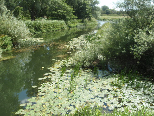
| Nene Way | 109 miles (176 km) | Follow the River Nene through the beautiful Nene Valley on this fabulous walk through Cambridgeshire, Lincolnshire and Northamptonshire. The long distance path runs for over 100 miles, passing Northampton, Wellingborough, Oundle, Peterborough and Wisbech. There's much to enjoy on the way with rushing weirs, a series of historic villages and old mills. It's an excellent area for birdwatchers too with the Nene Valley now one of the most important wetlands in England, gaining international recognition for its significance as a stop-over for thousands of wildfowl and waders that visit during the winter. In particular look out for birds around Rushden Lakes, Summer Leys Nature Reserve, the Titchmarsh Nature Reserve at Thrapston, Barnwell Country Park and Stanwick Lakes as you pass Irthlingborough and Higham Ferrers in Northamptonshire. View Full Details>> | |
| Northampton Canal Walk | 5 miles (8 km) | This easy walk follow the Northampton Arm of the Grand Union Canal from the town centre to the countryside near Milton Malsor. It runs for a distance of about 5 miles along a nice flat path with views of the River Nene and the surrounding Northamptonshire countryside on the way. The walk starts the Towcester Bridge which runs over the River Nene and the canal in the town centre. Follow the towpath west and it will take you past Briar Hill Meadows and Duston Mill Reservoir. The canal continues south towards Rothersthorpe before coming to Gayton Junction where there is a nice marina at the end of the route. The village of Gayton is a short stroll from here so you could head there for refreshments. View Full Details>> | |
| Northamptonshire Round | 51 miles (82 km) | This waymarked long distance walk runs for just over 50 miles through the countryside and villages surrounding Northampton. View Full Details>> | |
| Oundle River Nene Walk | 7 miles (11 km) | A circular riverside walk around the Northamptonshire town of Oundle. The route makes use of a series of waymarked paths including the long distance Nene Way. It's a lovely area with a series of weirs, pretty little villages, old mills and nice views of the Northamptonshire countryside. Starting in the town centre head south to meet the river. You have the option of continuing south to visit Oundle Marina and Barnwell Country Park but this route heads south east, following the bend in the river round to the little village of Ashton. You can take a small detour to explore the settlement, where you can see a nice village green and a number of Tudor style, thatched cottages dating from 1900-1901. The Creed Chapel and adjacent school building date from 1705 and the manor house from the 15th century. The river then heads north to another pretty village at Cotterstock. Here you will find the 12th century Church of St Andrew, located to the east of the village, next to the river. There's also the 17th century Cotterstock Hall, an early 19th century mill and lots of pretty little cottages to see here. At Cotterstock Hall the route turns south, passing Oundle Wharf before returning to the town. Here you can enjoy refreshments at one of the old pubs including the Talbot Hotel which was rebuilt with stone from the ruins of nearby Fotheringhay Castle. There's also the Rose & Crown (a 17th century inn haunted by the White Cavalier) and the Ship Inn which dates from the 14th century. View Full Details>> | |
| Ouse Valley Way | 142 miles (229 km) | Follow the River Great Ouse from the source at Brackley, Northamptonshire, to the mouth at The Wash at King's Lynn. You begin at Brackley and head to Buckingham, Milton Keynes, Olney, Bedford, St Neots, Huntingdon, St Ives, Ely, Downham Market before finishing at King's Lynn. View Full Details>> | |
| Oxford Canal Walk | 77 miles (124 km) | Follow the Oxford Canal from Oxford to Coventry on this splendid waterside walk. You follow the towpath of the canal for the duration of the route meaning this is a fairly easy walk (providing you don't do at all at once!) You will pass through a series of delightful villages including Thrupp, Lower Heyford, Banbury, Cropredy, Braunston Turn and Rugby before finishing at Hawkesbury Junction in Coventry. The peaceful south Midlands countryside, a series of pretty locks and several excellent canal side pubs make this walk a fantastic experience. Highlights include the delightful Port Meadow at the start of the route in Oxford, great views of the River Cherwell through Oxfordshire and the stunning gardens at Rousham Park. View Full Details>> | |
| Pitsford Reservoir | 6 miles (10 km) | This circular walk takes you around the lovely Pitsford Reservoir in Brixworth Northamptonshire. The waterside trail runs for just over 6 miles on a nice flat, surfaced path. It will probably take around 3-4 hours to complete the circuit. Start the walk from the car park and visitor centre at Brixworth Country Park on the western side of the water. Then head east to the village of Holcot where you cross the water on the causeway. Other paths will then take you along the northern edge of the water to the car park. The area is designated as a nature reserve so you can look out for a variety of wildlife on the way. Keep your eyes peeled for Northern Shoveler, Little egrets, Great crested grebes and Goldeneye as you make your way through this lovely area. View Full Details>> | |
| Ravensthorpe Reservoir | 2 miles (2.5 km) | This walk visits Ravensthorpe Reservoir near Northampton. It's a short stroll from the village of Ravensthorpe to the 100 acre reservoir. There's a footpath along the western edge of the water but please note access is restricted to permit holders only. Bird Watching Permits are available from the nearby Pitsford Fishing Lodge and include access to Pitsford and Hollowell reservoirs. To extend your walking in the area head to Brixworth Country Park where you can enjoy a walk along Pitsford Reservoir. It's a short walk to Hollowell Reservoir as well. View Full Details>> | |
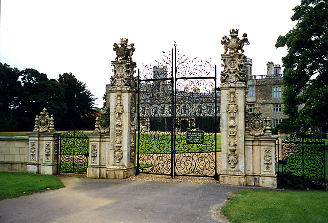
| Rockingham Castle | 1 miles (1 km) | The grounds and pretty gardens surrounding this castle near Corby are ideal for an easy afternoon stroll. The castle is in an elevated position giving wonderful views over the Welland Valley and five surrounding counties of England. There are 18 acres of beautiful gardens to explore with herbaceous borders, a rose garden, ornamental statues, yew hedges and yew pillars. There are also woodland trails, a pond and a tea room for refreshments. You can purchase a ticket for the grounds and gardens only to enjoy the walk. See website below for details. If you would like to continue your walk then you could pick up the long distance Jurassic Way trail and follow it to the nearby East Carlton Park. View Full Details>> | |
| Rockingham Forest | 5 miles (8.1 km) | A lovely walk from King's Cliffe to Barrowden through the ancient woodland of Rockingham Forest. The walk starts in the village of King's Cliffe and picks up a section of the Jurassic Way long distance trail to take you through Westhay Woods in Fineshade Woods. The woods have miles of good cycling and walking trails and are popular with bird watchers looking out for red kites. You can also see nightingale, nightjar, woodcock, grasshopper warbler, tree pipit, marsh and willow tits. The route then leaves Fineshade and continues west through Wakerley Woods. Here you can look out for deer on the Deer Park Trail where you will also pass two Bronze age burial cairns. The final section takes you over the River Welland and into the village of Barrowden. View Full Details>> | |
| Rushden Lakes | 5 miles (8 km) | This walk visits Rushden Lakes in the Nene Valley area of Northamptonshire. The area includes a series of pretty lakes, wetland nature reserves, nature trails and nice footpaths along the River Nene. It's an excellent area for birdwatchers with the Nene Valley now one of the most important wetlands in England gaining international recognition for its significance as a stop-over for thousands of wildfowl and waders that visit during the winter. Start the walk at the entrance point at the eastern end of the lakes between Irthlingborough and Higham Ferrers. You can then follow the trails south west along the river to the lakes. The first section takes you through the Irthlingborough Lakes and Meadows Nature Reserve where you can look out for Golden Plover and Gadwall. At the western end you'll pass the Wildlife Discovery Centre where you can find out all about the variety of wildlife which visits the area. You'll also pass Higham Ferrers Riverside Park and Ditchford Lakes Nature Reserve where there's a water skiing lake. This reserve also has lakes in old gravel pits which are used by otters and wintering and breeding birds such as Cetti's warblers, coots, oystercatchers and grey herons. There are also areas of grassland and willow scrub to explore. To continue your walking in the area simply head east and visit the adjacent Stanwick Lakes where there's more nice waterside trails. Part of this walk uses a section of the Nene Way. The waymarked long distance trail runs through the Nene Valley for over 100 miles. You could follow the trail west and visit Irchester Country Park near Wellinborough. View Full Details>> | |
| Salcey Forest | 4 miles (7 km) | Enjoy peaceful cycling and walking trails in this popular forest in Northamptonshire. For cyclists there is a lovely, family cycle trail starting at the car park. It's a gentle circuit of the forest on surfaced paths but with a couple of road crossings to look out for. Walkers can enjoy three waymarked routes of varying lengths. The easy Elephant walk takes you past Elephant pond. For a longer walk you could try the 10km (6 mile) Woodpecker trail where you can look out for all three British species of woodpecker - the lesser spotted, greater spotted, and green. The forest has good facilities with parking spaces and a very good cafe. It is located about 7 miles south of Northampton. Several long distance cycling and walking trails run through or past the forest so it's easy to continue your exercise in the area. You could pick up the Hanslope Circular Ride, The Swan's Way or the Midshires Way to extend your outing. View Full Details>> | |
| Shakespeare's Avon Way | 92 miles (148 km) | This terrific waterside walk follows the River Avon from its source near Naseby to its confluence with the Severn at Tewkesbury.
Starting at Naseby in Northamptonshire the walk heads to Welford,Rugby, Leamington Spa, Warwick, Stratford Upon Avon and Evesham before finishing at Tewkesbury. There are frequent waterside sections alongside the River Avon and also a section along the Grand Union Canal at Warwick. View Full Details>> | |
| Stanwick Lakes | 3 miles (5.5 km) | Explore 750 acres of parkland and nature reserve in the heart of Northamptonshire's beautiful Nene Valley. The park has a lovely cycle and walking track passing between the many lakes. In addition to the circular cycle routes around the lakes there is a four mile linear route running from Irthlingborough towards Thrapston, along a former railway line. Cycle hire is available within the park and there is an excellent visitor centre with interactive displays. The Nene Way walking route passes through the park so you could continue your walk along the River Nene to the nearby town of Wellingborough and the lovely Irchester Country Park. Just to the west you'll find the adjacent Rushden Lakes. View Full Details>> | |
| Stoke Bruerne | 7 miles (11 km) | This walk follows the Grand Union Canal Walk from Stoke Bruerne to Cosgrove. View Full Details>> | |
| Sulby Reservoir | 6 miles (9 km) | Sulby Reservoir is located near the villages of Welford and Naseby in Northamptonshire. They provide water to the summit level of the Grand Union Canal by way of the navigable Welford Arm. This circular walk visits both Welford and Sulby Reservoir before following waymarked trails to Sibbertoft. The route starts at the car park at the western end of Welford Reservoir. From here you can pick up the Jurassic Way and follow it north east to Sibbertoft. The village is a good place to stop for refreshments at what is roughly the half way point of the walk. From the village you can pick up bridleways heading south west through the countryside towards Welford. At the Naseby Road you pick up a section of Shakespeare's Avon Way which you can follow along the River Avon towards Welford and then back up to the car park. The walk passes along Naseby Field, site of the 1645 Battle of Naseby. You can extend your walking in the area by try our Naseby Battlefield Walk which visits the reservoirs. View Full Details>> | |
| Sywell Country Park | 3 miles (4.5 km) | Follow the waterside path around the delightful Sywell Reservoir on this easy walk in Northamptonshire. The reservoir gets a variety of winged visitors and there are two bird hides to use. View Full Details>> | |
| The Swan's Way | 65 miles (105 km) | The Swan's Way long distance bridleroute runs from Salcey Forest in the north to Goring on Thames in the south, a distance of 65 miles (105km). From the Northants border, the route crosses the Vale of Aylesbury to meet the Ridgeway near Princes Risborough and then follows the chalk slopes of the Chilterns to the Thames at Goring. View Full Details>> | |
| Thrapston | 9 miles (14.5 km) | This walk from the Northamptonshire town of Thrapston takes you along the River Nene to the neighbouring village of Wadenhoe. On the way you'll enjoy riverside trails and a visit to the lovely Titchmarsh Nature Reserve. The walk starts in Thrapston next to the viaduct where you can pick up the Nene Way and follow the waymarked trail north west to Islip. View Full Details>> | |
| Titchmarsh Nature Reserve | 4 miles (6 km) | Enjoy waterside walking in this nature reserve in Thrapston, near Kettering. There are several large lakes to stroll around and you can also follow the Nene Way along the River Nene which runs through the reserve. Large numbers of wildfowl can be seen on the water including heron, goosander, wigeon, gadwal, reed warbler and sedge warbler. Along the river Nene you can look out for butterflies, dragonflies and damselflies. If you would like to continue your walking in the area then you could follow the Nene Way to Stanwick Lakes and Rushden Lakes for more birdlife and lovely waterside walks. View Full Details>> | |
| Towcester | 4 miles (6 km) | This walk in Towcester takes you around the waterside parks located next to the River Tove. On the way you'll enjoy nice riverside paths, a visit to Towcester Racecourse and views of an interersting old ancient castle. The walk starts from Shire Meadows Park just north east of the town centre. Here you can enjoy riverside paths along the Tove and enjoy views of Bury Mount Motte. The site includes the recently restored remains of an earthwork motte and bailey fortification or ancient castle. The Motte probably dates back to the 11th Century when it was a Norman fortification but over time was subject to neglect. Follow the paths south along the mill stream and you will soon come to the edge of Towcester Racecourse. Recently rebuilt, it hosts National Hunt racing race meetings (over jumps) in the Winter months. It is situated on the Easton Neston estate. The route then heads west through the centre of the town along a nice riverside path. This will take you along the Silverstone Brook to the point where it meets with the Grafton Way. This long distance footpath is a great way of extening your walking around Towcester. You could follow the path north to Greens Norton or south to Pury End. Other good options are the woodland trails in nearby Hazelborough Wood or Bucknell Woods. To the north of the town you can enjoy a waterside stroll along the Northampton Canal into Northampton. View Full Details>> | |
| Wakerley Woods | 3 miles (5 km) | Enjoy several cycling and walking trails in this forest near Corby and Peterborough. View Full Details>> | |
| Warwickshire Millennium Way | 100 miles (161 km) | Follow the Millennium Way through the Warwickshire, Worcestershire and Northamptonshire countryside from Pershore to Middleton Cheney. The walk visits Stoulton, Inkberrow, Henley in Arden, Meriden, Kenilworth, Leamington Spa, Warwick, Long Itchington, Chipping Warden before finishing at Middleton Cheney. View Full Details>> | |
| Welford | 7 miles (11 km) | This circular walk around Welford visits the local reservoir before a stroll along the Welford Arm of the Grand Union Canal. View Full Details>> | |
| Wellingborough | 17 miles (27 km) | The Northamptonshire town of Wellingborough has some lovely walking trails to follow through the Nene Valley. This walk uses the waymarked Nene Way to visit Irchester Country Park and the nature reserves at Rushden Lakes and Stanwick Lakes. View Full Details>> | |
| Westbury Circular Ride | 12 miles (19 km) | This is a circular walk or cycle ride around Westbury in Buckinghamshire. View Full Details>> |