Rodborough Common
![]()
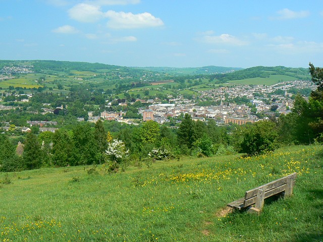
![]() Enjoy splendid views over the Severn Vale from this lovely open space near Stroud. The common covers nearly 300 acres and is criss crossed with miles of nice footpaths. There is a car park towards the eastern side of the common with direct access to the well surfaced paths.
Enjoy splendid views over the Severn Vale from this lovely open space near Stroud. The common covers nearly 300 acres and is criss crossed with miles of nice footpaths. There is a car park towards the eastern side of the common with direct access to the well surfaced paths.
The area is a biological and geological Site of Special Scientific Interest and also a Local Nature Reserve. Look out for various wildflowers and several species of orchid including Frog Orchid, Bee Orchid and Musk Orchid. The common consists of attractive grassland, scrub and woodland with Beech and Ash trees.
It's also great for wildlife with over 30 species of butterfly flying around the pretty wildflowers. Look out for the rare Duke of Burgundy and Adonis blue.
The common is in an elevated position above Stroud so on a clear day there are far reaching views towards the Forest of Dean and the Welsh hills.
If you would like to extend your walk then you could head to the nearby Woodchester Park. This National Trust owned park has miles of good footpaths taking you through the tranquil wooded valley to five pretty lakes. The National Trust also manages Minchinhampton Common which has more nice footpaths and views to enjoy.
You could also pick up the Cotswold Canals Walk and enjoy waterside walking through Stroud and the surrounding countryside.
Also nearby there is Selsley Common which has more nice footpaths, interesting vegetation and great views. Just north of Stroud is Haresfield Beacon with miles of cycling and walking trails.
Postcode
TGL5 5BL - Please note: Postcode may be approximate for some rural locationsRodborough Common Ordnance Survey Map  - view and print off detailed OS map
Rodborough Common Open Street Map  - view and print off detailed map
Rodborough Common OS Map  - Mobile GPS OS Map with Location tracking
Rodborough Common Open Street Map  - Mobile GPS Map with Location tracking
Explore the Area with Google Street View 
Pubs/Cafes
The Old Fleece on the western side of the common is a good choice for some post walk refreshment. The pub is set in a 250 year-old former coaching inn and is walker friendly. There's also a nice outdoor terrace where you can relax during the warmer months. You can find it on Rooksmoor Hill at postcode GL5 5NB.
Also consider the Bell Inn in nearby Selsley. It's a pub of some note dating from the 16th Century and also grade two listed. The pub can now boast listings in The Good Food Guide, and The Good Pub Guide as well as 2AA rosettes for their food. In the summer months you can sit outside and enjoy fine views of the surrounding countryside. In the winter there's roaring log burners to warm you up after your chilly walk!
Dog Walking
The common is an ideal place for a dog walk with miles of paths for you and the pooch. Please make sure they are kept under close control near livestock though. The Old Fleece pub mentioned above is also dog friendly.
Cycle Routes and Walking Routes Nearby
Photos
A view from Rodborough Common. The viewpoint is the northernmost extent of Rodborough Common. From here the land slopes down into Stroud, part of which can be seen in the distance on the other side of the valley. The views from up here are quite spectacular and you don't have to be a mountaineer to enjoy them.
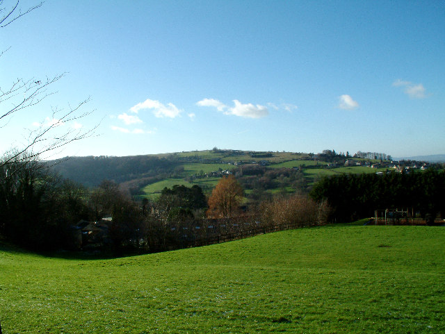
Rodborough Common viewed facing east. The village of Thrupp is in the distance. The common is host to numerous wild flowers including cowslips.


