Ombersley Circular Walk
![]()
![]() This pretty Worcestershire based village is notable for a number of historic timber framed properties. It's also great for walkers with nearby canal trails, riverside paths, woodland areas and an old country estate to explore on foot. Ombersley is located between Worcester and Stourport.
This pretty Worcestershire based village is notable for a number of historic timber framed properties. It's also great for walkers with nearby canal trails, riverside paths, woodland areas and an old country estate to explore on foot. Ombersley is located between Worcester and Stourport.
This circular walk from the village visits some of the local walking highlights including Westwood House Park, the Droitwich Canal and the River Severn. Much of the route makes uses of the Wychavon Way, a long distance footpath running through the area.
The walk starts in the village where you can pick up the Wychavon Way and follow the waymarked footpath east to Hadley and Westwood Park. The 17th century house is surrounded by some lovely parkland with woodland and a lake. You can follow public footpaths around the Great Pool and then continue south to cross the River Salwarpe at Salwarpe.
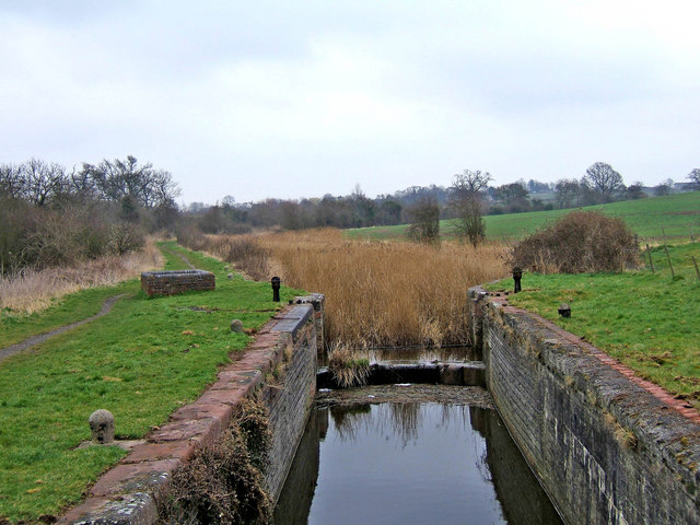
Here you pick up the Droitwich Canal and follow the waterside path south west to Porter's Mill. Leave the canal here and follow country lanes north west to Chatley and Bournes Dingle. Around here you can then pick up a riverside footpath heading along the River Severn towards Holt Fleet. Turn east and the final section will take you through Ombersley Park, passing the fish ponds before returning to the village.
Postcode
WR9 0EW - Please note: Postcode may be approximate for some rural locationsOmbersley Ordnance Survey Map  - view and print off detailed OS map
Ombersley Open Street Map  - view and print off detailed map
Ombersley OS Map  - Mobile GPS OS Map with Location tracking
Ombersley Open Street Map  - Mobile GPS Map with Location tracking
Walks near Ombersley
- Droitwich Canal - Enjoy an easy stroll along the Droitwich Barge Canal and the Droitwich Junction Canal, on this waterside walk in Worcestershire
- Hanbury Circular Walk - This circular walk in Droitwich visits the Worcester and Birmingham Canal and Hanbury Hall Park
- Hanbury Hall Park - A walk around the delightful Hanbury Hall Park in Droitwich Spa, Worcestershire
- Worcester Riverside Walk - An easy riverside walk along the River Severn from Worcester Cathedral to the nearby village of Hallow
- Shrawley Woods - Enjoy a circular walk around this attractive area of woodland near Worcester
- Stourport - This walk around Stourport on Severn makes use of the Severn Way and the Geopark Way to create a lovely circular route around the town
- Stourport to Bewdley River Walk - This easy walk takes you along the River Severn from Stourport to Bewdley
- Hadzor Circular Walk - This circular walk explores the area around the village of Hadzor near Droitwich Spa
- Severn Way - Follow the River Severn from its source at Plynlimon in Powys, to Bristol, the mouth of the river
- Wychavon Way - Follow the Wychavon Way through the Worcestershire countryside on this splendid 40 mile walk.
The walk begins at the town of Droitwch Spa, where you can pick up the waymarked trail just to the east of the town centre and train station - Worcester and Birmingham Canal - Follow the Worcester and Birmingham Canal from the vibrant centre of Birmingham, through the green hills of Worcestershire, to the cathedral city of Worcester
Pubs/Cafes
The ancient King's Arms is a nice place to enjoy some post exercise relaxation and refreshment. The handsome timber framed pub dates back to the early 15th century and has historical connections with King Charles II. They serve good quality food and can be found at postcode WR9 0EW for your sat navs.
Dog Walking
The country and woodland trails are ideal for dog walking. The King's Arms mentioned above is also dog friendly.
Photos
Ombersley Court The estate has been owned by the Sandys family since 1560, when Edwin Sandys was appointed Bishop of Worcester by Queen Elizabeth I. The house was built in the 1720s, replacing an earlier one on the same site. Viewed from near the Wychavon Way. There is a pub in the village of Ombersley called The Crown and Sandys, which has re-opened after renovation.


