Smarden Walks

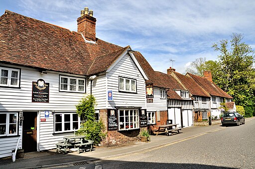
 This lovely Kent village includes a number of picturesque cottages, some fine local pubs and a noteworthy church which has been described as the 'Barn of Kent' due to its high scissor beam roof.
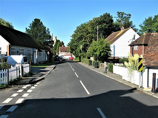
This circular walk from the village takes you through the surrounding area on some quiet country lanes. On the way there are some pleasant views of the surrounding countryside and a nice stroll along the village's main street.
To continue your walking in the area head east to visit the mysterious Dering Woods. The site is also known as "Screaming" wood due to reports of paranormal activity in the area. There's two waymarked trails here and lots of wildlife to look out for on the way.
Please scroll down for the full list of walks near and around Smarden. The detailed maps below also show a range of footpaths, bridleways and cycle paths in the area.
Postcode
TN27 8QA - Please note: Postcode may be approximate for some rural locationsSmarden Ordnance Survey Map  - view and print off detailed OS map
Smarden Open Street Map  - view and print off detailed map
Smarden OS Map  - Mobile GPS OS Map with Location tracking
Smarden Open Street Map  - Mobile GPS Map with Location tracking
Walks near Smarden
- Dering Woods - These woods near Pluckley are also known as "Screaming" wood due to reports of paranormal activity in the area
- Sutton Valence - This delightful Kent based village is located near Maidstone and Lenham
- Linton Park - Explore the stunning 19th-century landscape park surrounding this 18th-century country house in Linton, Kent
- Kingswood Kent - This walk visits the village of Kingswood in Kent
- Lenham - This Kent based village has some fine walking trails on which to explore the North Downs and the lovely Stour Valley countryside
- Maidstone River Walk - A nice riverside walk along the Medway from Maidstone to Leybourne Lakes Country Park
- Stour Valley Walk - Follow the River Stour from its source near Lenham to the estuary at Pegwell Bay on the Kent coast
- Hothfield Common - This area of common land is located near Ashford in the Kent Downs AONB
- Charing - This circular walk explores the countryside around the Kent village of Charing
- Pluckley - Explore the countryside associated with the 'Darling Buds of May' on this walk around the village of Pluckley
- Ashford - This Kent town is ideally positioned for walkers on the edge of the Kent Downs and the North Downs
- Eastwell Park Lake - This walk visits the Eastwell Park Estate in Boughton Lees in Kent
- Leeds Castle Maidstone - Explore the stunning grounds of this 19th century castle and former residence of Catherine of Aragon. There are 500 acres of beautiful parkland, open water and formal gardens to explore on well laid out walking paths.
- Hever Castle - Explore the beautiful grounds of this historic castle in Kent on this circular walk
- Chiddingstone - This delightful Kent village includes many picturesque features including a village pond, Chiddingstone Castle and several historic timber framed properties dating back to the Tudor period.
- Biddenden - This delightful Kent village is a splendid place for an afternoon stroll
Pubs/Cafes
Among the village's historic establishments is The Chequers Inn, a 14th-century coaching inn located on The Street. This venerable establishment even has its own resident ghost, a Napoleonic War soldier who met a tragic end within its walls. The pub includes a mature garden overlooking the village church and offering a peaceful setting next to a large, lilly-topped carp pond. The pub is dog friendly and located at postcode TN27 8QA.
In comparison, The Bell on Bell Lane, dating back to 1536, represents a relatively recent addition to Smarden's rich tapestry of history.
Further Information and Other Local Ideas
The name Smarden finds its origins in Saxon times, signifying the 'butter valley' and 'pasture,' reflecting its historical agricultural importance. While it stands as a tranquil village today, its historical significance is undeniable. In 1332, Edward II granted Smarden the privilege of hosting a market, a right later reaffirmed by Queen Elizabeth I, who also granted the village the privilege of holding a five-day fair.
Amidst this history, Smarden played a role in the dramatic events of 1450 when 66 local men participated in Jack Cade's rebellion, protesting against high taxes and prices.
The village boasts the 14th-century church of St. Michael the Archangel, affectionately known as the "Barn of Kent" due to its expansive scissor-beam roof that spans an aisleless nave, measuring an impressive 36 feet in width.
Archaeological excavations in Smarden have unearthed a treasure trove of English and French coins dating from the 13th to the 16th century.
Also noteworthy are the medieval Wealden hall houses, including the splendid Chessenden on The Street. Along the Headcorn Road, you'll find one of Kent's best-preserved cloth halls, distinguished by a projecting hoist used for lifting bales, which still adorns the gable end of the house.
Among the village's historic establishments is The Chequers Inn, a 14th-century coaching inn located on The Street. This venerable establishment even has its own resident ghost, a Napoleonic War soldier who met a tragic end within its walls. In comparison, The Bell on Bell Lane, dating back to 1536, represents a relatively recent addition to Smarden's rich tapestry of history.


