Solva Harbour River Circular Walks
![]()
![]() Enjoy a walk around the beautiful Solva Harbour on the Pembrokeshire Coast. There are good walking trails on the east and west side of the harbour with the rocky headland of the Gribin giving wonderful views of the coast and St Bride's Bay. There are also great views of the River Solva and of the pretty Solva beach.
Enjoy a walk around the beautiful Solva Harbour on the Pembrokeshire Coast. There are good walking trails on the east and west side of the harbour with the rocky headland of the Gribin giving wonderful views of the coast and St Bride's Bay. There are also great views of the River Solva and of the pretty Solva beach.
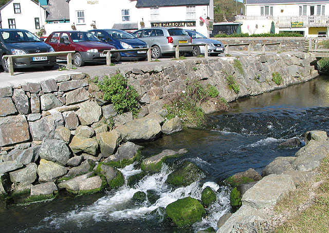
This walk starts from the car park and follows good footpaths to the Gribin on the eastern side of the harbour. At the Gribin summit you will find an Iron Age fort and really wonderful views of the harbour and the coast. You can descend to the pebble beach at Gwadn where you may see breeding chough. After returning to the village you could stop for refreshments at the lovely Harbour Inn which has outdoor tables overlooking the river. The walk then continues along the western side of the harbour where there is more lovely scenery.
If you would like to continue your walk you could pick up the Pembrokeshire Coast Path and head east towards Newgale on the Solva to Newgale Walk. This section of the path passes two impressive headlands with great views out to Green Scar Island and Ramsey Island. The Solva to St David's Coastal Walk will take you west to the city of St David's, starting from the harbour. It's another lovely section of the coast with highlights including the ruins of St Non's Chapel and the purple sandstone cliffs at Caerfai Bay.
Postcode
SA62 6UT - Please note: Postcode may be approximate for some rural locationsSolva Harbour Ordnance Survey Map  - view and print off detailed OS map
Solva Harbour Open Street Map  - view and print off detailed map
Solva Harbour OS Map  - Mobile GPS OS Map with Location tracking
Solva Harbour Open Street Map  - Mobile GPS Map with Location tracking
Explore the Area with Google Street View 
Pubs/Cafes
Head to the Harbour Inn in Solva for some refreshments. The friendly pub is in a great position overlooking the picturesque harbour. The pub has a good menu and some tables outside. It is also dog friendly. You can find it at 31 Main Street with a postcode of SA62 6UT.
The Cafe on the Quay is also beautifully located on Trinity Quay. You can sit outside on the balcony an enjoy wonderful views of the estuary with your lunch. You can find it at postcode SA62 6UQ.
Further Information and Other Local Ideas
Head north along the coast path and you could visit the quaint villages of Little Haven and Broad Haven. There's a lovely blue flag beach, natural arches and a fine beach front bar to visit here.
To the west there's the wonderful Treginnis Peninsula to explore. Here you can enjoy views towards Skomer Island and the oldest volcanic rocks in Wales, formed over 600 million years ago.
Cycle Routes and Walking Routes Nearby
Photos
Solva Harbour. Taken from the Gribin, looking North towards the village. The area is includes classic cliff exposures of Cambrian rocks which attract many geologists.
Lime Kilns. The village became the main trading centre of St Bride's Bay during the medieval period, and was important for lime burning. This prominent row of lime kilns is preserved at the harbour edge.


