Sutton-Under-Whitestonecliffe Walks

 This Yorkshire village is located close to some of the walking highlights of the North York Moors.
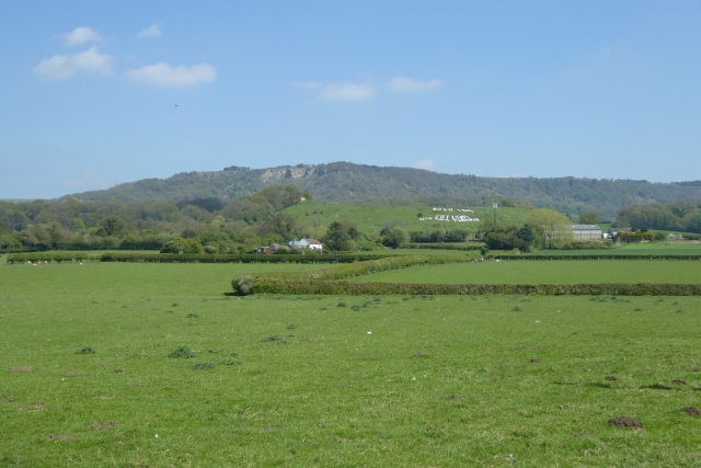
This circular walk from the village takes you up to Sutton Bank and the Kilburn White Horse before visiting the lovely Gormire Lake. There are some wonderful views over the area to enjoy along the way. Part of the walk uses the epic Cleveland Way National Trail which can be used to further explore the surrounding hills and countryside.
Please scroll down for the full list of walks near and around Sutton-Under-Whitestonecliffe. The detailed maps below also show a range of footpaths, bridleways and cycle paths in the area.
Sutton-Under-Whitestonecliffe Ordnance Survey Map  - view and print off detailed OS map
Sutton-Under-Whitestonecliffe Open Street Map  - view and print off detailed map
Sutton-Under-Whitestonecliffe OS Map  - Mobile GPS OS Map with Location tracking
Sutton-Under-Whitestonecliffe Open Street Map  - Mobile GPS Map with Location tracking
Walks near Sutton-Under-Whitestonecliffe
- Sutton Bank and the Kilburn White Horse - This challenging circular walk in the North York Moors visits the Kilburn White Horse, the lovely Gormire Lake and the scar at Sutton Bank
- Gormire Lake - A short and easy walk around this pretty lake in the North York Moors
- Hambleton Hills - This walk explores the Hambleton Hills range on the western edge of the North York Moors
- Byland Abbey - Visit this fascinating ruined abbey before exploring the surrounding countryside of Ryedale
- Helmsley to Rievaulx Abbey - This is a popular walk which takes you from the medieval Helmsley Castle to the fascinating ruins of Rievaulx Abbey
- Oulston Reservoir - This walk visits Oulston Reservoir in the Hambleton district of North Yorkshire.
- Felixkirk - This Yorkshire village is located in the Hambleton District, just west of the North York Moors.
- Cleveland Way - This wonderful trail runs from Helmsley to Filey, taking you through the beautiful North York Moors national park, atop the Hambleton Hills ridge and along the stunning North Yorkshire coastline.
The trail begins in Helmsley, with the first section taking you through the heather moorland of the North York Moors, passing the village of Osmotherley, the pretty Cod Beck Reservoir and the ancient stones at Lord Stones Country Park and the Wainstones.
After enjoying the fabulous views on the elevated moors you arrive at Saltburn to begin the coastal stretch - Boltby Forest - This large area of coniferous woodland on the western edge of the North York Moors is very popular with mountain bikers and walkers
- Hawnby Hill - This circular walk takes you up to the summit of Hawnby Hill from the village of Hawnby in Ryedale area of the North York Moors
- Coxwold - This pretty little village in the North York Moors makes a fine base for walkers
- Easingwold - This attractive market town is located in a fine location for walkers, sitting on the edge of the North York Moors National park and the Howardian Hills.
- Crayke - This picturesque village is located just to the east of Easingwold in the Hambleton District of North Yorkshire
- Thirsk - Enjoy a pleasant riverside stroll through this small market town, on this circular walk
Photos
Entering Sutton-Under-Whitestonecliffe. The village holds the distinction of being the longest hyphenated place name in England with 29 characters. There are 11 Grade II Listed Buildings in or near the village, including two mileposts, the former post office and village store and the former Methodist church. The list also includes Sutton Hall, which was built in the 18th century and was the seat of the Smyth family until 1766. Sutton Hall is now used as timeshare holiday flats.


