Twistleton Scar
![]()
![]() Enjoy wonderful views towards Ingleborough and Whernside on this circular walk in the Yorkshire Dales. It's a moderate walk with great limestone scenery and views of the surrounding hills. You can start and finish the walk from the pretty village of Chapel-le-Dale.
Enjoy wonderful views towards Ingleborough and Whernside on this circular walk in the Yorkshire Dales. It's a moderate walk with great limestone scenery and views of the surrounding hills. You can start and finish the walk from the pretty village of Chapel-le-Dale.
To extend your walk, head north east and visit the splendid Ribblehead Viaduct.
Twistleton Scar Ordnance Survey Map  - view and print off detailed OS map
Twistleton Scar Open Street Map  - view and print off detailed map
Twistleton Scar OS Map  - Mobile GPS OS Map with Location tracking
Twistleton Scar Open Street Map  - Mobile GPS Map with Location tracking
Pubs/Cafes
After your exercise treat yourself to well earned refreshments at the Station Inn (Postcode: LA6 3AS). The pub is located next to the Ribblehead Viaduct and is very walker friendly. There's a good menu and you can also book rooms for the night. Just up the road to the west you'll find the Old Hill Inn (LA6 3AR). This pub dates all the way back to 1615 and is another popular spot for walkers exploring the Dales.
Cycle Routes and Walking Routes Nearby
Photos

The wall runs along the south-eastern edge of Twistleton Scars towards Chapel-le-Dale

Stone man on Twistleton Scars. This is one of several tall cairns on the limestone pavement that runs on the south-eastern slopes of the fell lying between the courses of the Rivers Doe and Twiss. Park Fell that is part of the Ingleborough massif can be seen in the distance.

Limestone walls and a group of cyclists at the site.

Springcote and Twistleton Scars. From Seato, SD728760, looking northwest across the square.

Limestone boulder. On the limestone pavement above Twistleton Scars, looking towards Ingleborough.

White Scar Caves and Ingleborough. Seen from the lane which runs below the Crags. The light on this day in November was quite amazingly clear, picking out all the details of the hillside. The summit of Ingleborough is some 4 km distant in SD7474
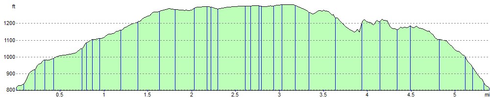
Elevation Profile