Warsash Walks
![]()
![]() The Hampshire village of Warsash is located in a lovely spot on the River Hamble and close to Southampton Water. It's a popular place for sailing with several yachts moored in the river here. The village is also notable as the home to the Warsash Maritime Academy, which provides training for Merchant Navy Officers from around the world. You can catch a ferry over the river to visit the neighbouring village of Hamble-le-Rice on the opposite side.
The Hampshire village of Warsash is located in a lovely spot on the River Hamble and close to Southampton Water. It's a popular place for sailing with several yachts moored in the river here. The village is also notable as the home to the Warsash Maritime Academy, which provides training for Merchant Navy Officers from around the world. You can catch a ferry over the river to visit the neighbouring village of Hamble-le-Rice on the opposite side.
This walk from the village takes you south along the River Hamble and Southampton Water to visit Hook Lake and the lovely Titchfield Haven Nature Reserve. The coastal reserve is one of the highlights of the area and located just a few miles from the village.
The walk starts in the village at the car park next to the river. From here you can pick up the Solent Way and follow the waymarked trail south past the piers to the pretty Hook Lake. The route then continues past the Solent Breezes Caravan site before passing Meon to arrive at Titchfield Haven. The delightful reserve includes 369 acres of river, fen, pools, reedbed and meadow with lots of birds to see. Look out for Reed Warblers, Bearded Tits, Water rails and Bittern around the reedbeds and Otters by the River Meon. After exploring the reserve the route returns to Warsash on the same paths.
Warsash Ordnance Survey Map  - view and print off detailed OS map
Warsash Open Street Map  - view and print off detailed map
Warsash OS Map  - Mobile GPS OS Map with Location tracking
Warsash Open Street Map  - Mobile GPS Map with Location tracking
Pubs/Cafes
The Rising Sun is in an excellent location next to the river. It's over 200 years old and includes and upstairs section with wonderful views over the river. It's the perfect spot to relax with a drink after your exercise. You can find them on Shore Road at a postcode of SO31 9FT for your sta navs.
Dog Walking
The river path is a lovely one to do with your dog although dogs aren't allowed in the Titchfield reserve except for assistance or guide dogs. You can take your dog along the Titchfield Canal though. The Rising sun mentioned above is also dog friendly.
Further Information and Other Local Ideas
The River Hamble Walk also starts in the village. This takes you north to Lower Swanick, passing Holly Hill Woodland Park on the way. The attractive park includes woodland trails, lakes and some ornamental exotic species of tree.
If you catch the ferry over the river you could visit Hamble Common in Hamble-le-Rice. The commons is a fine place for walks with ponds, heathland, oak woodland, meadow, salt-marsh, mudflats and a shingle beach on the River Hamble.
Just to the east of the village you can try the Fareham Walk which climbs to the distinctive Nelson Monument on Portsdown Hill.There's also a visit to Fort Nelson which has a fascinating military history. From the elevated position of the fort there are excellent views to the coast.
Head east along the coast path from Titchfield Haven and you will soon come to Alver Valley Country Park in Gosport and Lee on Solent. The 500 acre park has some nice trails along the River Alver, another wildlife rich nature reserve, a cafe and cycle paths.
For more walking ideas in the area see the Hampshire Walks page.
Cycle Routes and Walking Routes Nearby
Photos
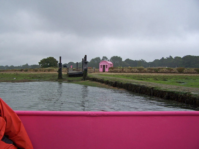
Approaching Warsash jetty. Viewed from on board the Hamble to Warsash ferry as it approaches the jetty at Warsash. Everything connected with the ferry company is pink, which at least makes it stand out!
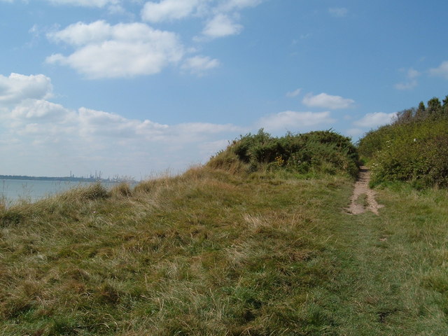
Cliff and foreshore near Sea House. A stream from Brownwich Pond flows into the sea here and the water in the foreground is therefore fresh. This water seems to be referred to on the OS 1:10,000 map as "spreads" a term whose definition I cannot find. Meon Shore Chalets are on the horizon centre, with the Isle of Wight right. There is a footpath along the top of the cliff and here it is easy to climb from shore to cliff top.
Hook Park lake. The main lake provides feeding areas for a variety of species and an area of freshwater for birds feeding on the mudflats to wash off the mud and salt.
Solent Breezes holiday village. A permanent caravan park is sited very close to the high water line, and coastal defence works have been carried out here to prevent further erosion. A public footpath is marked along the foreshore here, this side of the barrier, but as can be seen it is not accessible at high tide.


