Wey and Arun Canal Walk
![]()
![]() Follow the Wey River and the Wey and Arun Canal on this wonderful waterside walk through Surrey and Sussex. The route starts off in Guildford and heads south to Rowly and then onto Billinghurst. This section passes through Sidney Wood and the delightful village of Loxwood. There's some pretty locks and the picturesque Drungewick Aqueduct to admire here.
Follow the Wey River and the Wey and Arun Canal on this wonderful waterside walk through Surrey and Sussex. The route starts off in Guildford and heads south to Rowly and then onto Billinghurst. This section passes through Sidney Wood and the delightful village of Loxwood. There's some pretty locks and the picturesque Drungewick Aqueduct to admire here.
The walk continues towards Pulborough before passing through the delightful Amberley Wild Brooks wetland with its variety of interesting wildlife. The route then comes to an end near Amberley in Sussex.
Much of the walk follows canal side towpaths with footpaths and minor roads making up the remaining sections.
Some sections are also suitbale for cyclists for example around Shamley Green and Guidlford.
Wey and Arun Canal Walk Ordnance Survey Map  - view and print off detailed OS map
Wey and Arun Canal Walk Open Street Map  - view and print off detailed map
*New* - Walks and Cycle Routes Near Me Map - Waymarked Routes and Mountain Bike Trails>>
Wey and Arun Canal Walk OS Map  - Mobile GPS OS Map with Location tracking
Wey and Arun Canal Walk Open Street Map  - Mobile GPS Map with Location tracking
Pubs/Cafes
In Pulborough you could stop off at The White Horse on Mare Hill Road. They do good food and also have a fine terraced garden for warmer weather. It's a lovely place to sit out and enjoy views across the Brooks Nature RSPB Reserve. You can find the pub at a postcode of RH20 2DY for your sat navs.
In Cranleigh there's the 17th century Three Horseshoes to consider. The old fashioned village inn has a delightful interior with wooden floors, nooks, crannies and beams and even an inglenook fireplace with a roaring fire in winter. Outside there's a lovely garden area with lots of plants and herbs and private "wine huts"Āavailable for booking.
They serve good quality food and have a fine selection of real ales too.
You can find them on the High Street with postcode GU6 8AE for your sat navs.
Just off the route near Billingshurst is the worthy village of Wisborough Green. Here you will find an enormous village green, a cricket pitch and a fine old church.
Cycle Routes and Walking Routes Nearby
Photos

Path at High Bridge. Long distance footpath passing a stable block and heading into Glasshouse Copse. There was once a medieval glass industry in these woods.

Path looking towards Amberley Wild Brooks Rackham Woods Hill on the South Downs is in the distance

Bend on the Wey South Path in May 2009. At this time of the year the path has some dry sections, but during the winter the chalk and mud mixture makes it very slippery

Tile-Hung Cottage and Wey South Path. A picturesque corner on the Long Distance Path near Cranleigh. Behind the cottage with its apple blossom are cows grazing and poplars.

The lake in the Riverside Park Nature Reserve in Guildford. The path runs through this pleasant reserve where you can enjoy boardwalks and a wide variety of flora and fauna. Look out for Great crested grebe, water-rails, herons and reed buntings on the lakes and wetlands area of the park.

Footbridge Over the River Wey at Stoke Lock in Guildford.

Wey and Arun Canal. This short stump of the Wey and Arun Canal from its junction with the Godalming Navigation is used as mooring for boats, the remainder having been abandoned many years ago.

Coldwaltham from the Old Canal. Taken from the Wey-South Path looking over the water meadows and railway line to the houses on higher ground in Coldwaltham.
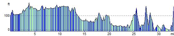
Elevation Profile