Win Hill Circular Walk
![]()
![]() This is a popular climb to Win Hill in the Derbyshire Peak District. The hill is in a delightful location above Ladybower Reservoir. From the 462 m (1,516 ft) summit there are excellent views of the reservoirs below, the River Derwent, the Hope Valley and the surrounding hills. This loop climbs to the hill summit before descending to Hope Brink and Aston.
This is a popular climb to Win Hill in the Derbyshire Peak District. The hill is in a delightful location above Ladybower Reservoir. From the 462 m (1,516 ft) summit there are excellent views of the reservoirs below, the River Derwent, the Hope Valley and the surrounding hills. This loop climbs to the hill summit before descending to Hope Brink and Aston.
Start your walk from the Heatherdene car park at the southern end of Ladbybower Reservoir, just off the A6013. From here you can pick up a footpath heading south along the reservoir before crossing the dam and beginning the steep ascent to Win Hill. This takes you through woodland and along Park Clough to the summit. From here you can enjoy one of the best views in the Peak District with the Upper Derwent Valley, Stanage Edge, the Great Ridge, Mam Tor and Kinder Scout all visible on a clear day.
After taking in the views the walk descends to Hope Brink. This area has some good bridleways which are popular with mountain bikers. From here you turn south towards the village of Aston where you follow country lanes back to the reservoir. The route finishes with a short section along the Derwent Valley Heritage Way which leads you back to the car park.
The hill is located very close to the villages of Bamford and Thornhill. You could start your walk from either of these places if you prefer.
There's lots of good options for extending your walk in this beautiful area. Just to the east you can climb to Bamford Edge where there are great views and lots of interesting gritstone rock formations to look out for. Also nearby is the wonderful gritstone escarpment of Stanage Edge. It's another geologically fascinating place with more wonderful views to enjoy.
Part of this walk uses the Derwent Valley Heritage Way long distance trail. You could follow the trail south along the River Derwent to Hathersage.
On the western side of the dam you can pick up the Thornhill Trail. The easy cycling and walking trail runs south along disused railway line from the dam to Bamford station.
Postcode
S33 0BY - Please note: Postcode may be approximate for some rural locationsWin Hill Ordnance Survey Map  - view and print off detailed OS map
Win Hill Open Street Map  - view and print off detailed map
*New* - Walks and Cycle Routes Near Me Map - Waymarked Routes and Mountain Bike Trails>>
Win Hill OS Map  - Mobile GPS OS Map with Location tracking
Win Hill Open Street Map  - Mobile GPS Map with Location tracking
Pubs/Cafes
Just to the south of Ladybower Reservoir you will find the pretty village of Bamford where there are some fine options for refreshments after your walk. The Angler's Rest is a delightful community-owned pub and cafe which includes facilities such as a post office, log burner, beer garden, large car park and secure bike racks. In the bar area there's a fine selection of real ales, while the cafe offers light meals, delicious cakes baked on the premises, as well as hot and cold drinks. The cafe also hosts a nice art gallery with a monthly exhibition of original work by local artists that not only brightens the walls but is also available to buy. It's a great place to go because you are not just enjoying a pint, a coffee or buying a stamp, you are also helping to sustain a community! You can easiliy find the pub on the Main Road in Bamford with a postcode of S33 0DY for your sat navs.
Also in the village you will find the Yorkshire Bridge Inn. This fine inn was awarded the Gold Award in the East Midlands Tourism Enjoy England Excellence Award 2009. There's an excellent menu and they also provide good quality accommodation if you need to stay over. Outside there's a lovely beer garden to relax in when the weather is good. You can find the pub on Ashopton Road with a postcode of S33 0AZ.
Cycle Routes and Walking Routes Nearby
Photos

On top of Win Hill. Ladybower Reservoir lies below in the valley.

Heading down from the summit towards Winhill Plantation.

Trig point on top of Win Hill Pike

View of the steps up to the hill top. Though the top section of the Win Hill Plantation at the top of this flight one breaks out on to the open moorland of the summit.

Interesting rock formations at the summit

View across Winhill Plantation towards Bamford Moor.

Upright Stone on Win Hill Has no inscriptions, and unmarked on maps, and does not appear to be on any parish boundary.

Shadows on the Derwent Moors on a glorious day from the Hill top
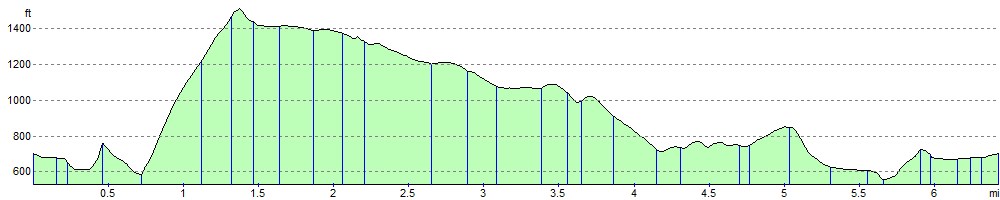
Elevation Profile