Wisbech Walk
![]()
![]() The Cambrideshire town of Wisbech has some nice flat riverside trails to try. There's also some easy country trails running through the surrounding Cambridgeshire, Norfolk and Lincolnshire countryside.
The Cambrideshire town of Wisbech has some nice flat riverside trails to try. There's also some easy country trails running through the surrounding Cambridgeshire, Norfolk and Lincolnshire countryside.
This walk from the town takes you north along the River Nene to the point where it enters The Wash. It follows a section of the waymarked Nene Way through Tydd Gote and Sutton Bridge to the coast. It's a long but easy walk along a flat path with nice country views on the way.
The walk starts to the west of the town centre next to
Peckover House and Garden. This National Trust owned house was built in 1722 and bought by Jonathan Peckover at the end of the 18th century. Near here you can pick up the Nene Way and follow it north towards Tydd Gote and Sutton Bridge. The route continues north to the point where the river enters the sea at The Wash. Here you can see two towers known as "the lighthouses".
Wisbech Ordnance Survey Map  - view and print off detailed OS map
Wisbech Open Street Map  - view and print off detailed map
Wisbech OS Map  - Mobile GPS OS Map with Location tracking
Wisbech Open Street Map  - Mobile GPS Map with Location tracking
Pubs/Cafes
The Red Lion is located next to the river at North Brink. They do good food and have a fine selection of ales. There's also a nice garden area to sit out in on warmer days. You can find it at postcode PE13 1JR for your sat navs.
Dog Walking
The river paths make for a pleasant walk with your dog. The Red Lion mentioned above is dog friendly in the outdoor area.
Further Information and Other Local Ideas
To the south of the town you can pick up a public footpath along the old Wisbech Canal at Collett's bridge. It's filled in now but has sections which are pleasant to walk along.
At the end of the walk you link up with the Peter Scott Walk at The Wash. You can follow the trail east to link up with the River Ouse in King's Lynn.
For more walks near Wisbech see the Cambridgeshire Walks page.
Cycle Routes and Walking Routes Nearby
Photos
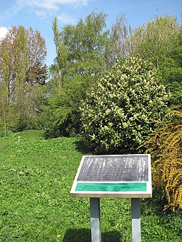
The old Wisbech Canal. A public footpath starts by Collett's bridge its first section providing access to properties located alongside it. The path skirts the infilled canal and here traverses it, emerging on Chapel Lane in Elm, further to the northwest. The Wisbech Canal (opened in 1797) - planned as a means to improve the status of Wisbech as a trading centre - linked the River Nene at Wisbech with Well Creek at Outwell. Sections which were not buried under the new road (A1101) have been planted with trees and can be walked.
River Nene approaching the Wash. View north along the river as it approaches the sea. West Lighthouse can be seen on the other side. Known as Metaris Aestuarium - a bay with tidal marshes and mudflats - in Alexander the Great's time, the first recorded use of the word Wysche or Waashe was used in the sixteenth century and described only the tidal areas of the Welland and the Nene but it has since been documented that 12% of the east coast drain into the Wash via five rivers: Steeping, Witham, Welland, Nene and Ouse.
The lighthouse on the West bank of the River Nene stands on the opposite bank to its twin on the East bank. No one seems to know why they are referred to as lighthouses as they never functioned as such. They were built to celebrate the recutting of the Nene Channel where it meets The Wash and acted as markers for ships.


