Cambridgeshire Walks

Use the filter to show walks of a certain type such as woods, reservoirs, hills, long distance, country parks, canals and rivers.
In the spring walkers flock to the beautiful bluebell woods in the Cambridgeshire area. Click the 'Woodland' button below to see these.
Use the links to view full route information including elevation profiles, interactive maps and GPS downloads.
You can also view an overview map of all the routes in the using the Cambridgeshire Walk Map>>
*New* - Walks and Cycle Routes Near Me Map - Waymarked Routes and Mountain Bike Trails>>
| Filter: |
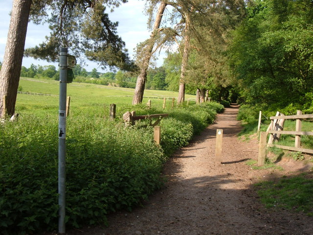
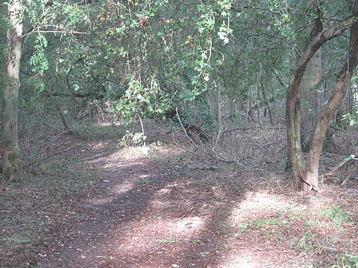
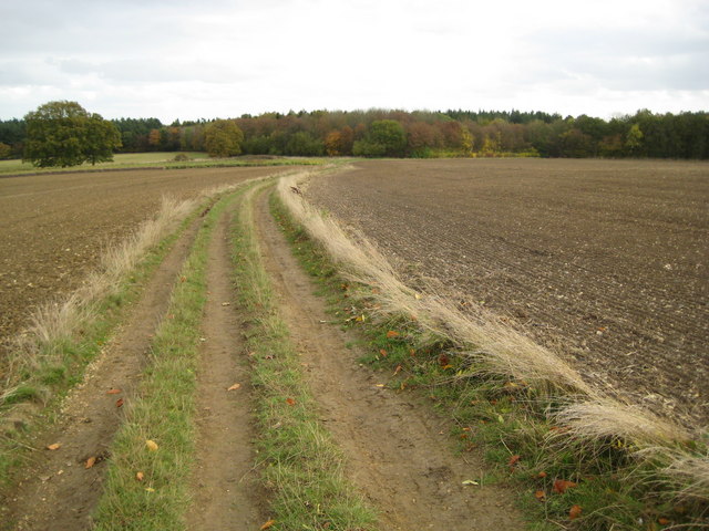
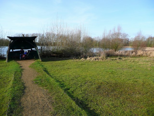
| Route Name | Photo | Distance | Description |
| Anglesey Abbey | 3.4 miles (5.5 km) | Explore 114 acres of beautiful gardens surrounding this Jacobean mansion in Cambridge. View Full Details>> | |
| Barnack Hills And Holes | 1 mile (1.6 km) | This walk explores the unique landscape of the Barnack Hills and Holes National Nature Reserve in the Cambridgeshire village of Barnack. View Full Details>> | |
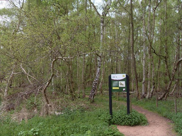
| Bedford Purlieus National Nature Reserve | 2.2 miles (3.5 km) | These splendid ancient woods near Peterborough have miles of woodland walking trails to try. You can start the walk from the car park off the A47, just east of Wansford (postcode PE8 6NN). The area is a hidden gem with 520 acres of ancient woodland to explore. The extensive flora includes beech, birch, field maple, bluebells, primroses, celandines, violets and wood anemones, wild strawberries and garlic. There's also lots of wildlife to look out for including deer, cuckoo, foxes, red kites and buzzards. The woods contains more plant and insect species than most other woods in this country. Bedford Purlieus is located just to the west of the lovely riverside village of Wansford. The Nene Way long distance footpath runs through the village so you could pick this up to extend your walk. View Full Details>> | |
| Brampton Wood | 1.6 miles (2.5 km) | These ancient woods near Huntingdon consist of 326 acres with lots of nice walking trails and interesting flora and fauna. Look out for 280 species of fern, conifer, flowering plant and trees. There are lots of pretty flowers in the spring and summer months such as bluebells, primrose and violets. It's great for wildlife too with several species of butterfly including Brown Argus, White Admiral and Purple Hairstreak. Also look out for Hazel Dormouse and Muntjac deer. To extend your walk you could visit the nearby Grafham Water. There's a great walking and cycling trail running around the lake with lots of water loving birdlife to look out for on the way. You can reach Brampton Wood and Grafham Water by cycling along National Cycle Route 12 which runs past the southern edge of the woods. This runs all the way to Huntingdon, passing Hinchingbrooke Country Park on the way. There is also a car park at the southern edge of the woods just off the Brampton Road. View Full Details>> | |
| Cambourne | 5.6 miles (9 km) | This walk visits the Cambourne Nature Reserve before heading to the neighbouring villages of Caxton and Bourn. View Full Details>> | |
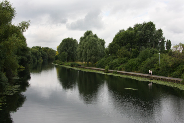
| Cambridge Backs Walk | 4.3 miles (7 km) | This circular city walk takes you around the highlights of Cambridge, visiting The Backs, a picturesque area where several colleges of the University of Cambridge back on to the River Cam. It's a delightful area for a stroll with magnificent architecture including St John's College, King's College and the fine bridges over the River Cam. The walk starts from the train station and follows Station Road and Hills Road to Downing College. Founded in 1800, it was the only college to be added to Cambridge University between 1596 and 1869, and is often described as the oldest of the new colleges and the newest of the old. You continue past Peterhouse College to the world famous Mathematical Bridge over the Cam. The Grade II listed wooden bridge was originally built in the 18th century and connects two parts of Queens' College. You can virtually explore this part of the walk using the google street view link below! The route then passes around Queens' College, one of the oldest and largest colleges of the university, founded in 1448 by Margaret of Anjou (the queen of Henry VI, who founded King's College). It spans both sides of the river and has some of the most recognisable buildings in Cambridge. The trail then heads aroud the back of King's College, St John's, Trinity, and Trinity Hall. King's was founded in 1441 by Henry VI, soon after he had founded its sister college in Eton. It is regarded as one of the greatest examples of late Gothic English architecture and includes a 13th century chapel with splendid stained-glass windows. The route then crosses the Cam, passing Trinity Lane and Bridge Street before coming to Magdalene College. Founded in 1428 the college's old buildings are representative of the growth from a monks' foundation into a centre of education. After heading around the back of Magdalene the route crosses Jesus Green where there is a lido. It is one of the few remaining examples of the lidos built across the country in the 1920s. After passing through the park you head around Jesus College. The college was established in the late 15th century and includes expansive grounds. Notable alumni include Thomas Cranmer, Samuel Taylor Coleridge, Lord Reid, Lord Toulson, Sir Rupert Jackson, Sir David Hare, Sir Roger Scruton, and Nick Hornby. The final section takes you past Christ's Pieces and through Parker's Piece parks. Christ's Pieces is a pretty Victorian park with flower beds and ornamental trees. Parker's Piece is a 25 acre park now regarded as the birthplace of the rules of Association Football. From here it is a short stroll back to the train station and the finish point. To extend your walking in the area try the Cambridge to Grantchester Walk. The delightful riverside walk starts in the city centre and takes you to the pretty village of Grantchester. The last mile of this walk makes use of the Fen Rivers Way long distance trail. At Jesus Green you have the option of picking up the trail and following it along the Cam to the nearby Milton Country Park. It's about 2 miles to the north and includes nice trails around several pretty lakes. The long distance Harcamlow Way also passes through the city. You could pick this up and head north east towards Lode and visit Anglesey Abbey. The National Trust site includes 114 acres of beautiful gardens surrounding a Jacobean mansion. To the south of the city you will find Wandlebury Country Park in the Gog Magog Hills. This is another excellent area for walking near the city. View Full Details>> | |
| Cambridge to Ely Walk | 18 miles (29 km) | Enjoy a lovely waterside walk along the River Cam and River Great Ouse from Cambridge to Ely. The route runs for about 18 miles on nice flat paths so could be completed in a day. You can catch a direct train back to Cambridge at the end of your walk. It's a really beautiful stretch of water with pretty marinas, lots of wildlife and lovely views of the surrounding Cambridgeshire countryside. Starting in Cambridge the route passes Milton Country Park, Horningsea, Waterbeach, Upware, Little Thetford before arriving in Ely. View Full Details>> | |
| Cambridge to Grantchester | 3.4 miles (5.5 km) | This is a popular riverside walk from Cambridge to the nearby village of Grantchester. It takes you along the River Cam with lovely views of Grantchester Meadows and the surrounding countryside. It's now a tradition for university students to punt to Grantchester for breakfast during the May Balls so you should see lots of little boats along the way. The walk starts in the centre of Cambridge near the tourist information centre. You then follow paths to the famous Cambridge Backs where you can enjoy nice views of some of the University colleges. The walk continues south through Sheep's Green and Coe Fen Nature Reserve. Considering it closeness to the city it's a delightfully pastoral scene with cows and sheep grazing next to the meandering river. You continue south through the pretty Paradise Nature Reserve where there are some peaceful woodland trails. The route then follows Grantchester Meadows Road away from the river before heading across Skater's Meadow to return to the Cam. You then follow the riverside path past Eight Acre Wood before turning towards the village of Grantchester. Here you can enjoy a cream tea at the delightful Orchard Tea Room. It's an idyllic setting with outdoor seating amongst the fruit trees. After refreshments you can either catch a bus back to Cambridge or follow the same route back on foot. If you enjoy this walk you could try the Fen Rivers Way long distance trail. It will take you along the Cam in the other direction, towards the lovely Milton Country Park. View Full Details>> | |
| Cambridge to St Ives along the Busway | 12.4 miles (20 km) | Enjoy a walk or cycle along this disused railway line which now forms part of National Cycle Network Route 51. It's now a great traffic free tarmac path following the route of the new Cambridgeshire Guided Busway which connects Cambridge, Huntingdon and St Ives. It runs just alongside the busway starting near the Cambridge Science Park just north of the city centre. You then head west passing Histon and the lovely Fen Drayton Lakes. View Full Details>> | |
| Castor Hanglands | 3.7 miles (6 km) | Explore the woodland, limestone, wetland grassland and scrub in this large National Nature Reserve near Peterborough. There's lots of rare plants and interesting wildlife to be found in the reserve. In particular look out for butterflies including silver-washed fritillary, purple hairstreak and white admiral. The reserve is located just to the west of Peterborough city centre with a parking area at the northern end. View Full Details>> | |
| Clopton Way | 10.6 miles (17 km) | This walk runs from Wimpole Hall to Gamlingay via the abandoned medieval village of Clopton. The path runs along a prominent ridge giving wonderful views of the surrounding countryside of Cambridgeshire. The walk start point at Wimpole Hall is particularly appealing. This 17th century country house has 3,000 acres (12 km˛) of parkland and farmland and is owned by the National Trust. The route then proceeds to Croydon, Tadlow and Cockayne Hatley before a section through Potton Wood takes you to Gamlingay. View Full Details>> | |
| Coton | 1.9 miles (3 km) | This small Cambridgeshire based village lies just to the west of the famous university town of Cambridge. View Full Details>> | |
| Cottenham | 4 miles (6.5 km) | This Cambridgeshire based village lies just a few miles north of the famous university city of Cambridge. It includes a pretty village green, picturesque old almshouses, quaint thatched cottages and a church dating back to the 15th century. View Full Details>> | |
| Crown Lakes Country Park | 0.9 miles (1.5 km) | Enjoy a stroll around the pretty lakes in this country park in Peterborough. There's 85 acres to explore with a series of footpaths taking you around the meadows, woodland and lakes. Look out for butterflies such as the black hairstreak and grizzled skipper. You may also see muntjac deer, badger and fox. The park is located just to the south of Peterborough town centre. If you'd like to extend your walk then you could head to the nearby Ferry Meadows Country Park for more waterside footpaths. View Full Details>> | |
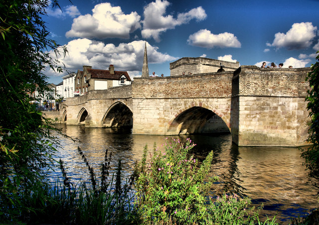
| Ely | 2.5 miles (4 km) | The cathedral city of Ely is a great place for walkers. With attractive streets, interesting architecture and a fascinating history there is much to enjoy on foot. The city also has two lovely long distance trails passing through it and riverside paths along the River Great Ouse. This easy circular walk uses sections of the Fen Rivers Way and the Hereward Way to take you through the city and along the river. The walk starts from the wonderful cathedral in the city centre. It dates from the 11th century, with cathedral status granted in 1109. It is an architectural masterpiece and a major tourist destination, receiving around 250,000 visitors per year. There are also pretty gardens to stroll around with a formal rose garden, wisteria, lawns, an orchard and a lavender hedge. From the cathedral you follow the Hereward Way through the city streets to Ely Country Park. The park includes two trails to take you through the natural fen landscape with lots of wildlife to look out for. The route then continues through Rosewell Pits. This area is a designated nature reserve with a pretty lake, reedbeds, wildflowers and wildfowl to look out for. Keep your eyes peeled for common terns, kingfishers, reed warblers and emperor dragonflies as you make your way through this area. After passing through the reserve you pick up a section of the Fen Rivers Way to take you along the River Great Ouse. You then turn towards Ely Castle where only a mound remains. The route then passes Cherry Hill and Dean's Meadow to return you to the cathedral. Nearby you will find Oliver Cromwell's House which dates from 1215. If you would like to extend your walk then one good option is to follow the river south to Wicken Fen. The lovely nature reserve is located just a few miles south of the city centre and includes nice cycling and walking trails with lots of wildlife to see. If you follow the river north it will take you from Ely to Downham Market in Norfolk. This will take you past the splendid Welney WWT, one of the premier birdwatching sites in the the country. View Full Details>> | |
| Fen Drayton Lakes | 3.4 miles (5.5 km) | This large RSPB nature reserve near St Ives has some nice walking trails and a cycle path running through it. The reserve consists of a series of lakes, ponds and lagoons with the River Great Ouse running through the northern section. There's lots of well laid out trails taking you around and between the lakes with National Cycle Route 51 running through the central section along the Cambridgeshire Guided Busway. The reserve is a haven for water loving wildlife with huge numbers of ducks, swans and geese on the lakes in winter. Also look out for terns, hobbies, lapwings, coots and a variety of dragonflies. You can extend your walk by picking up the Ouse Valley Way which runs through the reserve. If you head west it will take you into St Ives and then onto the lovely Houghton Mill which is well worth a visit. Heading north along the waymarked trail takes you along the river to Earith. There's also another public footpath running along the Ouse into nearby Hemingford Grey. Cyclists can continue along the Cambridge to St Ives busway cycle path. It's a great traffic free route running along a disused railway line. View Full Details>> | |
| Fen Rivers Way | 49.7 miles (80 km) | This is a teriffic riverside walking route running from Cambridge to King's Lynn in Norfolk. The path runs alongside the River Cam and the River Great Ouse and passes a series of delightful riverside towns and villages including Ely, Littleport and Downham Market. Highlights on the walk include Wicken Fen near Waterbeach in Cambridgeshire, the cathedral at Ely and the 18th century sluice at Denver. View Full Details>> | |
| Ferry Meadows Country Park | 5 miles (8 km) | This super country park in Peterborough has several pretty lakes with cycling and walking trails running alongside the water's edge. View Full Details>> | |
| Fleam Dyke and Roman Road | 24.9 miles (40 km) | This circular walk explores an area of chalk grassland woodland, and farmland using the Roman Road and Fleam Dyke just to the south east of Cambridge. View Full Details>> | |
| Godmanchester | 6 miles (9.7 km) | This attractive Cambridgeshire town has some delightful riverside paths and a wildlife rich local nature reserve to explore. The town is located on the southern outskirts of Huntingdon. View Full Details>> | |
| Gog Magog Hills | 9.9 miles (16 km) | This walk explores the Gog Magog Downs, a ridge of low chalk hills extending for several miles to the southeast of Cambridge. You start your walk at the village of Stapleford four miles to the south of Cambridge. The village became famous when it emerged that Barack Obama was a direct descendant of Thomas Blossom, who lived in Stapleford during the 16th century before emigrating to the United States. You can pick up footpaths taking you from the village to Ash Grove, crossing the River Granta on the way. The walk then climbs to Copley Hill and Wandlebury Country Park where there is an Iron Age Hill Fort and a nature reserve. View Full Details>> | |
| Grafham Water Circular Ride | 11.2 miles (18 km) | A cycle and walking route around the beautiful Grafham Water in Cambridgeshire. The route passes through woodland and the villages of Grafton and West Perry. There is also a nature reserve at the western end of the lake where you will see a variety of birdlife. Sailboats are also common during the warmer months of the year. Cycle hire is available at the start of the route at the eastern end of the reservoir. It's possible to create a longer circular walk around the lake using The Three Shires Way long distance trail. The waymarked footpath runs towards Great Staughton on the southern side of the reservoir. It will take you through some nice countryside before returning to the lakeside. To extend your walking in the area you could visit the nearby Brampton Wood. View Full Details>> | |
| Great Fen | 1.9 miles (3 km) | This short circular walk follows the Dragonfly Trail in the Great Fen wetland area in Cambridgeshire. The walk starts from the Great Fen Information Point on the Long Drove Road between the villages of Holme and Ramsey St Mary. There is a car park here with maps and information about the Great Fen project. You can pick up the 2 mile waymarked trail which takes you to Robinson's Ponds where dragonflies will be common in summer. It continues to an area of mature woodland with large Alder trees and then past a disused railway line before returning to the car park. Along the way there are picnic areas, information points and a bird hide where you can look out for a wide variety of birdlife. The Great Fen also consists of the splendid Woodwalton Fen and Holme Fen nature reserves. You can extend your walk by venturing in to these areas. In Woodwalton Fen you will find 500 acres of wildflower meadows, mixed fen, marsh, reedbed, scrub, open water and woodland. It is located just to the south of the start point for this walk. Holme Fen includes the largest Silver Birch woodland in lowland England and has more nice walking trails to try. It is located just to the north west of the Dragonfly Trail. If you are visiting the Great Fen by bike then National Cycle Route 12 runs through the village of Stilton on the western fringe of the area, near Holme. View Full Details>> | |
| Greensand Ridge Walk | 39.8 miles (64 km) | A walk through Bedforshire, Buckinghamshire and Cambridgeshire from Leighton Buzzard to Gamlingay. The route follows a ridge of greensand which rises from the clay vales on either side. You will pass through Woburn Park, Millbrook, Maulden Woods, Chicksands Wood, Ampthill Park and Sandy with some delightful countrsyside, woodland trails and fabulous views to enjoy. View Full Details>> | |
| Harcamlow Way | 141.1 miles (227 km) | This long distance walk takes you to some of the most beautiful countryside, interesting historical sites and delightful country parks in the counties of Cambridgeshire, Essex and Hertfordshire. The route is a figure-of-eight, starting in Harlow and first heading to Saffron Walden where you will pass the splendid Jacobean mansion and gardens at Audley End. You continue through the Bartlow Hills, Horseheath, the Fleam Dyke and Milton Country Park to Cambridge. You return passing along the Wimpole Way where you pass the splendid Wimpole Hall and park. This 17th century country house has 3,000 acres (12 km˛) of parkland and farmland and is owned by the National Trust. You continue through Melbourn and Chrishall to Newport , and then on to Debden, Thaxted and Takeley. You then pass through the expansive Hatfield Forest. View Full Details>> | |
| Hardwick Wood | 4.7 miles (7.5 km) | This walk takes you from the Cambridgeshire village of Hardwick to the nearby Hardwick Wood Nature Reserve. The route uses part of the Harcamlow Way long distance footpath to visit the site before continuing to the village of Toft. View Full Details>> | |
| Haslingfield | 5.1 miles (8.2 km) | This attractive village in South Cambridgeshire is a pleasant place for an easy riverside stroll. The historic settelement also includes many interesting old buildings including rows of quaint thatched cottages, a church dating back to the 12th century and a noteworthy Tudor Manor House where Queen Elizabeth I stayed during the 16th century. View Full Details>> | |
| Hereward Way | 110 miles (177 km) | Starting in Oakham, in Rutland, follow the Herward Way through Stamford, Peterborough, Ely, and the Breckland forests to Thetford, in Norfolk.
Highlights on the walk include
| |
| Hertfordshire Chain Walk | 38.5 miles (62 km) | The Hertfordshire Chain Walk is a series of circular walks running through Hertfordshire. This route is a combination of these walks, forming a linear route which runs from Enfield in London, through Hertfordshire to Ashwell & Morden Station in Cambridgeshire. View Full Details>> | |
| Hinchingbrooke Country Park | 3.1 miles (5 km) | Explore 170 acres of open grasslands, meadows, woodlands and lakes in this fine country park in Huntingdon. There are a number of pleasant woodland and lakeside paths to enjoy.
There is also a bridleway/cycle path running through the park while National Cycle Route 51 runs past the perimeter. For mountain bikers there is a specially designed course with mounds of various sizes. The park has excellent facilities with a visitor centre and cafe. View Full Details>> | |
| Holme Fen | 5.6 miles (9 km) | Explore the largest Silver Birch woodland in lowland England on this walk in Cambridgeshire. There are 657 acres of acid grassland, heath, raised bog, mere and woodland with several bird hides from which to view a wide variety of wildlife. At Holme Post you will be 2.75 metres (9.0 ft) below sea level - the lowest land point in Great Britain. If you would like to continue your walk you could head to the nearby Woodwalton Fen National Nature Reserve. Holme Fen is located between Peterborough and Huntingdon. The reserve is part of the larger Great Fen Wetland Project. You can visit the Great Fen information point and try the lovely Dragonfly Trail. View Full Details>> | |
| Houghton Mill | 2.5 miles (4 km) | Explore the delightful water meadows at Houghton Mill on this walk in Huntingdon. View Full Details>> | |
| Huntingdon | 9.9 miles (16 km) | A circular walk from Huntingdon taking in the River Great Ouse, Houghton Mill and Hemingford Abbots. The route makes use of the waymarked Ouse Valley Way and the Pathfinder Walk to visit streams, lakes and lovely water meadows to the east of the town. Starting in the centre of the town head south to Godmanchester to pick up the Ouse Valley Way. It will take you north east to the pretty Cook's Stream, where you'll pass a series of lakes. You continue past Wetside Common and Hartford Marina to the National Trust's Houghton Mill. View Full Details>> | |
| Icknield Way Path | 110 miles (177 km) | The Icknield Way Path starts at Ivinghoe Beacon in Buckinghamshire and heads to Knettishall Heath in Suffolk along prehistoric pathways. There's fantastic views as you climb through the hills of the Chilterns AONB. There's also a series of lovely nature reserves and country parks to enjoy on the way. Highlights on the walk include the Cam Valley views from Royston Heath, the lovely Dunstable Downs Country Park and the splendid Whipsnade Tree Cathedral. View Full Details>> | |
| Lodes Way | 18 miles (29 km) | This circular cycling trail runs through the Cambridgeshire Lodes on National Cycle Route 11 from the Wicken Fen Nature Reserve to Bottisham. View Full Details>> | |
| Madingley Hall | 1.1 miles (1.7 km) | This walk visits the historic Madingley Hall in the small Cambridgeshire village of Madingley. View Full Details>> | |
| Milton Country Park | 1.4 miles (2.3 km) | This lovely park in Cambridge boasts nearly 100 acres of lakes and gardens interlaced with footpaths and cycle trails. The Park includes a Visitor Centre with cafe, play-areas, viewing platforms and a sensory garden. The park can be reached by following the River Cam and the Fen Rivers Way from the centre of Cambridge. This section also makes for a lovely traffic free cycle ride. To extend your walkin in the area you can try our circular Cambridge Backs Walk which takes you on a tour of the famous university colleges. View Full Details>> | |
| Nene Way | 109.4 miles (176 km) | Follow the River Nene through the beautiful Nene Valley on this fabulous walk through Cambridgeshire, Lincolnshire and Northamptonshire. The long distance path runs for over 100 miles, passing Northampton, Wellingborough, Oundle, Peterborough and Wisbech. There's much to enjoy on the way with rushing weirs, a series of historic villages and old mills. It's an excellent area for birdwatchers too with the Nene Valley now one of the most important wetlands in England, gaining international recognition for its significance as a stop-over for thousands of wildfowl and waders that visit during the winter. In particular look out for birds around Rushden Lakes, Summer Leys Nature Reserve, the Titchmarsh Nature Reserve at Thrapston, Barnwell Country Park and Stanwick Lakes as you pass Irthlingborough and Higham Ferrers in Northamptonshire. View Full Details>> | |
| Pathfinder Long Distance Walk | 46 miles (74 km) | This circular walk in Cambridgeshire is named for the Royal Air Force Pathfinder Force - a group of target-marking squadrons in RAF Bomber Command during World War II. View Full Details>> | |
| Paxton Pits | 3.1 miles (5 km) | Visit this delightful nature reserve in Little Paxton and enjoy a series of well laid out, waterside walking trails. The paths run around a series of pretty ponds and lakes with a riverside stretch along the River Great Ouse to enjoy too. There's nearly 200 acres to explore with habitats including meadow, reedbed, scrub and woodland. It's great for wildlife with a heronry plus nightingales and cormorants to look out for. There's two, short waymarked trails to follow around the site. The Heron Trail runs for about 2 miles with a surfaced path for the first mile. The circular trail visits two bird hides where you can watch the Cormorants and Herons roosting on the islands. The 1.5 mile Meadow Trail visits the southern part of the reserve. You'll pass lakes and meadows with a variety of wildflowers such as Wild Roses and Hawthorn blossom. The Ouse Valley Way runs through the reserve so you can pick this up to extend yor walk. If you head south along the river you will soon come to St Neots. Head north and you will come to Godmanchester and Huntingdon. View Full Details>> | |
| Peterborough | 9 miles (14.5 km) | There's lots of fairly easy walks to enjoy around the cathedral city of Peterborough. Three notable long distance trails run through the area and there's also river walks, country parks and nature reserves to visit. This riverside walk takes you from the city centre to Ferry Meadows Country Park along the River Nene. There's much to enjoy with flat waterside trails, pretty lakes, old bridges and views of the Nene Valley Steam Railway which runs along much of the route. The walk starts on the river in the city centre, just to the south of the tourist information centre and train station. From here you can pick up a section of the Nene Way long distance trail to take you west along the river and into Nene Park. After a short while you will come to the Woodston Ponds Nature Reserve. Here you will find a lake with water birds such as grey herons, tufted ducks and pochards. There's also a reedbed which has pools and channels, with great crested newts and unusual species of water beetle to see. You continue west through Thorpe Meadows where there is a Sculpture Park and a purpose built rowing lake. The next stage passes the water features of Orton Meadows before entering the splendid Ferry Meadows Country Park. You can follow various trails around the large lakes, pretty meadows and pockets of woodland. There's also two cafes where you can enjoy refreshments before the returning to the city centre the same way. Alternatively you could catch the Nene Valley Railway back. View Full Details>> | |
| Shepreth | 1.4 miles (2.3 km) | This South Cambridgeshire village is located south of Cambridge and north of Royston. View Full Details>> | |
| St Ives Cambridgeshire | 5.5 miles (8.8 km) | This Cambridgeshire market town is located in the River Great Ouse just east of Huntingdon. View Full Details>> | |
| St Neots | 9.1 miles (14.6 km) | This pretty town in Cambridgeshire has some lovely country and riverside walks to try. St Neots is the largest town in the county and an interesting place to visit. The town dates back over 1,000 years to the Medieval Priory of St. Neot and includes an award winning museum which is well worth a visit. This circular walk uses part of the Ouse Valley Way to visit the lovely Riverside Park and the nearby Paxton Pits Nature Reserve. The walk starts from St Neots Bridge and follows the waymarked Ouse Valley Way north through the attractive Lammas Meadows on the eastern side of the river. The river eventually winds its way round to Paxton Pits where there's a series of nice ponds and lakes. In all there's 200 acres to explore with habitats including meadow, reedbed, scrub and woodland. It's a great place for bird watching so be sure to bring your binoculars. After exploring the reserve the walk returns to St Neots Bridge on the same paths. You then pass through the Riverside Park on the western side of the river, just to the south of the bridge. Follow the paths south past the cricket ground to Eaton Socon where you cross the river at the pretty lock. You can then follow the Ouse Valley Way past Eynesbury before returning to the bridge. View Full Details>> | |
| Stour Valley Path | 59.7 miles (96 km) | Follow the River Stour from Newmarket to Cattawade on this delightful walk through East Anglia. The walk passes through a series of pretty riverside towns and villages including Little Thurlow, Kedlington, Clare and the Clare Castle Country Park, Long Melford (with Melford Hall and Kentwell Hall), Sudbury, Stoke By Nayland, Nayland and Dedham. You will also pass through the Dedham Vale AONB, an area which inspired much of the work of painter John Constable. View Full Details>> | |
| The Three Shires Way | 37.3 miles (60 km) | The Three Shires Way is a long distance bridleway which runs between Tathall End in north-east Buckinghamshire and Grafham Water in Cambridgeshire. The shared cycling and walking route traces the outline of ancient trackways and passes through a beautiful rural landscape. Along the way it skirts several small, historic villages, meanders through remnants of ancient woodland, and has many spectacular views. The route is (sometimes) signposted with the Three Shires Way logo and officially runs for 37 miles, though it's nearer 39 miles long if starting/finishing at the Grafham Water Car Park. I'd recommend cycling north to south (unless faced by a strong south or south-west wind), hence : Start at Grafham Water Car Park, Cambs : TL166680 Finish at Tathall End, Milton Keynes : SP820468 A circular route around Grafham Water is also available, which extends the total distance to almost 47 miles. It passes through Easton, Spaldwick, Covington, Shelton, Yielden, Knotting, Lavendon and Emberton before arriving at Tathall End. It is generally a quiet rural route, much of it on clay and very muddy at certain times of the year. Some parts are classified as a 'Byway Open to All Traffic' or a 'Road Used as a Public Path' (generally open April to October), and are therefore legally accessible by motor vehicles. These tracks can be very rutted indeed; a notable example is Forty Foot Lane. Beware! Note : Mapped on the 1:25,000 series Submitted by:Mark Worthington November 2008 View Full Details>> | |
| Torpel Way | 11.2 miles (18 km) | This walk runs from Peterborough to Stamford through countryside and agricultural land. The path passes Marholm, Helpston and Barnack before finishing with a riverside stretch along the River Welland into Stamford. View Full Details>> | |
| Wandlebury Country Park | 1.2 miles (2 km) | This walk takes you around the delightful Wandlebury Country Park in Cambridge. The park is part of the Gog Magog Hills, a ridge of low chalk hills extending for several miles to the southeast of Cambridge. View Full Details>> | |
| Waterbeach | 7.1 miles (11.5 km) | This delightful village near Cambridge has a pretty village green, lovely riverside walks and some fine old pubs to visit. View Full Details>> | |
| Welney WWT | 9 miles (14.5 km) | Enjoy waterside footpaths along the New Bedford River on this easy circular walk at the Welney Wetland Centre. View Full Details>> | |
| Wicken Fen | 8.7 miles (14 km) | Enjoy a walk or cycle through the beautiful Wicken Fen Nature Reserve in Cambridgeshire. National Cycle Route 11 runs right through Wicken Fen and there are some peaceful country lanes around the reserve. Bike hire is available from just Ł5. The route below starts at the pretty village of Wicken before passing through the reserve and into the surrounding countryside. You follow quiet lanes to Upware, located on the River Cam, before returning to Wicken Village. In the reserve you will find flowering meadows, reedbeds and waterways where you can see a variety of wildlife such as hen harriers, water voles and bitterns. In the Baker's Fen area you can also see konik ponies, highland cattle, lapwings and barn owls. If you're on foot you can follow the Boardwalk Trail or the longer Nature Trail while stopping off at one of the many bird hides. In the summer months you can also enjoy a 50 minute boat trip along the waterways of Wicken Fen. A number of options are available if you would like to continue your outing. If you're on foot you could follow the Fen Rivers Way along the River Great Ouse to Ely. For cyclists National Route 11 runs along quiet roads and the River Great Ouse to Ely on the Ely to Wicken Fen Cycle Route. Or you can head east towards Newmarket via Burwell. View Full Details>> | |
| Wimpole Hall | 2.5 miles (4 km) | This 17th century country house near Cambridge is surrounded by 3,000 acres of parkland and farmland. View Full Details>> | |
| Wimpole Way | 11.2 miles (18 km) | Follow the Wimpole way through Cambridgeshire's farmland, ancient woodland and gentle rolling countryside from Cambridge to Wimpole Hall. The path starts in Cambridge by the River Cam heading ino the countryside and passing Coton, Caldecote and Kingston before finishing at Wimpole Hall. This 17th century country house has 3,000 acres of parkland and farmland and is owned by the National Trust. Also on the path is Hardwick Wood near Caldecote. View Full Details>> | |
| Wisbech | 21.1 miles (34 km) | The Cambrideshire town of Wisbech has some nice flat riverside trails to try. There's also some easy country trails running through the surrounding Cambridgeshire, Norfolk and Lincolnshire countryside. View Full Details>> | |
| Witchford | 10.3 miles (16.6 km) | This small rural village is located just west of Ely in Cambridgeshire. View Full Details>> | |
| Woodwalton Fen | 3.7 miles (6 km) | Enjoy a short walk around this beautiful national nature reserve in Cambridgeshire. There are 500 acres to explore with habitats including wildflower meadows, mixed fen, marsh, reedbed, scrub, open water and woodland. There are several waymarked walking trails taking you around the reserve on wide grassy paths. You can stop at the bird hides and look out for a wide variety of wildlife before heading to Rothschild Bungalow - Charles Rothschild, a successful banker and wildlife enthusiast bought Woodwalton Fen in 1910 to preserve this lovely area. If you would like to continue your walk you could head to the nearby Holme Fen National Nature Reserve. Woodwalton Fen is located between Peterborough and Huntingdon. View Full Details>> |