Bala Lake Walk
![]()
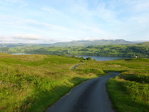
![]() Bala Lake (or Llyn Tegid) is the largest natural lake in Wales. The area on the south side of the lake is wonderful for walkers. Footpaths climb into the hills and forests for fabulous views of the lake below.
Bala Lake (or Llyn Tegid) is the largest natural lake in Wales. The area on the south side of the lake is wonderful for walkers. Footpaths climb into the hills and forests for fabulous views of the lake below.
The walk begins in Bala, at the visitor centre on the foreshore of the lake. You then follow footpaths along the lakeside before ascending to Craigy-Allor. From here the views over the lake and surrounding mountains are splendid. The route then descends through forest and countryside to Llanuwchllyn station. From here you can catch the Bala Lake railway back to Bala. The narrow gauge steam train runs along the southern end of the lake. It's a lovely journey with fine views of the lake and Arenig Fawr, Aran Benllyn and Aran Fawddw mountains.
To continue your walking in the area you could climb Aran Fawddwy.
The walk starts from the village of Llanuwchllyn near the southern end of the lake.
You could also head to the nearby Llyn Celyn where there's more lovely scenery and walks to try.
Postcode
LL23 7SR - Please note: Postcode may be approximate for some rural locationsBala Lake Ordnance Survey Map  - view and print off detailed OS map
Bala Lake Open Street Map  - view and print off detailed map
*New* - Walks and Cycle Routes Near Me Map - Waymarked Routes and Mountain Bike Trails>>
Bala Lake OS Map  - Mobile GPS OS Map with Location tracking
Bala Lake Open Street Map  - Mobile GPS Map with Location tracking
Explore the Area with Google Street View 
Pubs/Cafes
There's an on site cafe next to the sailing club where you can enjoy refreshments after your walk.
If you are looking for a camping site to stay over night please see this
Campsites near Bala Lake page on the campsites.co.uk website.
Further Information and Other Local Ideas
To continue your exercise in the area you could pick up the circular Bwlch y Groes Cycle Route. This challenging climb takes you to the second highest public road mountain pass in Wales, with a summit altitude of 545 metres (1,788 ft). The trail also visits Lake Vyrnwy at the south eastern end of the ride. With most of the route taking place on minor roads it is also suitable for walkers.
For more walking ideas in the area see the Snowdonia Walks page.


