Chinley Churn and Cracken Edge
![]()
![]() Climb Chinley Churn and enjoy super views over the Peak District towards Kinder Scout on this circular walk.
Climb Chinley Churn and enjoy super views over the Peak District towards Kinder Scout on this circular walk.
The walk starts from Chinley train staion and takes you over Cracken Edge to Chinley Churn. There are lots of interesting geological features and fantastic views across the Peak District. You'll also pass two large railway viaducts and the old slate quarry at Cracken Edge. The walk continues north to Hills Farm where you have the option of heading east along the Pennine Bridleway to the 1,620ft (494m) summit of South Head where there are more fabulous views. You can return to the train station on the same path or an alternative to the west of Chinley Churn.
Chinley Churn and Cracken Edge Ordnance Survey Map  - view and print off detailed OS map
Chinley Churn and Cracken Edge Open Street Map  - view and print off detailed map
Chinley Churn and Cracken Edge OS Map  - Mobile GPS OS Map with Location tracking
Chinley Churn and Cracken Edge Open Street Map  - Mobile GPS Map with Location tracking
Pubs/Cafes
There's a few good options for post walk refreshments in Chinley village. The Old Hall dates back to the 16th century and serves fine quality dishes. It has won several awards including CAMRA regional Pub of the Year and also the Great British Pub award for best cask pub in the region for several years.
Facilities include car parking and an out utdoor covered patio to the rear with pleasant gardens at the front.
You can find them at Whitehough with postcode SK23 6EJ.
Further Information and Other Local Ideas
A few miles to the south there's the pretty Combs Reservoir near Chapel en le Frith. Here you can also enjoy some splendid rock formations and an excellent viewpoint at Castle Naze. The Promontory fort on Combs Edge commands fine views to the surrounding Peak District hills.
For more walking ideas in the area see the Peak District Walks and the Cheshire Walks pages.
Cycle Routes and Walking Routes Nearby
Photos

Chinley Churn

Hillside above The Naze near Chinley Churn

Quarryman's hut, Cracken Edge

Footpath towards Cracken Edge

View over Chinley village

Cottages in the village

Cracken Edge and The Naze. Taken from just beyond the northern edge of the square, SK037840, looking south. The Edge is extensively quarried (and was still marked on the 1940s map as "Cracken Edge Quarry"). The Naze is the green-grassed, flat-topped plateau on the left of the picture (in SK0483). The prominent diagonal line on the hillside in front of The Naze is an inclined tramway; the winding gear is still present at the top. Combs Moss, Lady Low and Cow Low (SK0678) are visible in the background.

Winding gear, Cracken Edge. This pulley stands high on Cracken Edge, just below the footpath, and was used to haul wagons up and down an inclined plane below.
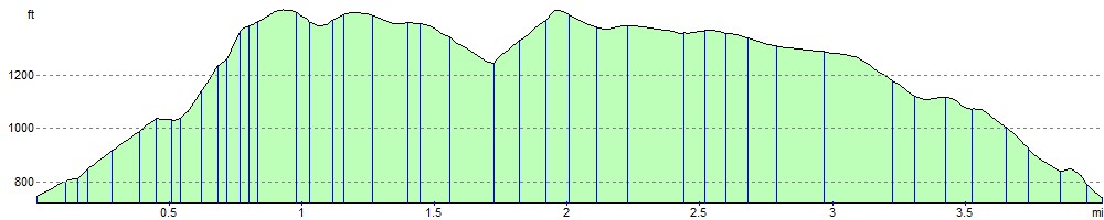
Elevation Profile