Deadwater Fell Walk
![]()
![]() Climb to the summit of Deadwater Fell in Kielder Forest and enjoy wonderful views over Northumberland and Scotland. The 1900 feet (571 metres) fell sits on the England-Scotland border about 2.5 miles north of Kielder. You can start the walk from Kielder Castle and follow footpaths through woodland and across open moorland to the hill summit. From here there are great views towards the Lake District, the Pentland Hills near Edinburgh and the North Sea coast. This route is for walkers but there is also a good mountain bike trail which you can follow all the way to the summit.
Climb to the summit of Deadwater Fell in Kielder Forest and enjoy wonderful views over Northumberland and Scotland. The 1900 feet (571 metres) fell sits on the England-Scotland border about 2.5 miles north of Kielder. You can start the walk from Kielder Castle and follow footpaths through woodland and across open moorland to the hill summit. From here there are great views towards the Lake District, the Pentland Hills near Edinburgh and the North Sea coast. This route is for walkers but there is also a good mountain bike trail which you can follow all the way to the summit.
If you would like to continue your walking in the area then you could try the Kielder Forest Lakeside Way and enjoy views across Kielder Water.
There's also the Bakethin Reservoir and Kielder Viaduct Walk which takes you across the 19th century railway viaduct near the car park.
Postcode
NE48 1ER - Please note: Postcode may be approximate for some rural locationsDeadwater Fell Ordnance Survey Map  - view and print off detailed OS map
Deadwater Fell Open Street Map  - view and print off detailed map
*New* - Walks and Cycle Routes Near Me Map - Waymarked Routes and Mountain Bike Trails>>
Deadwater Fell OS Map  - Mobile GPS OS Map with Location tracking
Deadwater Fell Open Street Map  - Mobile GPS Map with Location tracking
Pubs/Cafes
The Kielder Castle Café is a nice place to enjoy some post walk refreshments. It is integrated in the ancient Kielder castle which was built in 1775 as a hunting lodge for the Duke of Northumberland. The cosy family run Café serves locally sourced homemade food daily including, breakfasts, lunches, snacks, soups and cakes. The building also includes a free exhibition, an open log fire, a wildlife camera and an area where you can view the native red squirrels on the feeder outside.
Further Information and Other Local Ideas
To the east there's some nice waterside trails and lots of wildlife at the expansive Catcleugh Reservoir. Near here in the adjacent Redesdale Forest there's something of a hidden gem at Hindhope Linn. There's some pretty waterfalls here and more nice waterside trails along the burns that run through the area. The epic Pennine Way can also be picked up at the falls car park here.
On the southern side of the forest you can explore Wark Forest. It's a very peaceful area with miles of good walking and mountain bike trails. There's a car park at the Stonehaugh Picnic and campsite where you can pick up some nice walks along the Blacka Burn.
For more walking ideas in the area see the Northumberland National Park Walks page.
Cycle Routes and Walking Routes Nearby
Photos
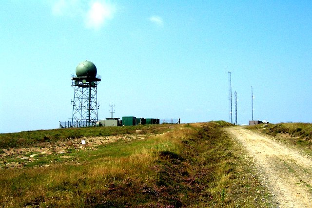
Deadwater Fell. This is Deadwater Fell near Kielder with its MOD Radio towers and Radar Station. Deadwater Fell is 569metres and commands fine views over Kielder water.
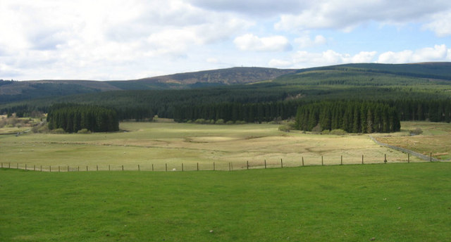
Kielder Burn and Deadwater Fell. The two clumps of trees in the foreground hug the meanders of the Kielder Burn. The mast scarred summit of Deadwater Fell can be seen in the distance.


