Heddon Valley to Woody Bay Walk
3.5 miles (5.6 km)
Enjoy an easy waterside walk through the beautiful Heddon Valley in Exmoor. The riverside footpath leads through woodland before the beautiful coast and cliffs of Heddon's mouth come in to view.
The walk starts at the National Trust car park and heads north through Heddon's Mouth Wood to the coast through Heddon's mouth with its imposing cliffs.... The point where the valley opens out to reveal the sea and cliffs is really lovely. The path then leads down to the pebble beach where you will find a 19th century lime kiln.
The area is great for wildlife spotting. Look out for otters and various birds suchs as�dippers, grey wagtails and herons. In summer the area is covered with yellow gorse flowers and heather. The route then continues east to the lovely wooded cove at Woody Bay with its secluded pebble beach.
If you would like to extend your walking in the area then you could head east towards Trentishoe Down for views of the beautiful Elwill Bay. You could also climb the Hangman Hills for tremendous views over Combe Martin.
Postcode: EX31 4PY
Pubs and More Info
The Hunter's Inn is a popular pub for walkers. The fine country inn serves good home cooked food and includes 4 acres of enchanting gardens. You can find them in the valley at postcode EX31 4PY.
For more walking ideas in the area see the Exmoor Walks and the North Devon Coast Walks pages.
More
Photos
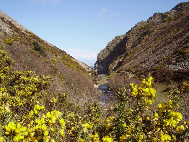
The Heddon Valley looking towards Heddon's Mouth with pretty yellow gorse in the foreground. The ancient woodlands, predominantly composed of oak and hazel trees, provide a habitat for a variety of bird species, including redstarts and wood warblers. The River Heddon, meandering through the valley, is home to otters, kingfishers, and native brown trout. The surrounding heathlands are adorned with heather and gorse, creating a vibrant tapestry of colors, especially during the blooming season. Notably, the valley supports populations of rare butterflies, such as the high brown fritillary, which thrives in the carefully managed bracken slopes.

This stone bridge carries the South West Coast Path over the River Heddon in Heddon Valley. Beyond its natural wonders, Heddon Valley offers a rich tapestry of cultural and historical intrigue. The area features remnants of 19th-century lime kilns, harking back to its industrial past. Literary enthusiasts may find interest in the valley's connection to poet Samuel Taylor Coleridge, who drew inspiration from its landscapes. For visitors seeking exploration, trails like the Heddon's Mouth walk lead through serene woodlands to a secluded pebble beach where the river meets the sea, offering breathtaking views and a tranquil retreat. The Hunter's Inn, a historic establishment dating back to the 19th century, provides a welcoming spot for refreshments and a glimpse into the area's heritage.

Hillside, above the Valley

Martinhoe Bridleway 1 runs beside some ponds at this point, a little north of the Hunter's Inn.

View of one of the woodland trails

Trentishoe, looking south over the Valley. Seen from the footpath that runs around the hill east from Trentishoe church.

Descending into the valley
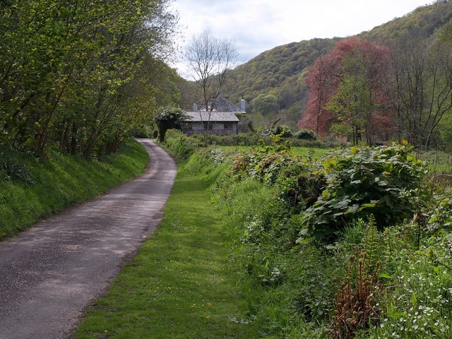
Milltown. The valley a little above�Hunter's Inn. The road remains on the valley floor across this square, but then rises sharply to the east.
 Ordnance Survey Map
 OpenStreetMap


